|
|
 |
FTF: Zieverer |
STF: PPasjes + BernPas |
TTF: nomuggel + zznochohnenamen |
| |
 Άλλα δημοσιευμένα στάδια του "Corfu Trail"
  Other published stages of the "Corfu Trail"
  Weitere veröffentlichte Etappen des „Corfu Trail“
Το Corfu Trail είναι μια μεγάλη απόσταση με τα πόδια από τον Κάβο στα νότια της Κέρκυρας μέχρι τον Άγιο Σπυρίδωνα στα βόρεια.
Δημιουργήθηκε από τον Hilary Paipeti τον Μάιο του 2001 και έχει μήκος περίπου 220 χιλιόμετρα.
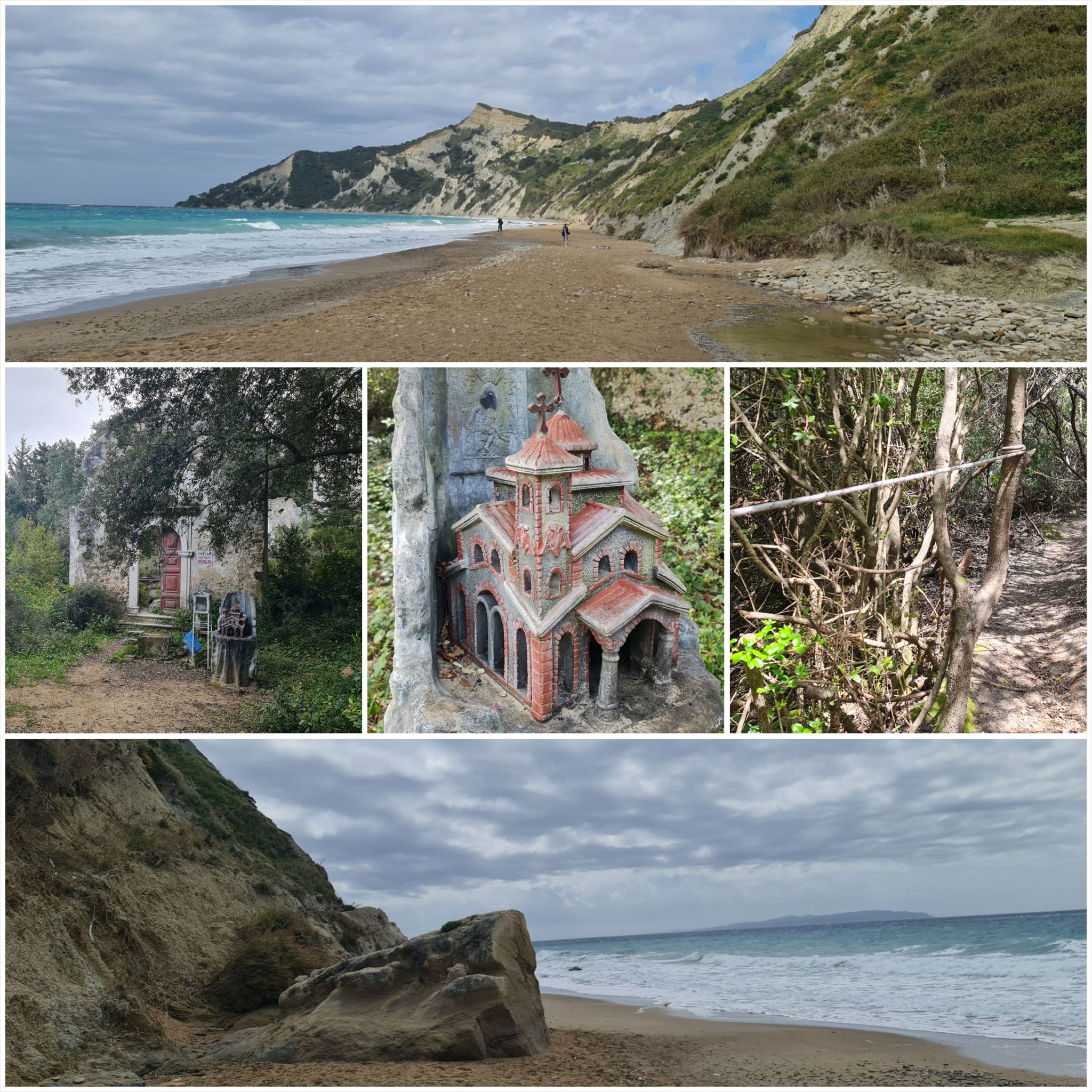
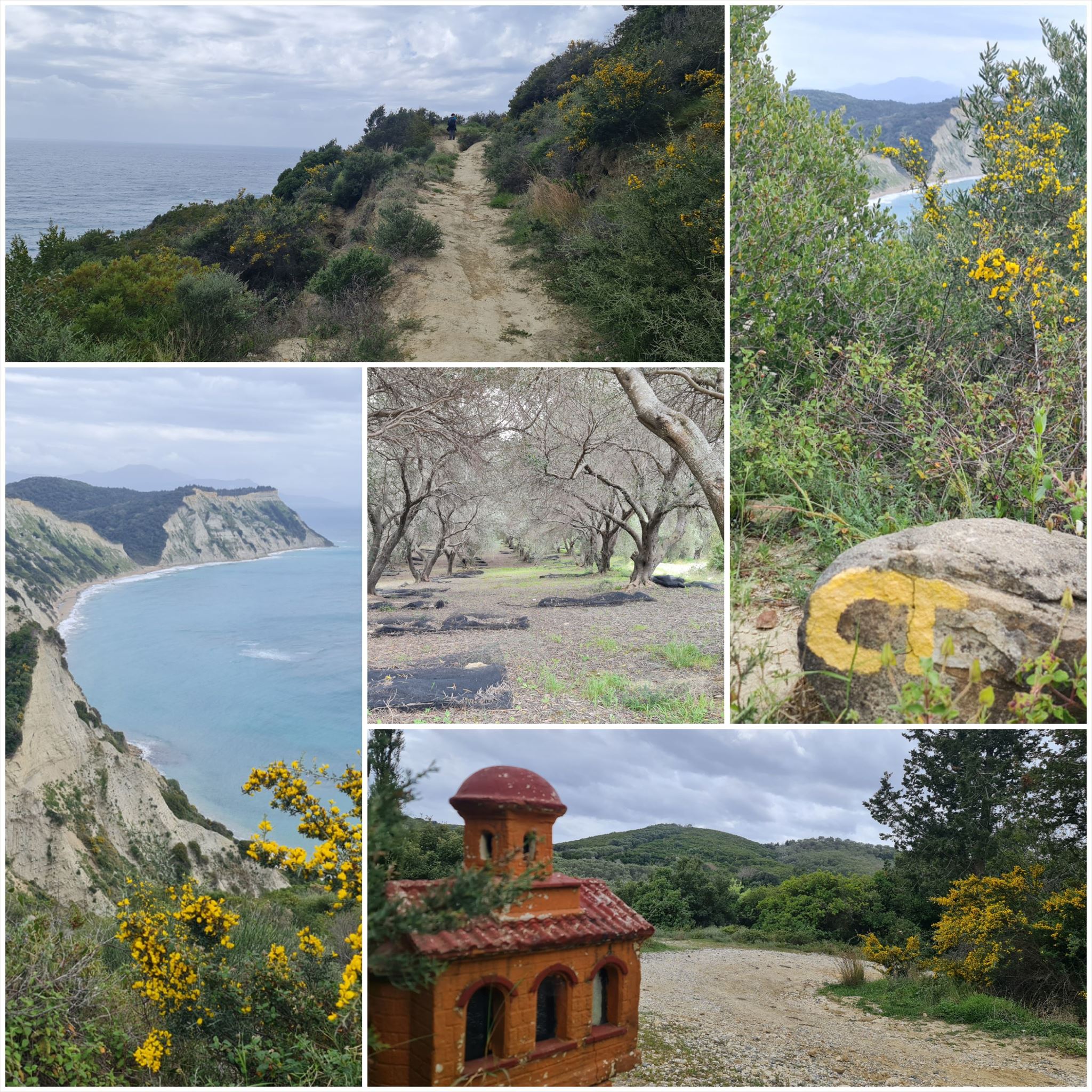
Το τοπίο αλλάζει από αμμώδεις παραλίες και αμμόλοφους στο νότο σε ελαιώνες και βουνά στη μέση και όμορφες παραλίες στα βόρεια.
Τα στάδια έχουν μήκος μεταξύ 10 και 18 χιλιομέτρων και πάντα ξεκινούν ή τελειώνουν εκεί όπου μπορείτε να βρείτε ένα δωμάτιο για τη νύχτα.
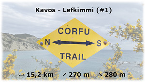
Από τον Κάβο στη Λευκίμμη (#1)
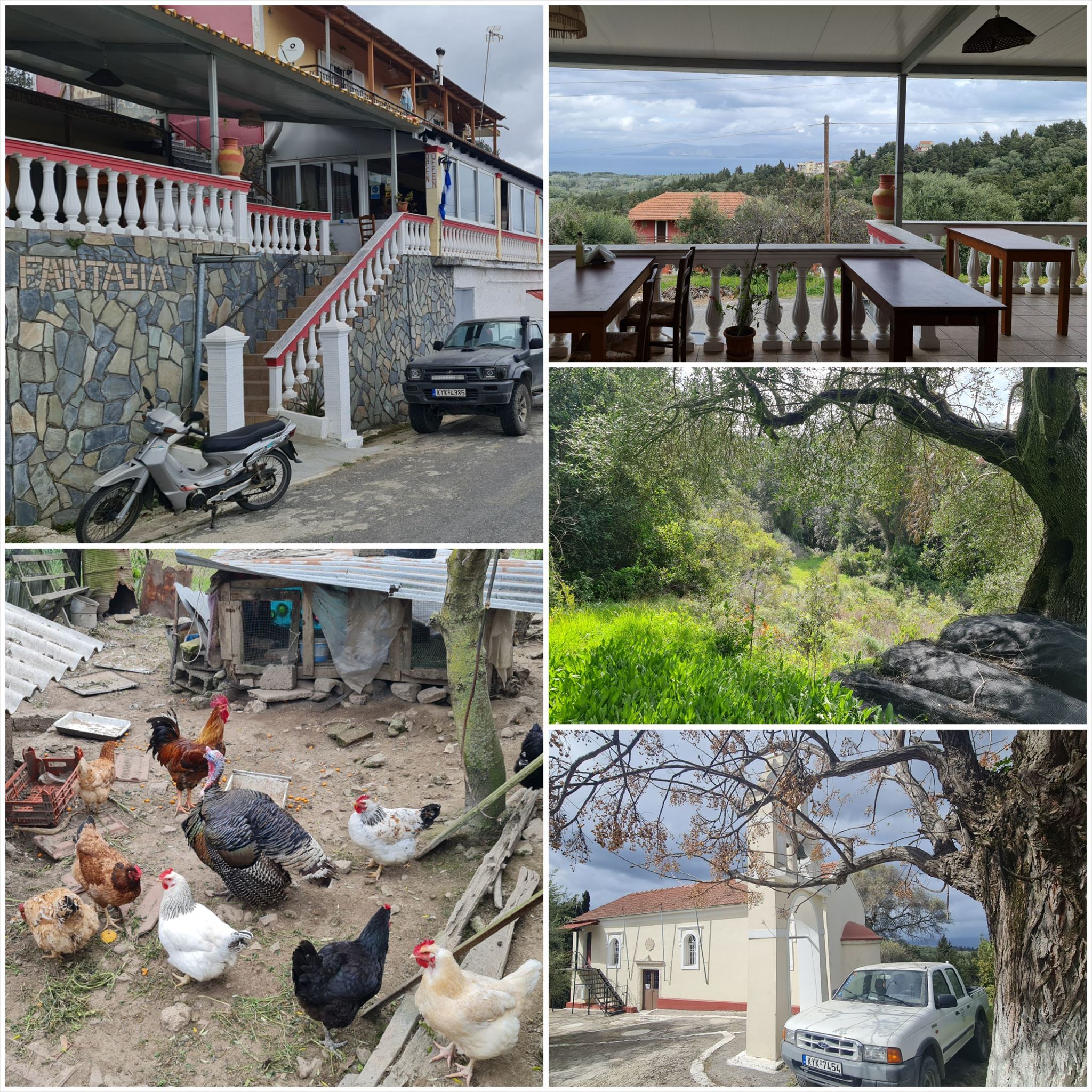
Διαμονή (προαιρετικό και δεν απαιτείται για την εύρεση του geocache):
Καφές: Mediterranean Blue
Λευκίμμη: The River Cost House
1. εργασία (Ήλιος):
N39° 22.596 E20° 7.047
A = Μετρήστε τις ακτίνες του ήλιου του κίτρινου ήλιου πάνω από την πόρτα.
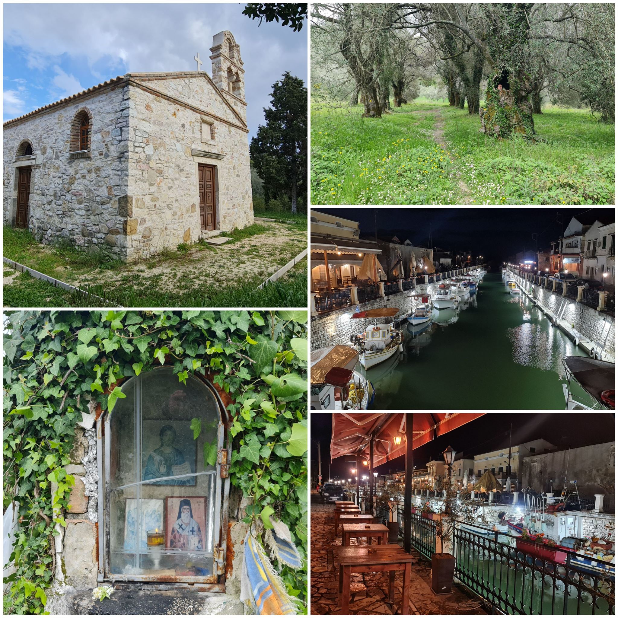
2. εργασία (Μικρή εκκλησία ή μοναστήρι):
N39° 21.856 E20° 6.426
B = Μετρήστε τα παράθυρα ακριβώς κάτω από την οροφή του στρογγυλού πύργου (το υψηλότερο).
3. εργασία (παρεκκλήσι):
N39° 22.538 E20° 5.213
C = Μετρήστε όλα τα παράθυρα και τις πόρτες.
4. έργο (Εκκλησία):
N39° 23.841 E20° 5.085
D = Μετρήστε σταυρούς και λουλούδια στην ξύλινη πόρτα.
Τελικές συντεταγμένες:
"N39° 25." A*B+296 "E20° 4." C*D+693

The Corfu Trail is a long distance walking route from Kavos in the south of Corfu to Agios Spiridon in the north.
It was created by Hilary Paipeti in May 2001 and is about 220 km long.
The landscape changes from sandy beaches and dunes in the south to olive groves and mountains in the middle and beautiful beaches in the north.
The stages are between 10 and 18 kilometers long and always starts and ends where you can find a room for the night.
From Kavos to Lefkimmi (#1)
Accommodation (optional and not needed to find the geocache):
Kavos: Mediterranean Blue
Lefkimmi: The River Cost House
1. task (Sun):
N39° 22.596 E20° 7.047
A = Count the sun rays of the yellow sun above the door.
2. task (Small church or monastery):
N39° 21.856 E20° 6.426
B = Count the windows just under the roof of the round tower (the highest).
3. task (Chapel):
N39° 22.538 E20° 5.213
C = Count all windows and doors.
4. task (Church):
N39° 23.841 E20° 5.085
D = Count crosses and flowers at the wooden door.
Final coordinates:
"N39° 25." A*B+296 " E20° 4." C*D+693
Der Corfu Trail ist ein Fernwanderweg von Kavos im Süden von Korfu nach Agios Spiridon im Norden.
Er wurde im Mai 2001 von Hilary Paipeti angelegt und ist etwa 220 km lang.
Die Landschaft wechselt von Sandstränden und Dünen im Süden zu Olivenhainen und Bergen in der Mitte und wunderschönen Stränden im Norden.
Die Etappen sind zwischen 10 und 18 Kilometer lang und beginnen bzw. enden immer dort wo man ein Zimmer für die Nacht finden kann.
Von Kavos nach Lefkimmi (#1)
Unterkünfte (optional und nicht notwendig um den Geocache zu finden):
Kavos: Mediterranean Blue
Lefkimmi: The River Cost House
1. Aufgabe (Sonne):
"N39° 22.596 E20° 7.047"
A = Zähle die Sonnenstrahlen der gelben Sonne über der Tür.
2. Aufgabe (Kleine Kirche oder Kloster):
N39° 21.856 E20° 6.426
B = Zähle die Fenster direkt unter dem Dach des runden Turms (der höchste).
3. Aufgabe (Kapelle):
N39° 22.538 E20° 5.213
C = Zähle alle Fenster und Türen.
4. Aufgabe (Kirche):
N39° 23.841 E20° 5.085
D = Zähle die Kreuze und Blumen an der Holztür.
Endgültige Koordinaten:
"N39° 25." A*B+296 "E20° 4." C*D+693
Πανό για το προφίλ σας: Banner for your profile: Banner für Dein Profil:
<a href="http://coord.info/GC9R7AQ><img src="https://img.geocaching.com:443/6c68ed2e-c937-485f-94c6-957a404cb860.png" width="300" height="169" /></a>