The cache is hidden near the Pararaha Valley Campsite shelter.
This walk is another section of the multi day Hillary Trail, a combination of tracks between Titirangi and Muriwai (75km). Here is a scientific reserve with unique coastal dunes and wetlands.
To get to the cache you can walk from either:
- Whatipu: the Gibbons and Muir Tracks, and return the same way, or walk around the coast.
- Karekare: from the main car park walk around Karekare Point at low to mid-tide only. Follow the track markers along Whatipu beach South and head inland at Tunnel Point, there is a raised boardwalk and formed path through the wetlands.
Booking is required through the Auckland Council website if you are planning on staying overnight, there is a grassed campground with an open shelter (40 spaces: $9 adult, $4.50 child)
Nearby at the mouth of the Pararaha stream was the Pararaha Mill and worker's cottages. If you walked from Karekare you may have seen signs of the tramway (possibly metal spikes or remains of railway sleepers) that used to run between Karekare and Whatipu.
The Mill was built in the early 1870's by William Foote, and burnt down in 1881, leaving parts of the valley uncut. After the fire, the Mill machinery was then shifted north to Karekare, and the tramway extended from Karekare to Pararaha.
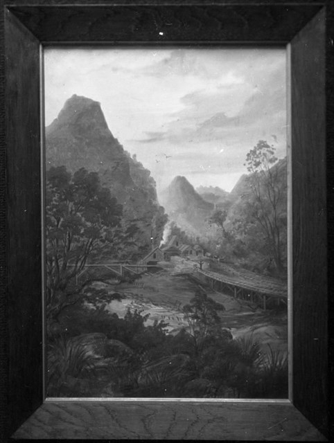
Above is a framed painting (1881) of the Pararaha Mill in the Pararaha valley showing the mill buildings, chimney stack, trestled tramways and yard: Auckland Libraries Heritage Collections JTD-05A-02325
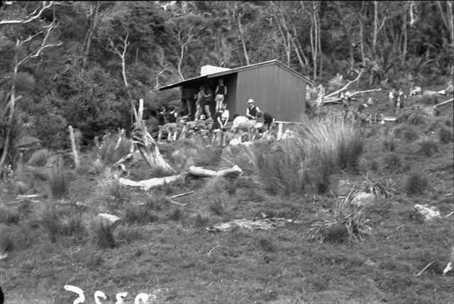
The image above is of Muir's Cottage (October 1964), the last farmhouse in the area, where trampers would stay the night, with rats as big as cats: Auckland Libraries Heritage Collections JTD-05A-02325
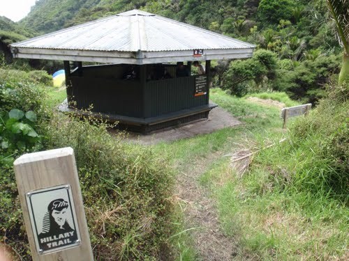
Later the Les Ward shelter was built, a large, octagonal picnic shelter, which was removed and replaced by the modern open shelter we see today. The above image of the Les Ward shelter was taken from a cache page by alligatorsnz: RIP Poly seat a gon? GC47Z1R now archived.