Welcome to Hawk Mountain Area, Weiser Forest and State Game Lands.
Here you can Hunt, Bike, Hike, Bring your dog, Ride your Horse, Snow Mobile, and just enjoy the great Outdoors.
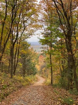
With miles of trails on logging roads and side trails
Spring time brings blooms on the Mountain Laurel along the streams and pathways,

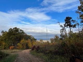
Fall has a spectacular view of colorful valleys and incredible leaf colors.
Winter snows brings the snowmobiles out to enjoy the specific trails,

Summer, the magnificent Rhododendrons are in bloom late June. While you are enjoying their beauty, you will be sharing the trails with bikers, hikers, dog walkers, horseback riders and various wildlife including deer, black bear, wild turkey, porcupine, coyotes, fox, snakes, geckos, spotted salamanders, chipmunks and squirrles...just to name a few.
As you hike on the main trails you will see red and white signage for controlled burns, which I think the marketing design group that the DCNR has knows these signs will stand out and give ample warning. As you cover more area in the different sections you will pass some very messy areas from recent logging. Loggers have left trees that are most likely too small or limbs and branches, rotten trees bases and tree tops, that cannot be processed. So they are left to become suitable cover for various animals and plants, where they can safely outwit their predators and eventually the area will revert back with all the new growth in the opened areas.
As I was placing these last set of caches in this series, the Mountain Laurel was at this season's peak bloom. The welcomed breeze was making the flowers dance like a puppet on a grand stage...I know I have a bit of an imagination that infuses at times!!

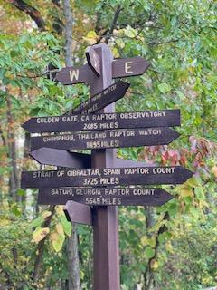
This area is a flyway for migratory birds and raptors. There are various hunting seasons to be aware of throughout the year and please wear orange to be visible during those times. Horses are not permitted during specific hunting days so please check the current hunting schedule. And of course there are quite a number of caches hidden throughout the roads and trails.
With 3,490 acres to explore, you may see a scaffold like apparatus in the woods, which would most likely be a hunter's tree stand for deer or bear hunting, please be respectful of those who hunt and wear the regulated orange per season. As you hike through this amazing protected and managed forest area, elevation will be noticeably gained as you get closer to the firetower.
Along the way to this series of hides there are awesome views to enjoy by taking some of the side trails You can watch the sun rise off the eastside of the main trail and also watch the afternoon sun as it lowers on the west side. I have placed hides on a couple of those trails!!

So Let's Take A Hike... will be a series of hides that may eventually take you up to the Fire Tower Area, where there is a large parking lot, now parking waypoints are supplied for botth ends.
The eighth hide in the series... hope you are enjoying the area!!!