EarthCache: White Sand Wonders – Biogenic Sand of Maldives
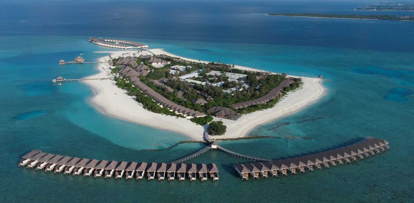
The Maldives is made up of more than a thousand islands spread over an area of over 298 km⊃2; in the Indian Ocean. They are of enchanting, unique beauty, unique on this earth.
The Maldives welcomes you to experience the splendor and charm of the islands, as well as the hospitality of the Maldivian people.
Approximately 550,000 people live in the Maldives; twice as many tourists spend their holidays here every year. Visitors have been welcomed with open arms for centuries. Some of them stayed while others spoke about the difficulties of life on these tiny islands.
Unlike the adventurers and seafarers of the past, today the Maldives can be easily reached from any country. We wish you a pleasant and unforgettable stay.
For most holidaymakers, sunny days with bright blue skies, crystal-clear lagoons in different shades of blue, moonlit nights, the soothing sound of the waves gently lapping the white beach, the rustling of palm trees and snow-white beaches are the most important features for a perfect holiday in the tropics. There are few places other than the Maldives that can offer all of this.
Although the Maldives are known to every traveler today, hardly anyone knows their history. The Maldives has undergone tremendous changes over time and has been affected by multiple geopolitical changes and upheavals over the past two millennia.
Geography
Few countries have such an extraordinary landscape as the Maldives. They consist of 1190 islands around the equator and are about 650 km southwest of Sri Lanka. The islands are lined up like a chain and are 820 km long and 130 km wide.
The islands form a total of 26 annular atolls; some atolls form around a single island, while others include around 200 islands. The Huvadhoo Atoll in the south is the second largest atoll on earth.
Atoll formation
In 1842, Charles Darwin presented the world with the first logical explanation of atoll formation. Darwin explained that atolls form when a volcanic landmass slowly sinks into the sea, causing coral to form on and around the plateau. Darwin also wrote that the formation of the Maldives is somewhat different from the Pacific and Atlantic islands he studied.
After a diving expedition in 1962, Hans Hass concluded that "the internal structure of certain coral reefs is not compact but porous and unstable, and they can therefore constantly expand at their center".
Reefs formed at the top of submerged mountain ranges that stretched out into the center of the Indian Ocean. The reefs sometimes break the water surface and begin to form platforms.
The center of a platform collapses from lack of food, lack of oxygen and the frictional effect of the tides.
Around the reef edge, where the highest and hardest corals have formed, sand and boulders accumulate, plants settle and islands begin to form.
Formation of the Maldives
The mysterious formation of the Maldives began more than 225 million years ago when only the hydrosphere and the lithosphere existed. At that time, more than half of the earth was made up of a continent called Pangea. This continent was surrounded by an ocean called Panthalassa.
About 136 million years ago, Pangea split into two continents. The northern continent was called Laurasia, the southern Gondwana, and in between lay a sea called Tethys. Then Gondwana broke apart and formed the Atlantic Ocean, separating the African continent from the American continent.
The continents were scattered due to plate movements. Then lava erupted from the Earth's core, forming an underwater landscape. The Laurasia also broke apart, forming the continents of the Northern Hemisphere about 6,600 years ago.
The Indian Ocean began to take shape about 150 million years ago. At that time, India was part of the southern continent. Asia, on the other hand, was part of the northern continent "Laurasia".
During the period mentioned above, plate movement caused India to break away from Madagascar and Africa and gradually began to move northward. As this plate moved through the Indian Ocean, it passed a hotspot. This hotspot, which is close to what is now Reunion Island, is said to have played a special role in the formation of the Maldives.
Scientific studies show that the rise that runs from the Chagos Archipelago through the Maldives to the Lakshadweep Deep was created by this hotspot. The passage of the hotspot created a long volcanic belt that extended to the Indian Plate.
After the long journey, the northern end of the Indian Plate collided with the southern end of the Asian Plate. The impact created the huge Himalayan mountain range. The Indian Ocean was then outlined.
The volcanoes that were the ancestors of the Maldives gradually began to sink into the Indian Ocean over a long period of time. The topography of the Maldives at that time was an island made up of volcanoes and highlands. However, the mountains gradually sank into the Indian Ocean, leaving only the crater at the top.
After millions of years, the tops of the remaining mountains began to form thousands of beautiful coral reef islands. Today, there are no mountains and no volcanoes in the Maldives, and the highest point above sea level is just 2.4 meters.
(Source: https://maldivestraveller.mv/de/travelguide/the-maldives)
The sand
Sand is formed over many years from rocks that weather. Most sand is made of quartz, a mineral. Other sand comes from the rocks of volcanoes. However, sand also comes from animals or plants.
Why is the sand in the Maldives so fine and white?
Fish nibble algae from corals and then excrete them again. The white dream beaches of the Maldives consist of 85 percent fish excrement.
A parrotfish can produce up to 320 kilograms of sand per year. The fish droppings are then washed up on the shore and this is how the dreamlike white sandy beaches are created.
Why doesn't the sand get hot in the Maldives?
Unlike 95 percent of all sandy beaches worldwide, Maldivian beaches are made of coral sand and are therefore even whiter. That's why it doesn't get hot and is comfortable for walking barefoot even in the midday sun.
To the cache
To be able to log the cache online you have to send me a mail or message with the results of the experiments and the answers to the following questions.
Beforehand, you should have gotten some vinegar and a spoon from a restaurant or a supermarket. :)
1. Cache name and GC code.
2. Names of all GeoCachers.
3. Pick up a handful of dry sand. Spread your fingers very slightly. Does the sand trickle down or does it get stuck between your fingers?
4. Dig a hole about 10 to 20 cm deep in the sand. From the hole, grab a handful of sand in one hand and some of the surface in the other hand. Do you notice a big temperature difference? The sand from the surface should actually be much hotter than that from the hole. Is it really like that? If not, how can you explain that?
5. Now you need the vinegar you brought with you. Put a pinch of dry sand on the spoon and pour some of the vinegar over it. you have to wait a bit what can you observe Alternatively, you can do the experiment on the palm of your hand. (Please wash your hands thoroughly after the experiment)
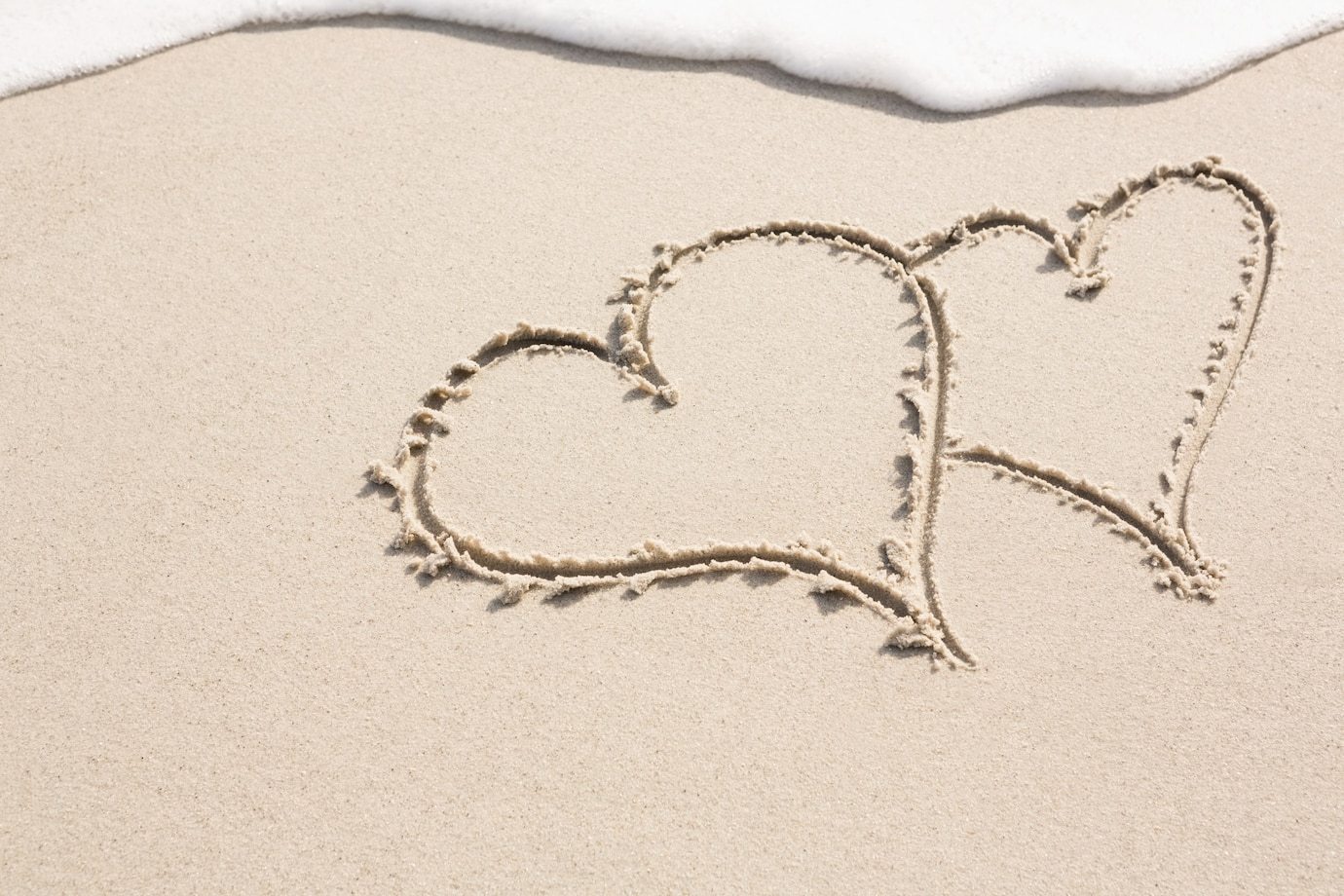
6. Write your cacher names in the sand, take a picture of it and attach it to the log.
7: Optionally, you can also add pictures of yourself to the logs.
And now have fun in the Maldives.
Warm greetings
X_Uwe_X
EarthCache: White Sand Wonders – Biogener Sand der Malediven
Die Malediven bestehen aus mehr als tausend Inseln, die sich auf einer Fläche von über 298 km⊃2; im Indischen Ozean erstrecken. Sie sind von bezaubernder, einmaliger Schönheit, einzigartig auf dieser Erde.
Die Malediven heißen sie willkommen, die Pracht und den Charme der Inseln, sowie die Gastfreundschaft des maledivischen Volkes kennen zu lernen.
Ungefähr 550.000 Menschen leben auf den Malediven; doppelt so viele Touristen verbringen hier jedes Jahr ihren Urlaub. Besucher werden seit Jahrhunderten mit offenen Armen empfangen. Manche von ihnen sind geblieben, während andere über die Schwierigkeiten des Lebens auf diesen winzigen Inseln berichteten.
Im Gegensatz zu den Abenteurern und Seeleuten in der Vergangenheit, können die Malediven heutzutage von jedem Land aus ganz einfach erreicht werden. Wir wünschen ihnen einen angenehmen und unvergesslichen Aufenthalt.
Für die meisten Urlauber sind Sonnentage mit strahlend blauem Himmel, kristallklare Lagunen in den verschiedensten Blautönen, Mondnächte, der wohltuende Klang, wenn die Wellen leise and den weißen Strand schwappen, das Rauschen der Palmen und schneeweiße Strände die wichtigsten Merkmale für einen perfekten Urlaub in den Tropen. Es gibt nur wenige Orte außer den Malediven, die all dies zu bieten haben.
Obwohl die Malediven heute jedem Reisenden ein Begriff sind, kennt kaum einer ihre Geschichte. Die Malediven haben im Laufe der Zeit gewaltige Änderungen erfahren und waren in den vergangenen zwei Jahrtausenden von mehreren geopolitischen Änderungen und Umbrüchen betroffen.
Geographie
Nur wenige Länder haben so eine außergewöhnliche Landschaft wie die Malediven. Sie bestehen aus 1190 Inseln rund um den Äquator und liegen ca. 650 km südwestlich von Sri Lanka. Die Inseln sind aufgereiht wie eine Kette und erstrecken sich auf einer Länge von 820 km und einer Breite von 130 km.
Die Inseln bilden insgesamt 26 ringförmige Atolle; manche Atolle bilden sich um eine einzige Insel, während andere um die 200 Inseln einschließen. Das Huvadhoo Atoll im Süden ist das zweitgrößte Atoll der Erde.
Atollbildung
1842 präsentierte Charles Darwin der Welt die erste logische Erklärung von der Atollbildung. Darwin erklärte, dass Atolle entstehen, wenn eine vulkanische Landmasse langsam im Meer versinkt und sich daraufhin Korallen auf dem Plateau und drum herum bilden. Darwin schrieb ebenfalls nieder, dass sich die Bildung der Malediven etwas von den Inseln im Pazifik und im Atlantik, die er untersucht hat, unterscheidet.
Nach einer Tauchexpedition im Jahre 1962 folgerte Hans Hass, dass „die innere Struktur gewisser Korallenriffe nicht kompakt ist, sondern porös und instabil und sie sich deshalb in ihrem Zentrum ständig ausdehnen können“.
Riffe bildeten sich an der Spitze untergetauchter Gebirgsketten, die sich im Zentrum des Indischen Ozeans ausdehnten. Die Riffe durchbrechen manchmal die Wasseroberfläche und beginnen, Plattformen zu bilden.
Der Mittelpunkt einer Plattform bricht durch den Mangel an Nahrung, an Sauerstoff und durch den Reibungseffekt der Gezeiten in sich zusammen.
Rund um die Riffkante, wo sich die höchsten und härtesten Korallen gebildet haben, sammeln sich Sand und Geröll, Pflanzen siedeln sich an, und es beginnen sich Inseln zu bilden.
Entstehung der Malediven
Die geheimnisvolle Entstehung der Malediven begann vor mehr als 225 Millionen Jahren, als nur die Hydrosphäre und die Lithosphäre existierten. Zu dieser Zeit bestand mehr als die Hälfte der Erde aus einem Kontinent namens Pangaea. Dieser Kontinent war von einem Ozean namens Panthalassa umgeben.
Vor etwa 136 Millionen Jahren teilte sich Pangaea in zwei Kontinente auf. Der nördliche Kontinent wurde Laurasia genannt, der südliche Gondwana, und dazwischen lag ein Meer namens Tethys. Dann brach Gondwana auseinander und bildete den Atlantischen Ozean, der den afrikanischen Kontinent vom amerikanischen Kontinent trennte.
Die Kontinente wurden aufgrund von Plattenbewegungen verstreut. Dann brach Lava aus dem Erdkern aus und bildete eine Unterwasserlandschaft. Die Laurasia brach ebenfalls auseinander und bildete vor etwa 6.600 Jahren die Kontinente der nördlichen Hemisphäre.
Der Indische Ozean begann vor etwa 150 Millionen Jahren Gestalt anzunehmen. Zu dieser Zeit war Indien Teil des südlichen Kontinents. Asien hingegen war Teil des nördlichen Kontinents "Laurasia".
Während des oben erwähnten Zeitraums führte die Plattenbewegung dazu, dass sich Indien von Madagaskar und Afrika abspaltete und sich allmählich nach Norden zu bewegen begann. Als sich diese Platte durch den Indischen Ozean bewegte, passierte sie einen Hotspot. Dieser Hotspot, der in der Nähe der heutigen Insel La Réunion liegt, soll eine besondere Rolle bei der Entstehung der Malediven gespielt haben.
Wissenschaftliche Studien belegen, dass die Erhebung, die vom Chagos-Archipel über die Malediven bis zur Lakshadweep-Tiefe verläuft, durch diesen Hotspot entstanden ist. Die Passage des Hotspots schuf einen langen Vulkangürtel, der sich bis zur Indischen Platte erstreckte.
Nach der langen Reise kollidierte das nördliche Ende der indischen Platte mit dem südlichen Ende der asiatischen Platte. Durch den Aufprall entstand das riesige Himalaya-Gebirge. Der Indische Ozean wurde dann umrissen.
Die Vulkane, die die Vorfahren der Malediven waren, begannen über einen langen Zeitraum hinweg allmählich im Indischen Ozean zu versinken. Die Topographie der Malediven war zu dieser Zeit eine Insel, die aus Vulkanen und Hochland bestand. Die Berge versanken jedoch allmählich im Indischen Ozean und ließen nur den Krater an der Spitze zurück.
Nach Millionen von Jahren begannen die Spitzen der verbliebenen Berge Tausende von wunderschönen Korallenriffinseln zu bilden. Heute gibt es auf den Malediven keine Berge und keine Vulkane, und der höchste Punkt über dem Meeresspiegel liegt bei gerade einmal 2,4 Metern.
(Quelle: https://maldivestraveller.mv/de/travelguide/the-maldives)
Der Sand
Sand entsteht im Laufe vieler Jahre aus Felsen, die verwittern. Der meiste Sand besteht aus Quarz, einem Mineral. Anderer Sand stammt aus dem Gestein von Vulkanen. Sand kommt allerdings auch von Tieren oder Pflanzen.
Warum ist der Sand auf den Malediven so fein und weiß?
Fische knabbern Algen von Korallen ab und scheiden sie danach wieder aus. Die weißen Traumstrände der Malediven bestehen also zu 85 Prozent aus Fischkot.
Ein Papageifisch kann dabei bis zu 320 Kilogramm Sand pro Jahr produzieren. Der Fischkot wird dann ans Ufer gespült und so entstehen die traumhaft weißen Sandstrände.
Warum wird der Sand auf den Malediven nicht heiß?
Anders als 95 Prozent aller weltweiten Sandstrände bestehen maledivische Strände aus Korallensand und sind daher noch weißer. Deswegen wird er auch nicht heiß und ist selbst unter der Mittagssonne angenehm zum Barfußlaufen.
Zum Cache
Um den Cache online loggen zu können musst du mir eine Mail oder Nachricht mit den Ergebnissen der Experimente und den Antworten auf folgenden Fragen senden.
Vorher solltest du dir in einem Restaurant oder in einem Supermarkt ein bisschen Essig und einen Löffel besorgt haben. :)
1. Name des Caches und GC-Code.
2. Namen aller GeoCacher.
3. Nimm eine handvoll trockenen Sand in die Hand. Spreize ganz leicht deine Finger. Rieselt der Sand runter oder bleibt er zwischen deinen Fingern haften?
4. Grabe ein ca. 10 bis 20 cm tiefes Loch in den Sand. Nimm dir aus dem Loch eine Handvoll Sand in die eine Hand und in die andere Hand etwas von der Oberfläche. Merkst du einen grossen Temperaturunterschied? Der Sand von der Oberfläche sollte ja eigentlich deutlich heisser wie der aus dem Loch sein. Ist das wirklich so? Wenn nein wie kannst du dir das erklären?
5. Nun brauchst du den mitgebrachten Essig. Lege eine Prise trockenen Sand auf den Löffel und giesse etwas von dem Essig darüber. Du musst etwas warten. Was kannst du beobachten? Alternativ kannst du das Experiment auch auf deiner Handfläche machen. (Bitte wasche dir nach dem Experiment gründlich die Hände)
6. Schreibt eure Cachernamen in den Sand, macht ein Foto davon und hängt es mit an den Log.
7: Optional könnt ihr auch gerne von euch noch Bilder mit in die Logs hängen.
Und nun viel Spass auf den Malediven.
Liebe Grüsse
X_Uwe_X
--------------------------------------------------------------------------------------------------------------------------------------------
--------------------------------------------------------------------------------------------------------------------------------------------
--------------------------------------------------------------------------------------------------------------------------------------------
Banner:
Für die Bannerfans von euch gibt es hier noch ein Banner das ihr gerne in eurem Profil einfügen könnt.
For the banner fans of yours, there is another banner that you can add to your profile.
<a href="http://coord.info/GC9XEXF"><img src="https://s3.amazonaws.com/gs-geo-images/ffcbc2a2-da1d-478b-9a74-7d2b1ce7b9f5.jpg" alt="GC9XEXF" width="307" height="198" /> </a>
--------------------------------------------------------------------------------------------------------------------------------------------
--------------------------------------------------------------------------------------------------------------------------------------------
--------------------------------------------------------------------------------------------------------------------------------------------

--------------------------------------------------------------------------------------------------------------------------------------------
--------------------------------------------------------------------------------------------------------------------------------------------