About the KMTA GeoTrail:
Welcome to a geocaching trail exploring Alaska’s only National Heritage Area. In 2009, Congress designated the Kenai Mountains-Turnagain Arm (KMTA) region of Southcentral Alaska as a National Heritage Area (NHA). This designation formally recognizes the history of an area that has deeply shaped the legacy of Alaska and the nation. It is the history of the Alutiiq, Sugpiaq, and Dena’ina people—the original stewards and inhabitants of the Kenai Peninsula. It’s that of the Iditarod National Historic Trail, Alaska Railroad, Gold Rush, Seward Highway, and local industries that give KMTA its character. KMTA’s geographic footprint bridges Cook Inlet and Prince William Sound via mountains, glacial valleys, and productive rivers. Throughout this landscape are communities and stories that connect us to our past and future. It includes the small and vibrant communities of Bird, Indian, Girdwood, Whittier, Hope, Cooper Landing, Moose Pass, and Seward, and all the wilderness between them. As Alaska’s only National Heritage Area, KMTA aims to enhance, preserve, and share the region’s natural and cultural resources— in essence its heritage. Above all else, KMTA strives to foster pride of place and an enduring stewardship ethic for this special place. As you travel through the Heritage Area to complete this GeoTrail, we encourage to keep that stewardship ethic front of mind as you learn about and enjoy the richness of the region.
As you search for the geocaches making up this GeoTrail, you’ll be asked to complete a passport that qualifies you to purchase the KMTA GeoTrail Geocoin. For more information on the Passport and GeoTrail, please visit KMTA-GeoTrail.GCAK.org
KMTA field guide link: https://kmtacorridor.org/field-trip-guide/
The unique code word for this cache is found on the front of the logbook and/or on the inside of the container lid.
**Cell coverage warning: this location may have limited cell phone coverage (at least for data). It would be wise to download the cache information before arriving at GZ.**
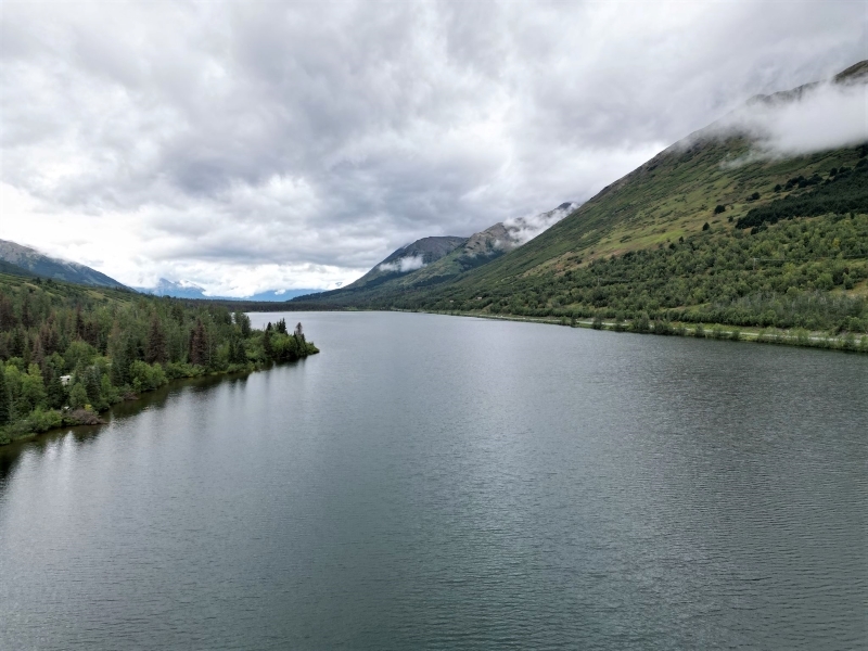
KMTA GeoTrail #9: Effects of Glaciation
The bench and related alluvial fans are glacier-related. It was at the end of the Naptown glaciation (some 12,000 years ago) that the glacier that once occupied this valley melted. The last remnants of that glacier were a shadow of its former self (the area of Summit Lake). The melting slowed and movement ceased — the ice persisted. Prior to melting entirely, rock loosened from above, fell, and formed a colluvial fan at the margins of this shrinking form that once was a proud and mighty glacier. The faint colluvial fans provide further evidence of this geologic phenomenon.

This cache is maintained by local Alaskan geocacher GeoFootstomper.
Please contact him with any questions or maintenance requests.