EarthCaches have no box to find. Instead, they teach you about geology. For more information, see earthcache.org.

Welcome to The Rocks Nature Preserve, a 2-acre woodland along a rocky stretch of Ellerbe Creek. The Rocks became a preserve in July 2016. Before that, a local developer who built most of the houses in the area north of The Rocks owned the land. The developer loved the property’s rocky terrain and dreamed of one day building his own home along the creek there. When he passed away, his son sold the land to the Ellerbe Creek Watershed Association to be preserved for future generations.

The Rocks Nature Preserve is in the Durham Triassic Basin. This basin was formed about 245 million years ago when the supercontinent Pangea began to pull apart from the Atlantic ocean and the continents we have today. Pangea's crust stretched before it broke, resulting in long, narrow basins such as the Durham Triassic Basin.
During the Triassic geologic period, Durham was a semi-dry lakebed between 2 highlands. Eroded sediment from the 2 highlands deposited sand, silt, and mud into the area. These deposits accumulated and formed the sedimentary mudstones, siltstones, and sandstones we see today.
The stretching of the crust also opened up pathways for molten rock (that is, magma) to work its way up through weaknesses to fill the basin where it slowly cooled in shallow intrusions such as sills and dikes and solidified into a rock type called diabase.
Diabase rocks are dark grey to black intrusive rocks that are similar to basalt and gabbro. The difference is their grain size.
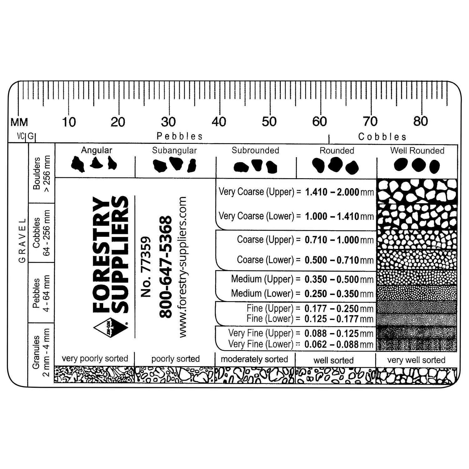
Grain size is the average diameter of the particles in rocks. Geologists determine grain sizes in the field using printed cards called comparators, which usually have a millimeter scale, phi scale, and angularity chart.
Sills are tabular sheet intrusions that form between older layers of sedimentary rock. They form when magma moves into and crystalizes between preexisting horizontal rock layers. Dikes are formed when magma flows into vertical cracks or faults across horizontal layers of rock and then solidifies. The following image shows the difference between dikes and sills.

Here below you, Ellerbe Creek flows over exposed diabase rocks because diabase rocks are much more resistant to erosion than the surrounding clay-rich sedimentary rocks.
Logging Tasks: (Required)
Send the answers to me through in an email or a geocaching message.
- What type of rocks are diabase rocks (sedimentary, igneous, or metamorphic)?
- Approximately how many million years ago did the molten rock work its way up through the earth here?
- Do you think the rocks below you formed in dikes or sills? Why?
- Using the comparator in the description, do you think diabase rocks are fine, medium, or coarse grained?
- Please post a a picture in your log of you, your GPS, your group, your arm, your geo-pet — just something to show you were here.
References