DIAS - NIEDERELBEHÜTTE - KAPPLER KOPF - DIAS
Zur Niederelbehütte und zurück #22


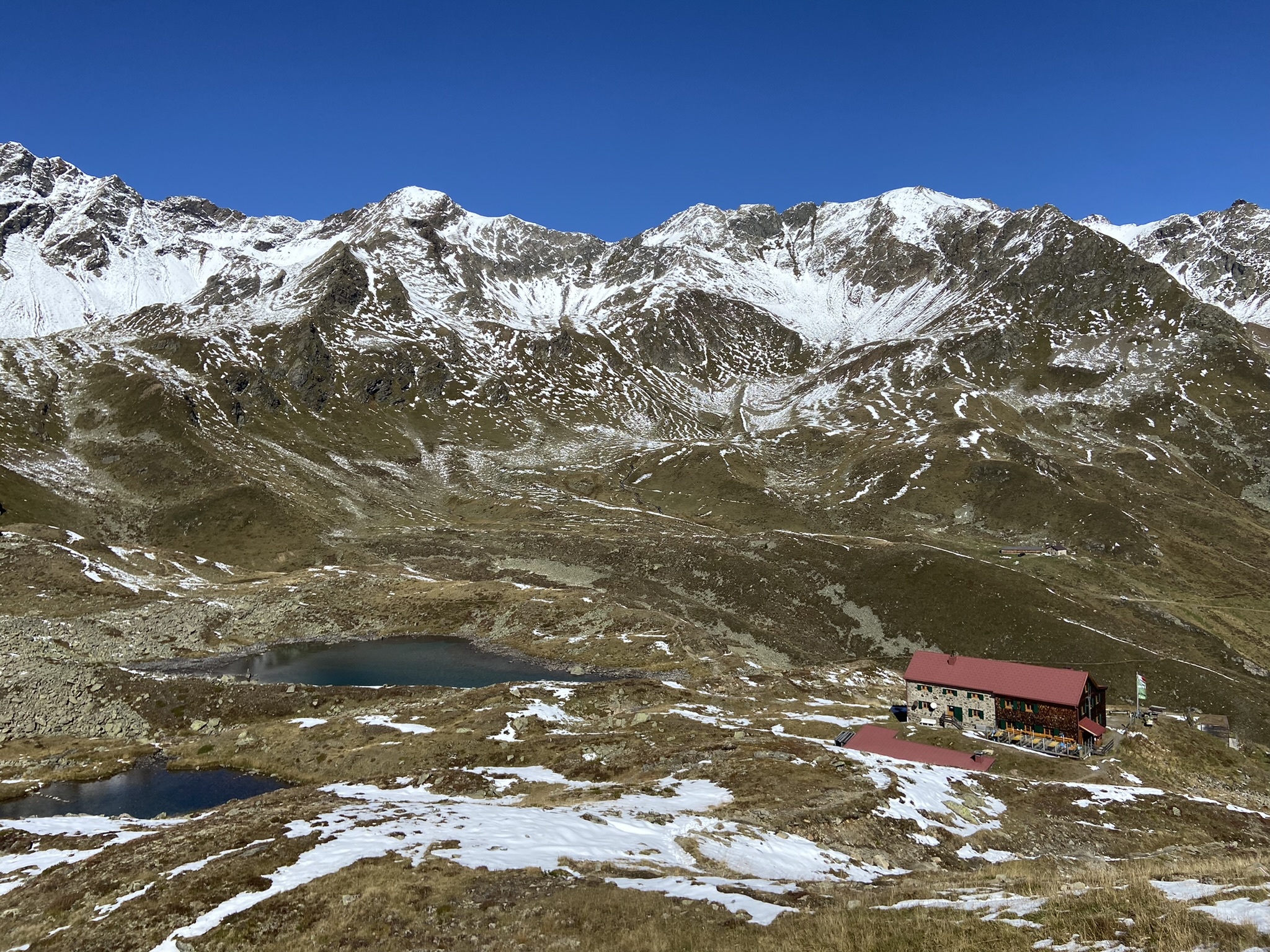
Die Niederelbehütte wurde 1930/31 im Seßladtal in der Verwallgruppe, Gemeindegebiet von Kappl auf einer Seehöhe von 2.310 Metern errichtet.
1966/67 wurde die Hütte großzügig erweitert und mit eigenem Wasserkraftwerk versehen.
Seit längerem ist die Hütte mit dem Umweltgütesiegel ausgezeichnet. Versorgt wird die Hütte über einen Lastenaufzug aus dem Paznaun.
Dauer reine Gehzeit: 4:30 h
Dauer mit cachen: 6:30 - 7:30 h
Geocaches: 43 + 2 Sidecaches

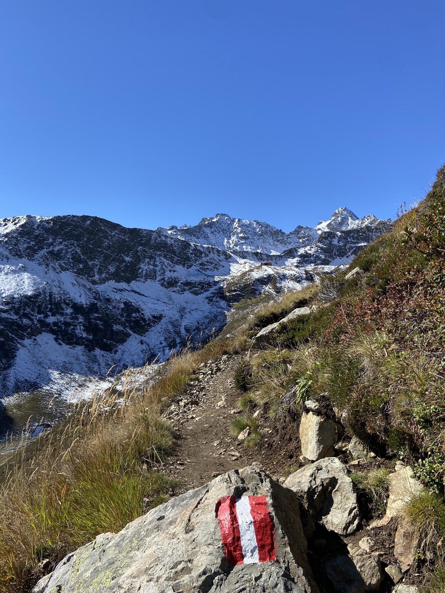
Von der Bergstation Dias aus geht es bei der Diasalpe Kapelle vorbei Richtung Almstüberl.
Nach einigen Höhenmeter geht es gemütlich über den Kieler Weg am Seßsee vorbei zur Niederelbehütte. Hier könnten Sie vor oder nach dem kurzen Aufstieg zum Kappler Kopf eine Rast einlegen.
Informieren Sie sich aber vorher über die Öffnungszeiten(siehe link zuvor).
Nach der grandiosen Fernsicht vom Gipfelkreuz ins Paznauntal und darüber hinaus, geht es wieder hinunter zur Niederelbehütte.
Nach dem Seßsee nehmen Sie die rechte Abzweigung, die Sie direkt zu den zwei Speicherseen Dias und zum Ausgangspunkt der Runde führt.

Zu beachten:
Es gibt für jeden Cache ein recht eindeutiges Spoilerbild und einen hilfreichen Hint.
Die D/T Wertung bezieht sich auf die komplette Runde.
Bedenken sie das im Gebirge fast kein Handyempfang sein kann.
Ich empfehle dringlichst eine Offline Liste zu erstellen, und/oder die Spoiler Fotos down zu loaden.
Es ist nicht verboten volle oder nasse logbücher auszutauschen und eventuelle verschwunderne Caches zu ersetzen. Besten Dank dafür!

Bergrettung Österreich: Notruf 140
Bitte gebt bei einem Unfall die Koordinaten an, ihr habt ja ein GPS-Gerät. Hilfreich ist auch die Gratis-Notfall-App der Bergrettung Tirol für iPhone oder Android:  Im Falle eines Unfalles werden durch Drücken des Knopfes die GPS-Koordinaten an die Leitstelle Tirol GmbH übermittelt und es wird eine Verbindung zur Leitstelle aufgebaut. Diese App funktioniert nur in Tirol.

The Niederelbehütte was built in 1930/31 in the Seßladtal in the Verwall group, in the municipality of Kappl at an altitude of 2,310 metres.
In 1966/67 the hut was generously expanded and provided with its own hydroelectric power station.
The hut has been awarded the environmental seal of approval for a long time. The hut is supplied by a freight elevator from Paznaun.
Duration pure walking time: 4:30 h
Duration with caching: 6:30 - 7:30 h
The highest point: 2.402 hm
Geocaches: 43 + 2 Sidecaches
From the mountain station `Dias´ it goes past the Diasalpe-chapel towards `Almstüberl´.
After a few meters of altitude,
you will take the `Kieler Weg´ rather
leisurely past the Seßsee lake to the Niederelbehütte.
Here you could take a break before or after the short ascent to the Kappler Kopf. Please check the opening hours beforehand (see link above).
After the magnificent view from the summit cross into the Paznaun valley and beyond,
we go back down to the Niederelbehütte.
After the lake `Seßsee´, take the right branch, which leads you directly to the two reservoir lakes `Dias´ and back to the starting point of the round.
To note:
There is a pretty clear spoiler image and a helpful hint for each cache.
The D/T rating refers to the complete round.
Consider that there can be almost
no mobile phone reception in the mountains.
I strongly recommend creating an offline list
and/or downloading the spoiler photos.
It is not forbidden to promote full or wet logbooks
and to replace eventual lost caches. Many thanks for that!!
Mountain rescue Austria:Emergency call 140
In the event of an accident, please give the coordinates, you have a GPS device. The free emergency app from Bergrettung Tirol for iPhone or Android is also helpful: in the event of an accident, pressing the button transmits the GPS coordinates to the control center Tirol GmbH and a connection to the control center is established. This app only works in Tyrol.