The learning purpose of this cache is to get to know meandering better. Meandering is clearly visible all over the country, in both large and small editions. The large editions tend not to think about this as the scope falls more in line with the size of the river, compared to a stream or a small os. The phenomenon of meanders are regular bends in rivers that run over very gently sloping ground covered with loose deposits. When the arc of the bends becomes larger than a semicircle, they are called serpentines (snake bends). You will have a closer look at this by studying the location and with the help of the text in the description, and you will have a good basis for answering the questions further down. Enjoy!
Main characteristics:
Meandering are used to characterize specific types of rivers based on their design. There are three types of tributaries: braided, straight and curved or serpentine. In the rivers that flow through the floodplain, meandering are usually easier to form when the slope is small.
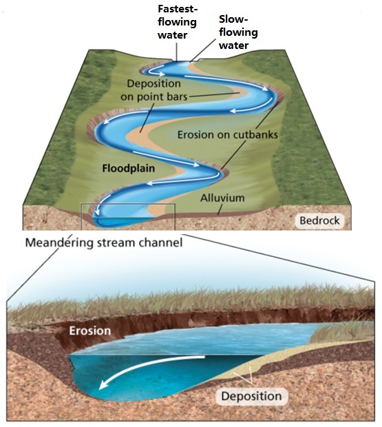
The sediment is usually deposited in the bump in a zigzag fashion and then moves from there to the shore. In the recesses, erosion dominates, and it is clear how the filling retreats due to the centrifugal force. When the advance of the fill in the convex zone is combined with the retreat of the concave zone, the river course begins to migrate and meandering occur.
It is easy to identify or distinguish from other types of rivers, because its main characteristic is the very clear meandering curve it forms in the river bed.
When the meandering current forms a very large curve, it can cause the river course to change. They are constantly moving in certain areas, for example the plains, so they can form a so-called meander-shaped lake at a certain time. The meandering process of each river is different because it depends on the current, the speed of the water and the materials that make it up.
Meandering:
The water in a river always flows in one direction, which is determined by the slope of the terrain over which it moves, even if the surface sometimes appears flat. To test it, you can do a simple experiment. Put the water into the pipe, it can be seen that the water filling speed increases or decreases; the speed depends on the slope of the pipe.
The same applies to the river bed. The water flows in the channel; the steeper the terrain, the greater the speed of the water flow and therefore the greater the force on it. It is this force that erodes the land, causing the river channel to take on a curved shape.
As the river moves over the porous, permeable surface, the edges of the natural passage through which the river continues to flow are eroded. As it wears out, it takes on a characteristic concave shape, which creates a curve.
According to geologists, the meandering process occurs in three stages: corrosion, erosion and wear. First, the rapid force of the water or the pressure of the water corrodes the river bank and carries away soil, stones and rocks.
So this material moved by the force of the water helps to erode the river bed. Finally, the particles collide into the separated and colliding elements; this causes wear, which increases the force that destroys the foundations of the river bed.
In the same way that outward erosion forms a curve, sediment also accumulates on the opposite bank, forming the convex or inner side of the curve. Fluvial channels are usually formed in the middle and lower reaches of rivers; rarely occurs at the source. This is because it is in the lower or middle part of the river where the current produces the greatest pressure and force. Meandering can change the landscape and even change the course of the river.
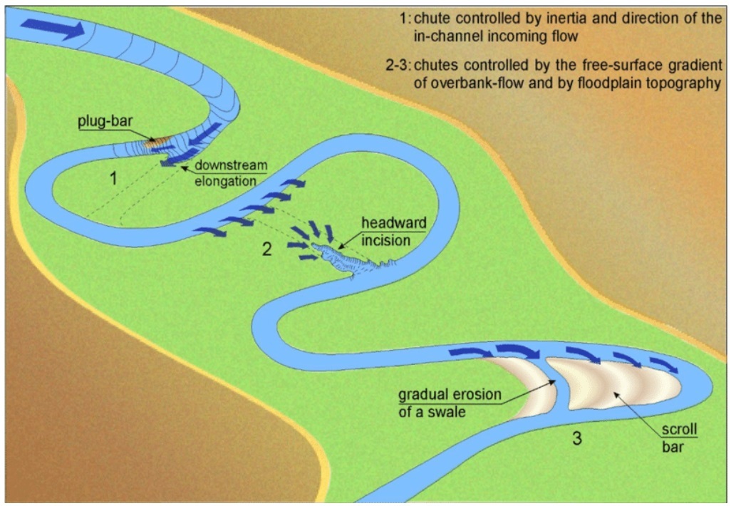
Different mechanisms of chute cutoff formation in meandering rivers.
1) Downstream elongation of a chute, controlled by inertia and direction of the in-channel incoming flow.
2) headward incision
3) swale enlargement aligned to main scroll bar direction.
To log this cache.
To get to log this cache you will have to visit and answer the questions which are related to the coordinates given the earthcache.
When answers are collected, send them to CO for verification.
You can log immediately after answers are sent CO. If there are any questions about your answers CO will contact you.
Logs without answers to CO or with pending questions from CO will be deleted without any further notice.
Please do not include pictures in your log that may answer the questions.
Questions:
1. Answer the questions below by visiting the coordinates.
A. Study the meander and note the size of the gravel/stone/sand/particles that you find in the inner bend/shore of the meandering at gz. A1) Do you want to claim that the mass is sorted in some way? B1) How big are the largest gravel/stone particles?
B. Explain why the gravel/stone/sand/particles remain (in the inside bend) here? And why is it distributed with small and large particles in different places?
C. If the river is allowed to wander freely in the future - what will this meander look like after long enough time?
2. Take a photo of you, the group or the GPS from the location without revealing any of the answers.
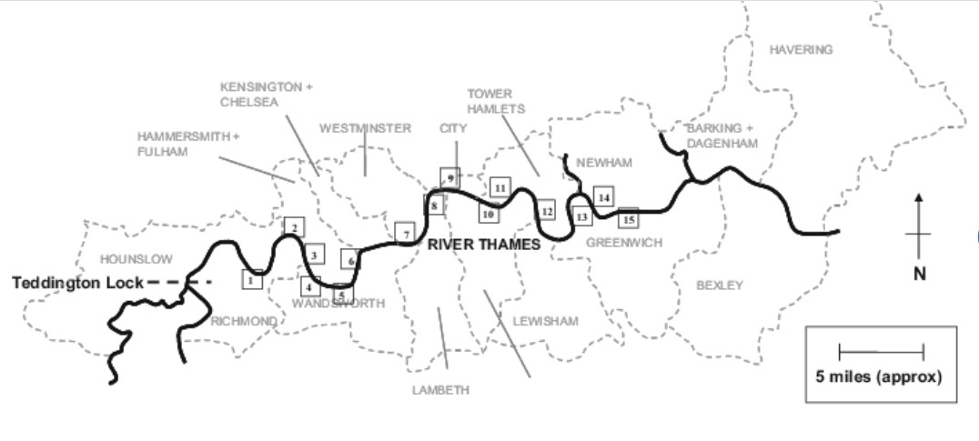
Make sure to plan your visit as for the Thames Tide Times:
https://www.metservice.com/marine/regions/coromandel/tides/locations/thames