Notice: "Cache seekers assume all risks and responsibilities involved in seeking this earthcache." “Just because it is there, doesn’t mean you have to seek the cache!” Don’t let earthcaching control you, but rather you control earthcaching.
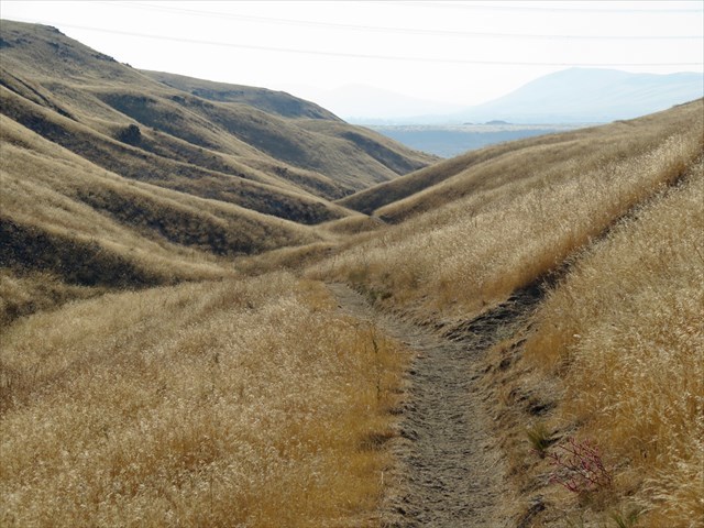
Note: Red Rock Ravine is located 1.35 miles from the trailhead or a little under 3 mile round trip hike with an elevation change of 500 feet.
Be prepared for snakes on the trail. There are ten waypoints/stops along the way.
A discovery pass is required to park in the parking area.
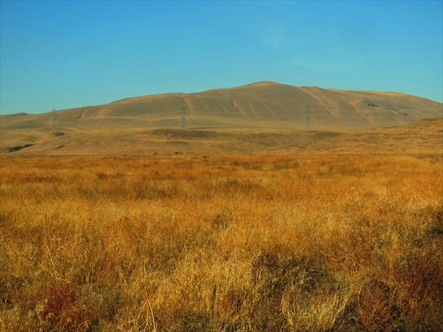
Rattlesnake Mountain
Rattlesnake Mountain north of Benton City rises from the Yakima River to a height of 3,500 feet. The eastern slope overlooks the Hanford Nuclear Reservation and the western slope of the Yakima Valley. The ridge is an asymmetrical anticline pushed up from tectonic pressure within the Yakima Fold and Thrust Belt some 5-23 million years ago. A thrust fault runs along the eastern slope just below the ridge. The fault continues southeast under Red, Candy and Badger Mountains. Above 1,200 feet, the surface soil is loess (wind blow sand and silt). Below 1,200 feet, the loess overlays Missoula flood deposit of sand, gravel, and lake sediment including glacial ice rafted boulders. The basalt outcroppings expose the Elephant Mountain lava flow a member of the Saddle Mountain Basalt and one of the last flows of the Columbia River Basalt Floods.
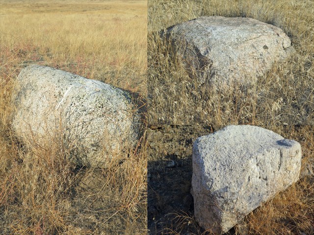
Ice Rafted Glacial Boulders
Red Rock Ravine is lined with exotic rocks that have no business being among the topography. These boulders are of Granite, an igneous rock formed under pressure, with a coarse grain crystal structure. The glassy grey material is Quartz and the dark speckles are Biotite or Hornblende. They differ from a closely related granite looking rock called Gneiss. They are metamorphic rock created under greater pressure with fine grain crystal structure forming light and dark bands. These boulders were ice rafted to the lower slope of Rattlesnake Mountain from northern Idaho during the Missoula flood and dropped as the ice rafts melted some 13,000 years ago.
Red Rock Ravine
Red Rock Ravine starts out as a gulley but becomes deeper and deeper with steeper and steeper opposing slopes. Towards the end of the ravine where the red rocks of the Elephant Mountain member are exposed, the gulch becomes narrow with walls of over 70 degrees in gradiant and 100 feet deep. During seasonal rainfall, a small stream gathers water to erode and polish lava rocks in the stream bed.
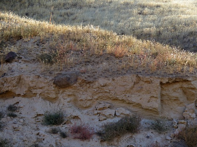
Encased Boulder (Waypoint 5)
Throughout the ravine, fluvial processes are present created from the seasonal stream cutting into the bank exposing Missoula flood deposits. The lighter color sand and silt are windblown alluvial sediments, whereas the darker are landslide composites. There are several crowns and scraps on the ridge of Rattlesnake Mountain indications of landslides from the Holocene period during and after the ice age floods from 13-15,000 years ago. The eastern slope of the ravine has conglomerate deposits from these slides. Notice there are no cross-stratification bedding (sediments layers) in these deposits and in several places mud encased boulders from the slide.
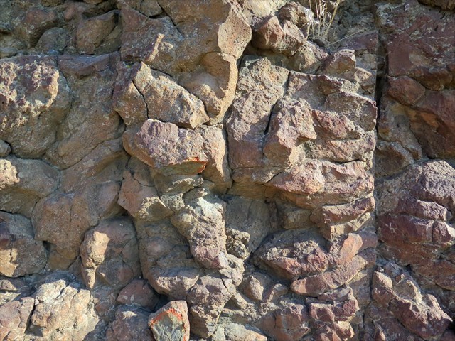
Red Rock (Elephant Mountain Lava Flow)
The Elephant Mountain member of the Saddle Mountain Formation was laid down during the waning phase of the Columbia River Basalt Group 10.5 million years ago during the Miocene.
The flow began in northcentral Idaho and exited down the ancestral Snake River. The exposed Elephant Mountain basalt ranges in color from gray-brown to brown-red due to surface exposure and iron oxidation. The specimen found here are Plagioclase (a feldspar mineral), and Olivine (Magnesium Iron Silicate), in a clinopyroxene and glass (crystal structure) with both normal and transitional magnetic polarity. The basalt is of the upper colonnade and top of the flow which is rubbly, cracked and angular. Small to large vesicles (gas holes) is observable in the basalt. Older members of the Saddle Mountain Formation (Pomona, Equatzel, Umatilla) as well as Elephant Mountain are exposed at the top of the ridge.
To log this Earthcache, please send me the answers to the following questions.
1. At waypoint 3, how did the basalt boulder come to rest at this location and where did it come from? What do you think?
2. At waypoint 5, how did the basalt boulder come to be encased? What do you think?
3. At the following waypoints 1,2,4,6,7,8,10 inspect each ice rafted boulder. How many were granite and how many were gneiss?
4. At the final, why does the exposed Elephant Mountain lava have variation of red shading?
Optional: You may upload a photo to the page of any local wildlife, unique vegetation or geology in the area.
Sources:
Video: Flood Basalts of the Pacific Northwest
Reidel, Stephen., Tolan, Terry., “The late Cenozoic evolution of the Columbia River system in the Columbia River flood basalt province” Special Paper of the Geological Society of America, January 2013
Bush, John H., Seward, W. Patrick., “Geologic Field Guide to the Columbia River Basalt, Norther Idaho and Southeastern Washington” Idaho Geological Society, September 1992
Bjornstad, B. N. (2014): Ice-Rafted Erratics and Bergmounds from Pleistocene Outburst Floods, Rattlesnake Mountain, Washing- ton, USA. – E&G Quaternary Science Journal, 63 (1): 44–59. DOI: 10.3285/eg.63.1.03