Skip to content

Tejedelo EarthCache

Hidden : 12/16/2022
Difficulty:
2 out of 5
Terrain:
3 out of 5

Size: Size:   other (other)

Join now to view geocache location details. It's free!

Watch

How Geocaching Works

Please note Use of geocaching.com services is subject to the terms and conditions in our disclaimer.

Geocache Description:


tejedelo
Tejedelo


Español


Para registrar este earthcache, enviame un mensage o correo eletrónico com la respuesta a las seguintes preguntas:

1) Desde las coordenadas dadas, en el mirador:  ¿Que tipo de valle es este ? ¿Cual es su origen ?

2) ¿Que es un valle suspendido?, ¿es este un valle suspendido? Justificalo ( ayudade del mapa topografico y de lo que ves en el lugar )

3) ¿Cual es el nombre de la última glaciación? ¿Cuales fueron las alturas máximas de la capa de hielo en la zona de Sanabria ?

4) Añade una fotografia tuya en el lugar, u otra en la que se pueda ver algún objeto, o tu nick en un papel

-Si crees que as concluido con exito los objetivos de este Earth Cache, y me ha enviado todas las respuestas solicitadas, puede hacer el log. Luego yo comprobaré que son correctas, y si hay cualquier problema me pondre en contacto para arreglarlo.
-Logs sin respuestas enviadas previamente, seran borrados sin aviso
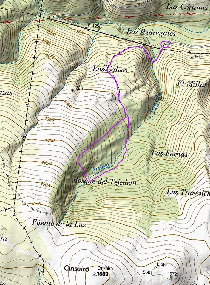
Localización

El Tejedelo es un bosque de tejos milenarios que se encuentra situado en el término municipal de Requejo de Sanabria de la comarca de Sanabria, en el cuadrante noroeste de la provincia española de Zamora.

Esta es una tierra fronteriza entre el clima mediterráneo y el atlántico, donde las sierras Cabrera y Segundera la separan de León, Galicia y Portugal. Esta singular situación geográfica hace que su clima sea de transición, entre la Meseta y Galicia, lluvioso (más de 1000 mm de precipitaciones medias anuales) pero con veranos poco húmedos y poco cálidos (16,8º), y 1º de temperatura media en enero.

El Tejedelo se encuentra a 1350 m de altitud, en una ladera con una pendiente del 20 %, orientada al norte. Se cierra a la umbría de un pequeño rincón de la sierra de Gamoneda, dentro de un valle entre peñas de granito y pizarra, excavado por los glaciares de los hielos cuaternarios. Se tiende sobre un suelo ácido, de poca materia orgánica. 


Glaciarismo en Sanábria

Hoy en día la temperatura media anual en la comarca de Sanabria es de 10,5˚, sin embargo, en el último periodo glaciar —periodo Würm— las temperaturas eran mucho más bajas. Para entender la historia glaciar de Sanabria debemos retroceder hasta el Pleistoceno superior y el Paleolítico: entre hace 80.000 y 10.000 años.

En aquel momento las temperaturas descendieron en toda la península provocando la aparición de nieves perpetuas y creando en Sanabria la gran meseta de la alta montaña: un casquete de montaña del que partían varias lenguas glaciares. Los vientos oceánicos del suroeste impulsaban masas de aire marino sobre la Meseta, produciendo abundantes nieves en ella y en sus estribaciones montañosas. La corriente del Golfo no estaba operando como hoy y en estas latitudes la supervivencia de formas animales tuvo que ser muy difícil.

Existen estudios basados en los fósiles hallados en otras partes de Europa, pero la historia glaciar de se basa exclusivamente en la geomorfología glaciar, de donde se han deducido las siguientes fases:

    Fase I: En la que se formó el casquete glaciar montañoso y el inicio de la meseta de la alta montaña.

    Fase II: en la que se comienzan a excavar los glaciares de valle.

    Fase III: el hielo remonta los valles y forma los glaciares de circo elevados en las cotas más altas.

Durante el Holoceno (Cuaternario) se depositaron los sedimentos de origen glaciar y peri-glaciar de la cuenca del Lago de Sanabria. Algunos estudios concluyen que en estos sedimentos (y en sus cambios) se encuentran las evidencias de los cambios climáticos del pasado. Tan sensible es el registro sedimentario a los cambios medioambientales que se han deducido varios ciclos climáticos, que duraron: 1.500, 456 y 311 años respectivamente.

La cartografía revela que el hielo no solo se encontraba en Sanabria sino que se extendía por todo el borde noroeste de la provincia, sobre un área de 220 km2 con epicentro en la cuenca de drenaje del Lago de Sanabria. Las máximas potencias del hielo en el momento más frío, fueron de entre 400 y 454m, lo equivale a 214 veces el volumen actual de agua que hoy contiene el Lago.

Después del periodo Würm comenzó la historia humana, y con ella la historia fluvial de la comarca de Sanabria: lo que durante miles de años fueron hielos perpetuos, se convirtieron en ríos y lagos. Así llegamos a nuestros días, en los que la montaña de Sanabria espera, quién sabe, al próximo periodo glaciar para volver a cubrirse de nieve y modelar otra vez y como siempre en geología, su relieve.


Modelado glaciar

El modelado glaciar se refiere al modelado de las formas terrestres que derivan del desplazamiento de las grandes capas de hielo durante las glaciaciones del Cuaternario en su mayoría en las partes altas de las montañas. Los accidentes glaciares son accidentes geográficos creados por la acción de los glaciares. Al paisaje consecuencia del modelado glaciar se le llama paisaje glaciar y al estudio del mismo glaciomorfología

El modelado glaciar se produce por la acción de efectos erosivos —principalmente por abrasión y arranque— y por el depósito de los materiales arrastrados

Valles glaciares

Un valle glaciar, también llamado artesa glaciar, se define como aquel valle por el que circula o ha circulado un glaciar de dimensiones importantes que ha dejado una geomorfología clara de glaciarismo. Los valles glaciares son ríos de hielo. Se forman cuando el espesor del hielo acumulado en el circo es grande. El hielo de las capas inferiores se desplaza fuera del circo y se derrama valle abajo. Los fragmentos rocosos que contienen hielo ensanchan el valle. También excavan cubetas en las zonas de roquedo menos resistente.

Los valles glaciares se caracterizan por presentar un perfil transversal en "U" o artesa, considerado este en geomorfología el rasgo principal que permite diferenciar este tipo de canales por los que se desliza o deslizó una lengua de hielo. Un valle glaciar se diferencia de uno fluvial en la forma que deja la erosión. El valle glaciar tiene forma de "U" y el fluvial forma de "V".


Otras características de los valles glaciares son las huellas de abrasión y sobreexcavación provocada por la fricción del hielo y el arrastre de material, existencia de canales de aludes, fondos planos con alternancia de umbrales y cubetas, vertientes muy verticales labradas que dan lugar a una ruptura de pendiente en hombrera y a la formación de valles colgados o suspendidos.


Valles suspendidos o colgados

Son un tipo de valle que estaba ocupado anteriormente por un glaciar de valle tributario, que debido a su pequeño tamaño no consiguió socavar el valle originalmente tributario a la misma velocidad que el glaciar principal. Después de la deglaciación, estos valles tributarios quedaron a mayor altura que el suelo del valle principal, y si presentan corrientes de agua, desembocan en el valle principal mediante una cascada. Es posible, pero no raro, que debido a erosión diferencial un río y sus tributarios den lugar a valles colgados sin intervención glaciar.


English

To log this earthcache, send me an email with the answer to the following questions:

1) From the given coordinates, at the viewpoint: What kind of valley is this? Where are you from ?

2) What is a suspended valley, is this a suspended valley? Justify it ( help of the topographic map and what you see in the place )

3) What is the name of the last ice age? What were the maximum heights of the ice sheet in the Sanabria area?

4) Add a photo to your local, another one that you can see an object, or one nick in a piece of paper


-If you believe you have successfully completed this Earth Cache goals and has already sent to me all the requirements as requested, Please, feel free to log it as found. Later i will verify the requirements sent and, if necessary, contact you in order to make the necessary corrections to your log.

-Logs without responses previously sent, will be deleted without notice

Location


"El Tejedelo" is a forest of ancient yew trees that is located in the municipality of Requejo de Sanabria in the Sanabria region, in the northwest quadrant of the Spanish province of Zamora.

This is a borderland between the Mediterranean and the Atlantic climate, where the Cabrera and Segundera mountains separate it from León, Galicia and Portugal. This unique geographical situation means that its climate is transitional, between the Meseta and Galicia, rainy (more than 1000 mm of average annual rainfall) but with slightly humid and slightly warm summers (16.8º), and an average temperature of 1º in January. .

"El Tejedelo" is located at an altitude of 1,350 m, on a slope with a 20% slope, facing north. It closes to the shade of a small corner of the Sierra de Gamoneda, within a valley between granite and slate rocks, excavated by the Quaternary ice glaciers. It tends on an acid soil, with little organic matter.


Glaciarism in Sanábria


Today the average annual temperature in the Sanabria region is 10.5˚, however, in the last glacial period —Würm period— temperatures were much lower. To understand the glacier history of Sanabria we must go back to the Upper Pleistocene and Paleolithic: between 80,000 and 10,000 years ago.

At that time, temperatures dropped throughout the peninsula, causing the appearance of perpetual snow and creating the great high mountain plateau in Sanabria: a mountain cap from which several glacial tongues originated. Southwest oceanic winds drove sea air masses over the Plateau, producing abundant snowfall on it and its mountainous foothills. The Gulf Stream was not operating as it is today and in these latitudes the survival of animal forms must have been very difficult.

There are studies based on fossils found in other parts of Europe, but the glacial history of is based exclusively on glacial geomorphology, from which the following phases have been deduced:

    Phase I: In which the mountain ice cap was formed and the beginning of the high mountain plateau.

    Phase II: in which the valley glaciers begin to be excavated.

    Phase III: the ice rises up the valleys and forms elevated cirque glaciers at the highest levels.

During the Holocene (Quaternary) sediments of glacial and peri-glacial origin of the Sanabria Lake basin were deposited. Some studies conclude that these sediments (and their changes) contain evidence of past climate changes. So sensitive is the sedimentary record to environmental changes that several climatic cycles have been deduced, which lasted: 1,500, 456 and 311 years respectively.

The cartography reveals that the ice was not only found in Sanabria, but also extended throughout the northwestern edge of the province, over an area of ​​220 km2 with an epicenter in the drainage basin of Lake Sanabria. The maximum powers of the ice at the coldest moment were between 400 and 454m, which is equivalent to 214 times the current volume of water that the Lake contains today.

After the Würm period, human history began, and with it the fluvial history of the Sanabria region: what for thousands of years were perpetual ice, became rivers and lakes. Thus we come to our days, in which the Sanabria mountain waits, who knows, for the next glacial period to be covered with snow again and to shape its relief once again, as always in geology.

Glacier modeling


Glacier modeling refers to the modeling of landforms that derive from the displacement of large ice sheets during the Quaternary glaciations, mostly in the upper parts of the mountains. Glacial features are landforms created by the action of glaciers. The landscape resulting from glacial modeling is called glacial landscape and the study of the same glaciomorphology

Glacier modeling is produced by the action of erosive effects —mainly by abrasion and uprooting— and by the deposit of dragged materials


Glacial valleys

A glacial valley, also called a glacial trough, is defined as a valley through which a large glacier circulates or has circulated, leaving a clear geomorphology of glacialism. Glacial valleys are rivers of ice. They are formed when the thickness of the ice accumulated in the circus is great. The ice in the lower layers moves out of the cirque and spills down the valley. Rock fragments containing ice widen the valley. They also dig buckets in less resistant rocky areas.

The glacial valleys are characterized by presenting a "U" or trough transversal profile, considered in geomorphology the main feature that allows differentiating this type of channel through which an ice tongue slides or slipped. A glacial valley differs from a fluvial one in the way erosion leaves it. The glacial valley has a "U" shape and the fluvial valley has a "V" shape.


Other characteristics of the glacial valleys are the traces of abrasion and overexcavation caused by the friction of the ice and the dragging of material, the existence of avalanche channels, flat bottoms with alternating thresholds and basins, very vertical carved slopes that give rise to a rupture. from slope to shoulder pad and to the formation of hanging or suspended valleys


Suspended or hung valleys


They are a type of valley that was previously occupied by a tributary valley glacier, which due to its small size failed to undermine the originally tributary valley at the same rate as the main glacier. After the deglaciation, these tributary valleys were higher than the main valley floor, and if they have water currents, they flow into the main valley through a waterfall. It is possible, but not rare, that due to differential erosion, a river and its tributaries give rise to hanging valleys without glacial intervention.


Additional Hints (No hints available.)