
Welcome to Cache Across Maryland 2023. This year is the 20th anniversary of CAM. We have made this year a little special with a CAM cache in every county, plus Baltimore City.
This is one of the caches placed for Cache Across Maryland 2023. You must find a minimum of ten caches prior to the picnic held on Saturday, June 3, 2023 in order to receive a free Maryland Geocaching Society CAM geocoin.
Make note of the code word found inside each cache container. You must enter all the symbols into an online decoder in order to print your CAM certificate as well as print a claim form to submit and receive your geocoin at the picnic. More info on CAM is available here.
There are FIVE MANDATORY COUNTIES. THOSE WILL BE GARRETT, ST MARY'S, CECIL, WORCESTER AND ANNE ARUNDEL. You can choose any of the other five counties to find a minimum of ten CAM caches.
Bowie State University / Fran Uhler Natural Area
Park at the Bowie State MARC train station Park and Ride off Lemon Bridge Road. Please use ONLY this lot for parking.
All on campus parking at Bowie State University (including VISITOR) is BY PERMIT ONLY and is enforced.
The main trail of this park has a surface of old pavement and gravel, it is flat, but it can be muddy most of the year. There isn't much shade along the trail and it can be quite buggy too. It runs parallel to the railroad tracks which for much of the park has no barrier. PLEASE STAY AWAY FROM THE TRACKS USE ONLY THE TRAILS. Park is open from dawn to dusk only. Dogs are allowed on leash.

Bowie State University is the oldest historically black university (HBCU) in Maryland and one of the ten oldest in the country. It was founded in 1865 by the Baltimore Association for the Moral and Educational Improvement of Colored People as a teaching school. The school first used space at the African Baptist Church at Calvert Street and Saratoga Street, in Baltimore. In 1867, the school was formally named the Baltimore Normal School for Colored Teachers. After being reorganized in 1883 as the Baltimore Normal School, it educated African Americans to be teachers for African American students until 1908. At that time, the school became a state institution of teaching under the Maryland State Department of Education and was redesignated as a Normal School No. 3. Shortly thereafter, in 1910, the school moved to the Jericho Farm, a 187-acre campus in Prince George's County, near Bowie. About 60 students lived in the old farmhouse. The school was renamed in 1914 as the Maryland Normal and Industrial School at Bowie. the school was renamed in 1935 as Maryland Teachers College at Bowie. In 1963, Bowie State College was officially named a liberal arts school, although emphasis remained on teacher education. The school was renamed Bowie State University in 1988.

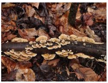
Fran Uhler Natural Area is located along the Patuxent River between Bowie State University and the Patuxent Wildlife Research Center and features five miles of woodland trails open for hiking, bicycling, and nature study. This is a popular area for local bird watching groups. It’s also a great area for trainspotting as you walk the trail adjacent to the MARC railroad tracks.
PUZZLE
Gather what you need to complete the coordinates N39 01.ABC W076 45.XYZ by taking a short walk to the campus of Bowie State University. Once you have complete coordinates you will return through the tunnel to proceed to the park (see trailhead waypoint) to find the cache.
A: N39 01.064 W076 45.900: TUNNEL Enter the tunnel to go from the Lemon Bridge parking lot under the railroad tracks to enter Bowie State University Campus. Inside the tunnel, locate the white sign with red lettering. Count the number of times the letters “A” and “E” appear in the sign. Use the total number (A’s + E’s) for A _____.
X: N39 01.076, W076 45.684: PLAZA Proceed west around the Martin Luther King, Jr. Communication Arts Building (Sidewalk waypoint N39 01.034, W076 45.778) to the plaza in front of the building. Count the number of sculptures in the ring. Use this number for X_____.
Note 10/28/25 there is construction going on at the plaza and the sculptures have been removed. Use the value of 5 for X.
Y: N39 01.08, W076 45.630: SIGN Find the date on line 5 of text use the last digit for Y_____. (Ignore the headline.)
B: N39 01.108, W076° 45.611: BULLDOG Find the Bulldog mascot in front of the Thurgood Marshall Library, to the left is a small plaque. Use the number on line 3 for B_____.
Note 10/28/25 plaque may be missing, use the value of 4 for B
Z: N39 01.124, W076° 45.620: OBELISK Count the total number of words in the image on one of the sides at the top of the obelisk. Use the last digit of this number for Z_____.
C: N39 01.147, W076 45.614: PLAQUE Find the first date on the first line, use the last digit for C_____.
N39 01.ABC W076 45.XYZ
(A + B + C + X + Y + Z) = 22
As you near GZ you on the main trail, you will spot a trail to your left (just past the MNCPP rules sign), that is the best approach to access the cache.
Access / Hours


You can validate your puzzle solution with
certitude.