Please read the questions below and note the requirement to add a photo to your log.
The Port Macquarie area preserves spectacular and rare rocks that illustrate the processes involved in plate tectonics. About 490 to 450 million years ago, in the Ordovician period, the region had an active subduction zone, where two crustal plates converged, and one plate is dragged under another.
On Shelly Beach are rocks formed on the deep ocean floor, showing evidence of sedimentary and tectonic forces from 500 millions years ago.
Chert is a hard, fine-grained sedimentary rock composed of microcrystalline or cryptocrystalline quartz, the mineral form of silicon dioxide (SiO2). Chert is characteristically of biological origin, but may also occur inorganically as a chemical precipitate or a diagenetic replacement, as in petrified wood.
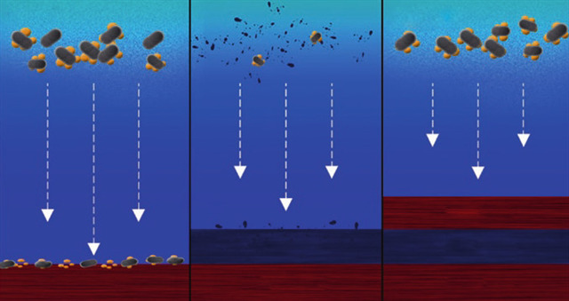
Chert is typically composed of the petrified remains of siliceous ooze, the biogenic sediment that covers large areas of the deep ocean floor, and which contains the silicon skeletal remains of microorganisms - diatoms, silicoflagellates, and radiolarians.
When they die, the skeletons of tiny marine organisms fall to the seafloor. In deep ocean water most skeletons dissolve in the acidic water, except for those made from silica. As layers of these skeletons build up, pressure and chemical changes convert them into rock known as chert.
Chert varies greatly in colour (from white to black), but most often manifests as greys to browns and light green to rusty red (occasionally dark green); its colour is an expression of trace elements present in the rock, and both red and green are most often related to traces of iron.
Depending on other ocean sediments that may form from time to time, other rock layers may form between the chert layers, including muds and silts forming shales, and volcanic sediments forming basalt. Evidence of local volcanic activity can actually be seen in the form of basaltic rocks about 200m south of GZ here on Shelly Beach.
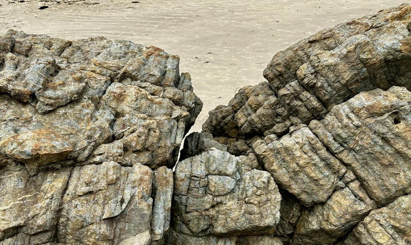
Thick layers of sediment on the seafloor is subjected to forces as is it transported along the ocean trench by tectonic forces. The layers slump and slide, deforming into folds and bends in the sedimentary layers. Evidence of these folds are well demonstrated here.
To log this EarthCache, you will need to answer the following questions (through geocaching messaging please), and post a photo in your log.
Q1. At GZ find some rocks exhibiting obvious banding patterns. Describe the rocks (an average specimen) in terms of colours/texture and thickness of the banding.
Q2. Do you think the banding you note here today is in the same orientation as it was when laid down? If not - what has happened?
Q3. Some areas show obvious silica-rich bands of sediment (chert) with intervening layers of clearly different rock. What processes would you think has led to these different layers forming?
Q4. See if you can find an example of bending in the chert bands. Describe how you feel the bending/flexing of this rock has occurred. Add a photo of some folded chert including your GPS/team swag item to your log.
Take care at GZ. We visited at high tide, and had no difficulty accessing GZ - in strong sea conditions the area could become more hazardous. There is no need to go all the way to the wave-break zone to do this EC.
References:
App - iOS/Android - NSW Geotours
Wikipedia - Chert