To complete this cache you need to review this cache page and make observations at the GZ.
About this Location
The Intracoastal Waterway (ICW) is a 3,000-mile (4,800 km) inland waterway along the Atlantic and Gulf of Mexico coasts of the United States. Some sections of the waterway consist of natural inlets, saltwater rivers, bays, and sounds, while others are artificial canals. It provides a navigable route along its length without many of the hazards of travel on the open sea. Many boat enthusiasts call this part of 'The Great Loop' where you can travel the ICW as well as the Great Lakes, the Rideau Canal, and the Mississippi and Tennessee-Tombigbee Waterway as part of a 6,000 mile journey through the Eastern United States and parts of Canada via waterways.
The Geology/Earth Lesson
Geology is fascinating because it gives landscapes and the scenery they are surrounded by a logical, scientific explanation. Geologic histories can be found in even the smallest surface differences. Hence, geology is a useful tool for understanding much of the natural world and all life found within it. It is unlike any other visual science. Geologic knowledge also helps us find the essential resources we need to survive, teaches us how to safeguard and preserve those resources and our environment, and gives us a tool for predicting and, consequently, preparing for life-changing events.
The geologic past is largely out of sight in Florida, which has a maximum elevation of only around 345 feet (105 meters) in the Panhandle which is the lowest highpoint of any state in the US. A large portion of south Florida is basically flat with only a few meters of relief and resting only a few meters above sea level. Subtle paleoshorelines from former sea-level highstands, karst-created lakes, and minor river drainage basins are what most characterize Florida's surface topography. What we observe are contemporary geologic (and biologic) ecosystems, including some well-known locales like the Everglades, coral reefs, and 360 miles of coastline with 189 official beaches.
If you want to learn more about the geologic features of Florida, you can view Florida's interactive Geologic Map here:
https://ca.dep.state.fl.us/mapdirect/?focus=fgsgeologicmaps

Florida Stratigraphic Geology - Map Legend
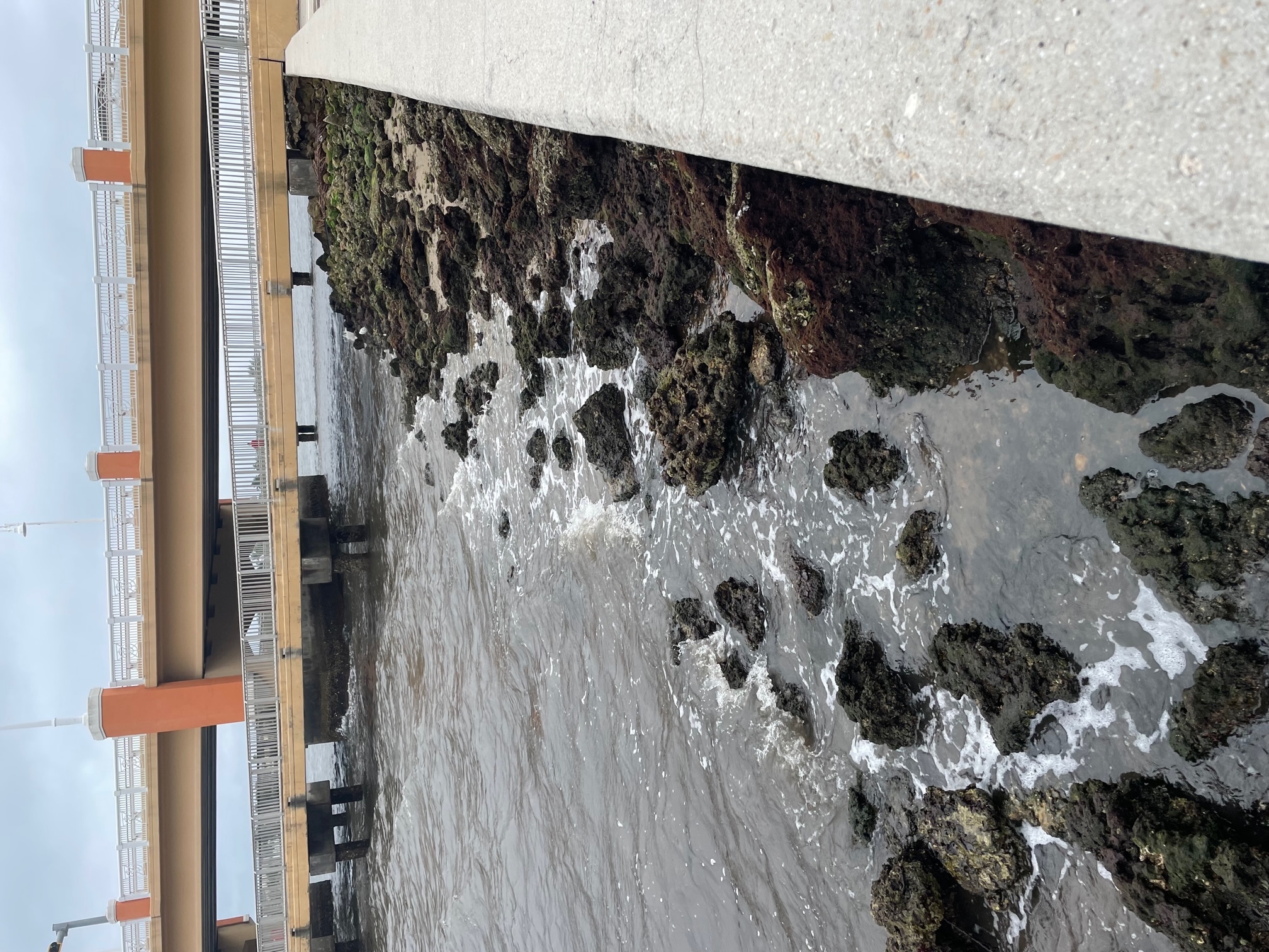
In terms of geological time, the intercoastal waterway has seen numerous modifications over the years. This portion of the ICW has experienced ebbs and flows over time due to both natural erosion and damage caused by humans. In some places, the combined effects of all of the dredging and the natural erosion that takes place on both sides of the river can be rather dramatic. To stop additional erosion in this area, the shoreline at the GZ has been strengthened with a common manmade structure, the seawall.
A Living Shoreline for Erosion Control
There is an urgent need for links between artificial and natural systems. Urbanization and proximity to waterways and coastlines now account for the majority of the world's population, and these dense concentrations have a disproportionate impact on ecosystem function.
A living coastline, an alternative to traditional armoring or man made seawall construction, is starting to gain popularity, particularly those who are worried about the resilience of their erosion control measures. There are several types of living shorelines and/or hybrid options including those with vegetation, oyster shell, native limestone riprap, terracing and retaining walls. The advantage of using a combination of solutions is that these can be tailored to withstand the energy level of the site. Below is an example of one such hybrid method being used in Lantana.
Logging This Earthcache
Please send your answers to the following questions first, then log your find.
1) Using the map above, which type of geology do you think this location has?
2) What are the main geomorphologic characteristics (the landforms produced by erosion, weathering, deposition, transport and/or tectonic processes) that characterize the geography of Florida at this point?
3) What kind of erosion control is in place here?
(Optional) Upload a photo of yourself at the GZ.
Happy Earthcaching!