Skip to content

ClimateQuest - The tale of water Traditional Geocache

Hidden : 5/26/2023
Difficulty:
2 out of 5
Terrain:
3 out of 5

Size: Size:   regular (regular)

Join now to view geocache location details. It's free!

Watch

How Geocaching Works

Please note Use of geocaching.com services is subject to the terms and conditions in our disclaimer.

Geocache Description:


Povestea apei

Acest geocache face parte din jocul ClimateQuest, care te va călăuzi în unele zone umede interesante din România și îți va arăta efectele schimbărilor climatice, precum și efectele intervenției umane asupra acestor habitate.

În cadrul Munților Bihorului, platoul carstic Padiș ocupă un loc special, fiind una dintre cele mai unice zone carstice din România. Multe dintre formațiunile sale exo- și endocarstice prezintă un interes științific și turistic deosebit.

Acest platou unic, care se întinde pe o suprafață de numai 39 km2 este înconjurat de stânci și include opt mici depresiuni, găzduiește aproape toate tipurile de fenomene carstice: defileuri, peșteri, ponoare, izbucuri, peșteri de gheață și doline.

Printre acestea se numără  Cetățile Ponorului, Peștera Rădeasa, Peștera Focul Viu, Izbucul Galbenei, Cascada Bulbuci, etc.

Platoul Padiș este situat în Munții Bihor-Vlădeasa mai exact în Munții Padiș-Scărișoara, în partea de nord a acestor munți, la sud de Masivul Vlădeasa.

Din punct de vedere hidrografic, apele din platoul Padiș se află într-o situație specială, deoarece părăsesc platoul sub formă de cursuri de apă în adâncime doar sub suprafață, străbătând stâncile, pentru a ieși din nou la suprafață dincolo de acestea.

Climatul este caracterizat de inversiunea de temperatură, motiv pentru care pe partea inferioară a văilor crește molidul, iar pe dealurile din jur cresc arbori de foioase. Datorită condițiilor microclimatice deosebite, în unele locuri, vegetația este nordică în raport cu latitudinea geografică, iar speciile alpine se găsesc la altitudini foarte joase.
 
Rezervația naturală de 39 km2 se suprapune cu două arii protejate Natura 2000: Munții Apuseni - Vlădeasa (ROSPA0081) și Apuseni (ROSCI00002).

Unele dintre numeroasele specii de plante care se găsesc aici sunt protejate, cum ar fi bulbucul de munte (Trollius europaeus), mai multe specii de gențiane și orhidee, crinul de pădure (Lilium martagon), săbiuța (Gladiolus imbricatus), roua cerului (Drosera rotundifolia) etc.

Pășunatul intensiv are consecințe negative, cum ar fi sărăcirea elementelor valoroase ale pajiștilor și răspândirea elementelor mai puțin valoroase, cum ar țăpoșica (Nardus stricta), precum și pagubele provocate de călcare de către animalele care pășunează. În plus, pentru a-și proteja animalele, ciobanii au umplut unele ponoare cu crengi și pietre.

Platoul carstic Padiș este un loc popular pentru recreere, explorarea peșterilor și drumeții. Ca urmare a activității antropice și a factorilor naturali, Peștera Scărișoara, Ghețarul de la Barsa, Peștera Focul Viu, printre altele, își pierd treptat din volumul de gheață.

Izbucul Ponor

Traversați Poiana Ponorului pentru a ajunge la Izbucul Ponor. Aceasta este a doua treaptă a sistemului hidrografic Măgura Vânătă. Este locul unde apa din pârâurile care dispar de pe platoul Padiș iese la suprafață, dispare într-o dolină după o scurtă porțiune și apoi reapare la Cetățile Ponorului.

Geocache-ul se află la coordonatele N 46° 34.59984’ E 22° 43.01898’.


A víz meséje

Ez a geoláda a ClimateQuest játék része. A játék elvezet téged Románia különböző vizes élőhelyeire, bemutatva a klímaváltozás és az emberi tevékenység ott érezhető hatásait.

A Bihar-hegységen belül különleges helyet foglal el a Pádis-karsztfennsík, amely Erdély és Románia egyik legkülönlegesebb karsztvidéke. Számos exo- és endokarsztikus alakzata tudományos és turisztikai szempontból is különleges jelentőséggel bír. 

Ezen a mindössze 39 km2 nagyságú, sziklafalakkal körülvett, nyolc kisebb medencét magában foglaló különleges fennsíkon a karsztjelenségek szinte minden változata megtalálható: sziklaszorosok, barlangok, víznyelők és vízkeletek, szurdokvölgyek, jégbarlangok, dolinák váltakoznak.

Ilyenek a Pádis jelképének számító Csodavár, a Regyásza-barlang, a Pokol Tüze-barlang, más néven Eszkimó barlang, Galbina vízkitörés, Háromkirály vízesés stb. A Pádis-fennsík a Bihar-Vlegyásza-hegységben, pontosabban a Pádis-Szkerisóra-hegységen belül helyezkedik el, mégpedig e hegység északi részén, a Vlegyásza-masszívumtól délre.

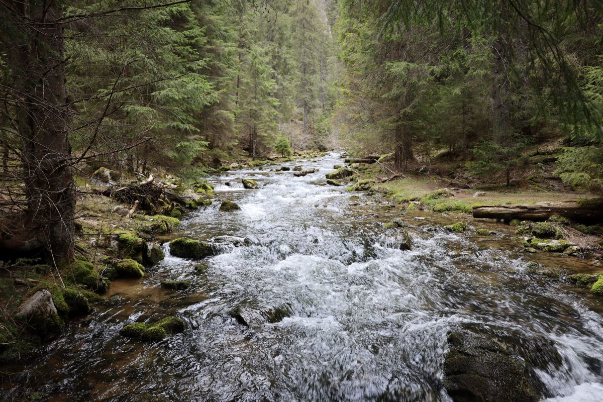
Hidrográfiai szempontból a Pádis-fennsík vizei különleges helyzetben vannak, mivel a fennsíkot csak a felszín alatt, a sziklákban utat törve, búvópatakokként hagyják el, hogy majd a sziklákon túl bukkanjanak újra a felszínre. A Pádis fennsík vizei a Köves-Körösön keresztül a Fekete-Körösbe ömlenek.

Klímájára jellemző a hőmérsékleti inverzió. Emiatt  a völgyek alján lucfenyő, míg a környező hegyoldalakon lombhullató fák élnek. A különleges mikroklimatikus viszonyok miatt egyes helyeken, a földrajzi szélességhez képest északi növényzet fordul elő, így itt alpesi fajok élnek rendkívül alacsony tengerszint feletti magasságon.

A 39 km2 természetvédelmi terület átfedésben van a ROSPA0081 Apuseni - Vlădeasa különleges madárvédelmi területtel, valamint a ROSCI00002 Apuseni közösségi jelentőségű területtel.

A számos, itt fellelhető növényfaj közül egyesek védettek, mint pl. az európai zergeboglár (Trollius europaeus), több tárnics és orchidea faj, turbánliliom (Lilium martagon), réti kardvirág (Gladiolus imbricatus), kereklevelű harmatfű (Drosera rotundifolia) stb.

A túlzott legeltetésnek olyan negatív következményei vannak, mint az értékes gyepelemek elszegényedése, és kevésbé értékes elemek, pl. szőrfű elterjedése, a legelő állatok okozta taposási károk. Ezen kívül, a pásztorok, hogy megvédjék állataikat, néhány víznyelőt faágakkal, sziklákkal töltöttek fel.

A Pádis karsztfennsík a pihenés, a barlangkutatás és a túrázás kedvelt helyszíne az ide látogatók körében. Az emberi tevékenység és természetes tényezők következtében többek között az Aranyosfői-, a Bársza-, az Eszkimó-jégbarlangok fokozatosan veszítenek jégtérfogatukból.

Ponor-vízkelet

A Ponor-réten átkelve jutunk el a Ponor-vízkelethez. Ez egy három szakaszból álló vízrendszer, a Kék Magura - Galbina vízrendszer második foka. Ezen a helyen bukkan a felszínre a Pádis-fennsíkon eltűnő patakok vize, amely egy rövid szakaszon továbbhaladva, víznyelőben tűnik el, majd legközelebb a Csodavárnál tör újra a felszínre.

A ládát a N 46° 34.59984’  E 22° 43.01898’ koordinátán találod.


The tale of water

This geocache is part of the ClimateQuest game, which will guide you around some interesting wetlands in Romania and show you the effects of climate change, as well as the effects of human intervention on these habitats.

Within the Bihor Mountains, the Pádis karst plateau occupies a special place, being one of the most unique karst areas in Transylvania and Romania. Many of its exo- and endokarstic formations are of special scientific and touristic interest.

This unique plateau, which covers an area of only 39 km2 and is surrounded by rock walls and includes eight small basins, is home to almost all types of karst phenomena: rock gorges, caves, sinkholes and water chasms, gorge valleys, ice caves.

The Padiș plateau is located in the Bihor-Vlădeasa Mountains, more precisely in the northern part of the Padiș-Scărișoara Mountains, south of the Vlădeasa Massif.

The Padiș plateau waters are of particular interest from a hydrographic point of view since they leave the plateau as diving streams only below the surface, breaking their way through the rocks, to emerge again beyond the rocks.

Its climate is characterized by temperature inversion, which is why spruce grows at the bottom of the valleys and deciduous trees on the surrounding hillsides.  Due to the particular microclimatic conditions, in some places the vegetation is northern in relation to the geographical latitude, and alpine species are found at very low altitudes.

The 39 km2 nature reserve overlaps with the ROSPA0081 Apuseni - Vlădeasa Special Protection Area for Birds and the ROSCI00002 Apuseni Site of Community Importance.

Some of the many plant species found here are protected, such as the Globeflower (Trollius europaeus), several species of Gentianaceae and Orchideaceae, the Martagon Lily (Lilium martagon), the Turkish Marsh Gladiolus (Gladiolus imbricatus), the Round Leaved Sundew (Drosera rotundifolia), etc.

Excessive grazing has negative consequences such as the impoverishment of valuable grassland elements and the spread of less valuable elements such as Matgrass (Nardus stricta), also trampling damage caused by grazing animals. In addition, in order to protect their animals, shepherds have filled some  sinkholes with tree branches and rocks.

The Padiș karst plateau is a popular place for recreation, cave exploration and hiking for visitors. As a result of human activity and natural factors, the Scărișoara Cave, the Barsa ice Cave, the Eskimo Cave, among others, are gradually losing ice volume.
 

Ponor emergence

Cross the Ponor ridge to reach the Ponor emergence. It is the second stage of the Blue Magura - Galbina water system. This is where the water from the disappearing streams on the Padiș plateau comes to the surface, disappears in a sinkhole after a short stretch and then resurfaces at the Cetățile Ponorului.

The geocache is located at the coordinates N 46° 34.59984’ E 22° 43.01898’. 

Additional Hints (Decrypt)

Jbbqra arfg obk

Decryption Key

A|B|C|D|E|F|G|H|I|J|K|L|M
-------------------------
N|O|P|Q|R|S|T|U|V|W|X|Y|Z

(letter above equals below, and vice versa)