West Morton Trail #1: Intro & Info
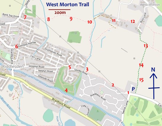
This 4km 15-cache trail takes in quiet suburbia, cobbled ginnels, mature woodland, farmland, ancient shady trails, the delightful hamlet of West Morton and some great views, especially to the south over the Aire valley.
It can easily be done in 2 hours or so, allowing for short stops to complete caching formalities, take photos, admire the view, etc. It ascends some 70m, so some moderately steep walking is involved - but only for around 10-15 minutes. The rest is on mainly level ground.
Parking for the start of the trail is available kerbside on Carr Banks @ or near N 53 52.509 W 1 51.835. Whether you do the trail in sequence or in reverse depends on whether you wish to do the steep bit after ~30 minutes or from the start.
Note: The distance attribute and the terrain rating (reflecting a combination of distance and slopes) for a particular cache is the cumulative value, starting from 1 and continuing through the series. However, where parking is available near (within a 2-3 minute walk) of a cache, a P (parking nearby) attribute is given, in case more rapid access to a given cache is needed.
The trail became possible with the archiving f98nay's 9-cache West Morton series which was hidden on 19/6/16 and archived by 28/3/22 after a total of 395 finds, garnering a total of 21 FPs along the way.
The first cache, a small, magnetic, camo-taped, screw-capped tube, is hidden near a busy corner with muggles likely to be passing by at any time, so suitable stealth will be required to safely undertake your caching operations . . .
Please take care to replace carefully - thanks!
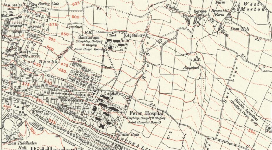
See the Gallery for a series of historical maps of the area dating from 1851 to 1947 which highlight the changes which have occurred over that period.
 1851
1851
It appears that up to the late 1800s, there was minimal change but then the 1908 map is the first to show the two hospitals (Isolation Hospital and Sanatorium) at Low Banks and the Barden Aqueduct bringing water to Bradford and environs.
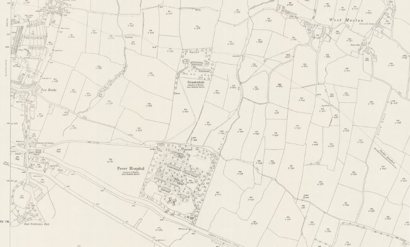 1919
1919
The 1919 map shows housing development at Low Banks and High Banks and further expansion of the hospitals. The 1934 map is the first to show housing in the Riddlesden area south of the canal and the 1947 shows further significant housing development - but not yet the housing estates north of the main hospital site (now woodland).
 1947
1947