
PRESENTS:
Zur Jamtalhütte

Vom Startpunkt im Zentrum fährt man Richtung Süden und
gelangt sehr bald auf die Straße, die ins Jamtal hineinführt.
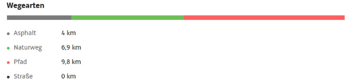
Ziemlich genau 10 km und ca. 600 hm legt man zurück,
bis man das Ziel auf der Jamtalhütte erreicht.
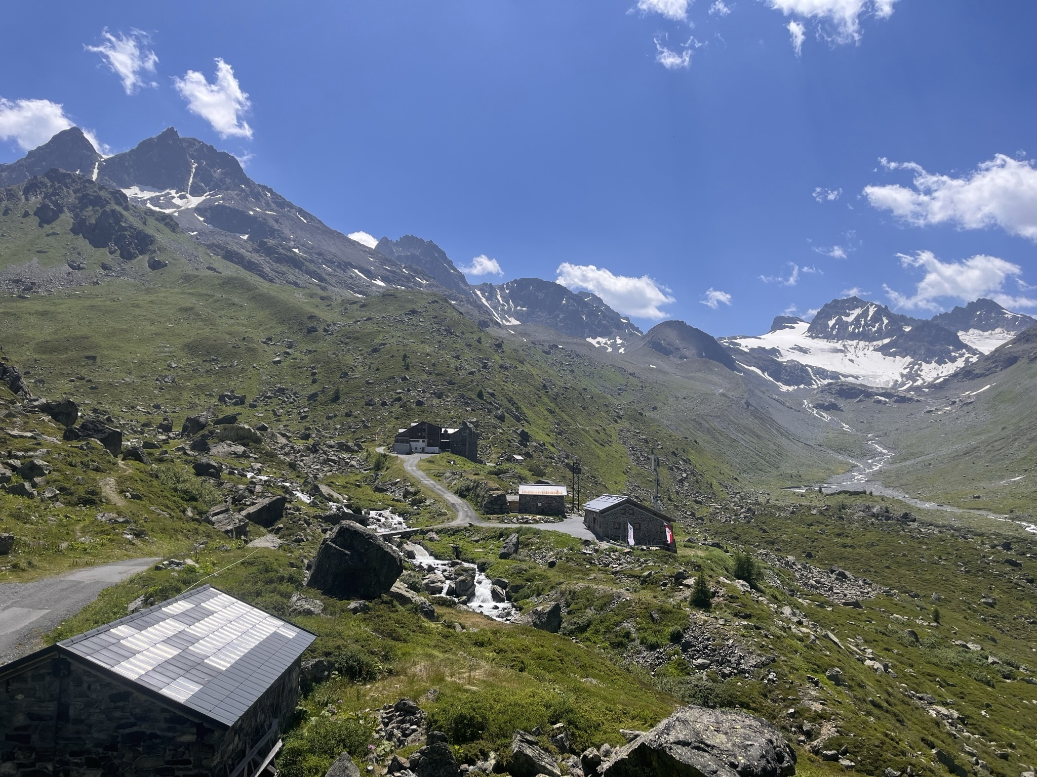
Begleitet wird die Tour durch fantastische Ausblicke
auf die vergletscherten Gipfel im hinteren Jamtal.
Landschaftlich ist das stille Tal durch typische Tiroler Almwirtschaft charakterisiert,
verschiedene Weidetiere sind also ein ständiger Wegbegleiter.
Zusätzlich zu Jamtalhütte sind zwei der Almen – die Menta-Alm und die Scheibenalm –
im Sommer bewirtschaftet und laden zur Stärkung ein.
Die Tour zur Hütte weist immer wieder steilere Abschnitte auf,
darf also konditionell nicht unterschätzt werden.
Die Jamtalhütte gehört der Sektion Schwaben des Deutschen Alpenvereins an
und ist einer der bedeutendsten Stützpunkte für Bergsteiger,
Kletterer und Skitourengeher im Silvrettagebiet.

--->Informationen zur Jamtalhütte <---

Dauer reine Gehzeit: 6:30 h
Dauer reine Bikezeit: 3:00 h
Dauer mit cachen: ~9:00 h bzw 5:30 h
Geocaches: 45 + 4 Sidecaches


Zu beachten:
Es gibt für jeden Cache ein recht eindeutiges Spoilerbild und einen hilfreichen Hint.
Die D/T Wertung bezieht sich auf die komplette Runde.
Bedenken sie das im Gebirge fast kein Handyempfang sein kann.
Ich empfehle dringlichst eine Offline Liste zu erstellen, und/oder die Spoiler Fotos down zu loaden.
Es ist nicht verboten volle oder nasse logbücher auszutauschen und eventuelle verschwunderne Caches zu ersetzen. Besten Dank dafür!
=======>SPOILER SAMMLUNG JAMTAL <=======
Bergrettung Österreich: Notruf 140
Bitte gebt bei einem Unfall die Koordinaten an, ihr habt ja ein GPS-Gerät. Hilfreich ist auch die Gratis-Notfall-App der Bergrettung Tirol für iPhone oder Android:  Im Falle eines Unfalles werden durch Drücken des Knopfes die GPS-Koordinaten an die Leitstelle Tirol GmbH übermittelt und es wird eine Verbindung zur Leitstelle aufgebaut. Diese App funktioniert nur in Tirol.

To the Jamtalhütte
From the starting point in the center,
you head south and soon reach the road that leads into the Jamtal.
You cover approximately 10 km and climb about 600 meters
until you reach your destination, the Jamtal Hut.
The tour is accompanied by fantastic views of the glaciated
peaks in the rear Jamtal.
The picturesque valley is characterized by typical Tyrolean alpine farming,
so various grazing animals are a constant companion along the way.
In addition to the Jamtal Hut, two of the alpine pastures,
the Menta Alm and the Scheibenalm,
are open in the summer and offer opportunities for refreshments.
The route to the hut has sections that are consistently steep,
so it should not be underestimated in terms of physical fitness.
The Jamtal Hut is owned by the Swabian Section of the German Alpine Club
and is one of the most important bases for mountaineers,
climbers, and ski tourers in the Silvretta area.
--->Information about the Jamtalhütte <---

Duration pure walking time: 6:30 h
Duration pure biking time: 3:00 h
Duration with caching: 9:00 h bzw. 5:30
The highest point: 2.165 hm
Geocaches: 45 + 4 Sidecaches
To note:
There is a pretty clear spoiler image and a helpful hint for each cache.
The D/T rating refers to the complete round.
Consider that there can be almost
no mobile phone reception in the mountains.
I strongly recommend creating an offline list
and/or downloading the spoiler photos.
It is not forbidden to promote full or wet logbooks
and to replace eventual lost caches. Many thanks for that!!
======>SPOILER COLLECTION JAMTAL <======
Mountain rescue Austria:Emergency call 140
In the event of an accident, please give the coordinates, you have a GPS device. The free emergency app from Bergrettung Tirol for iPhone or Android is also helpful: in the event of an accident, pressing the button transmits the GPS coordinates to the control center Tirol GmbH and a connection to the control center is established. This app only works in Tyrol.