Up until 1 August 2023 this Beaumont Bridge remained in use as part of State Highway 8. Completed in March 1887, the Beaumont Bridge is a single lane structure with concrete piers and abutments.
An interesting feature of this bridge is that it was the first of four early iron truss bridges made entirely from iron fabricated in New Zealand. All of the other iron truss bridges are no longer in use for vehicles because they were never designed for the loads. Traffic signals were introduced several years ago as a measure to reduce stress on the wrought iron truss structure, by lowering vehicle speeds over the bridge.
This was not the first Bridge here in Beaumont over the Clutha River - Mata- Au; an earlier structure was destroyed in the disastrous flood of 1878 and in turn took out other bridges downstream too, including the one at Balcutha (see GC9G6GG). After the floods the apporach and piers were raised to ensure this next bridge (the one you see here today) was above the flood level.
This historic structure has done well over the years but as traffic levels grow and the size/weight of vehicles increase, it is time to retire this bridge from taking the load of the vehicular traffic and the new bridge from 1 August 2023 will bear this load. For more information see GCAHTB7.
But never fear this old historic bridge is not getting demolished - it has been converted into a foot/cycle bridge for those on the Clutha Gold walking and cycling trail.
This is just some of the intresting facts I learnt about the bridge when working on the new one (some more info can be found through links on https://www.nzta.govt.nz/projects/new-beaumont-bridge or better yet go visit the local museum to learn more).
Some other instresting facts;
- The Dam structures upstream now control the water levels of the Clutha River, typically water is released around 11am upstream of the bridge, so to see the rock outcrops (below the piers) you need to be here before noon.
- There is a lovely little museum display at the village hall (corner of Stonewall Street and Eastferry Street) of all of the early Maori and European Settlers. This area was a popular rest spot for both groups when hunting and exporing the nearby area.
- You might notice on google maps there is a West Ferry and East Ferry (just downstream of the two bridges) - this was were a ferry punt service would operate before the first was built. To enjoy/see a ferry crossing of the Clutha River head down the river to GC23BY0 or GC1M75F
For this multi simply go to the plaque on the stone by the south eastern end of the bridge and answer the following questions (note; take care with the cache itself and make sure you have a good grip before removing your hand and place back exactly as found - on side not top).
S 45° 4A.BCF E 169° 3B.DEC
A = sixth number on the plaque
B = ninth number on the plaque
C = eleventh number on the plaque
D = tenth number on the plaque
E = third number on the plaque
F = number of t's in the last word
Check sum A+B+C+D+E+F = 26 (note; take care with the cache itself and make sure you have a good grip before removing your hand and place back exactly as found - on side not top, you reach from bridge deck).
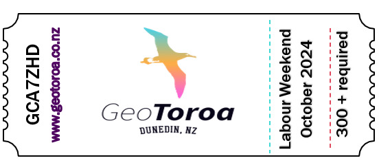
Wish to attend New Zealand’s next large multi-day event? GCA7ZHD Geo Toroa will be held on NZ’s Labour Day long weekend 26-27th October 2024 in Dunedin. Details in the link below;