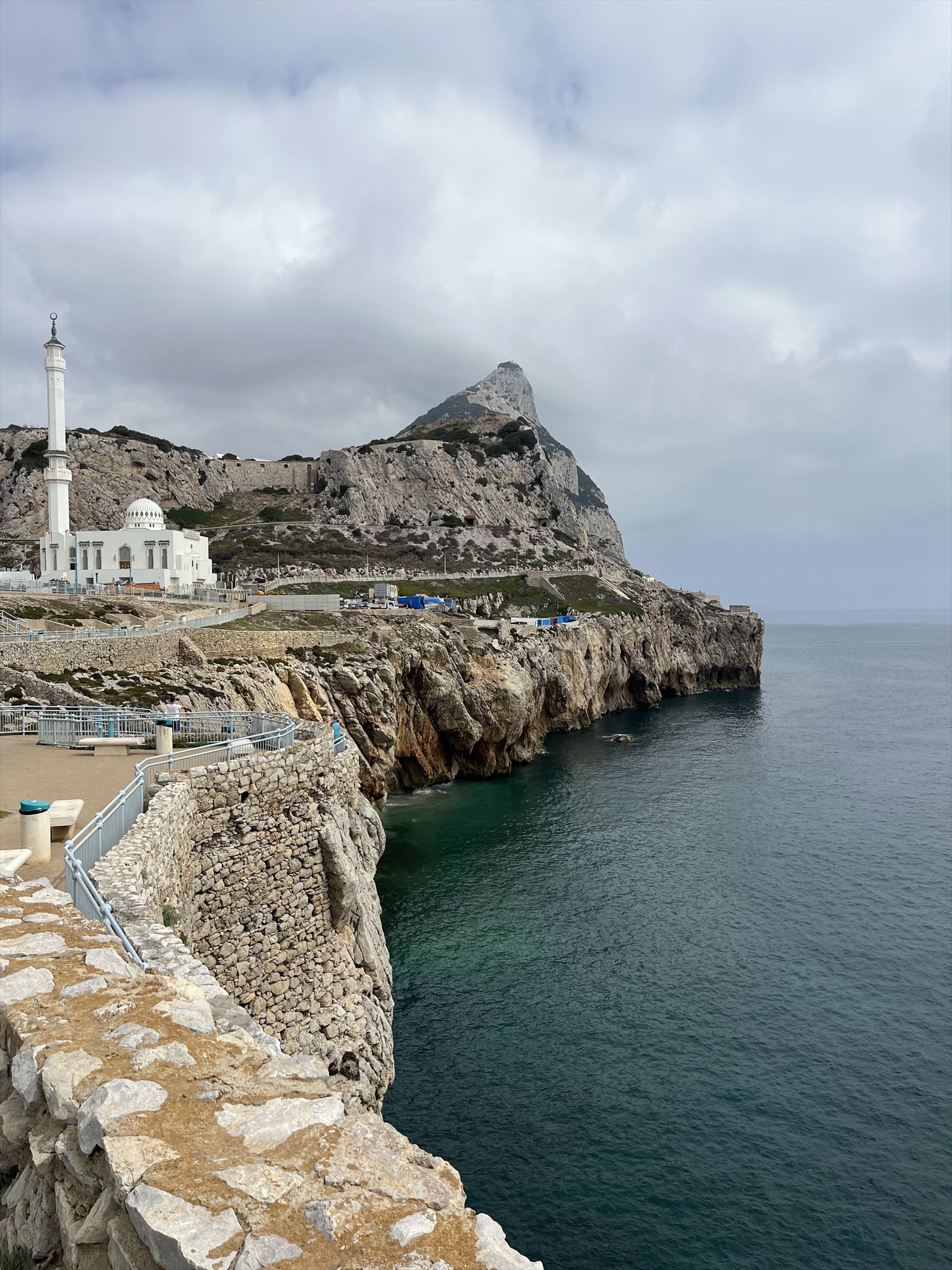
Nestled at the crossroads of Europe and Africa, Gibraltar stands as a captivating British Overseas Territory celebrated for its exceptional amalgamation of history, culture, and breathtaking landscapes. This petite yet historically significant enclave, famously dominated by the iconic Rock of Gibraltar – reminiscent of the legendary monkeys that inhabit it – has played a pivotal role in shaping the course of history, thanks to its strategic positioning at the entrance to the Mediterranean Sea.
Near Europa Point, the southernmost tip of Gibraltar, you'll find a network of sea caves that have been carved into the limestone cliffs by the relentless waves of the Mediterranean Sea. Sea caves are formed by the strong force of ocean waves hitting rocky coastlines over a long time. These waves slowly create empty spaces inside cliffs and headlands along the coast. Several things, like the type of rock, how strong the waves are, and if there are cracks in the rocks, affect how sea caves are made. The main way they form is called wave abrasion. When big waves crash onto the shore, they carry sand, pebbles, and other rough bits that act like tools, breaking away the rock bit by bit. As the years go by, this wearing away makes cracks get deeper and wider, eventually turning them into sea caves.
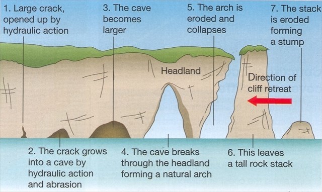
The composition of the coastal rock plays a pivotal role in the intricate process of sea cave formation. Rocks with a lower level of hardness and greater susceptibility to erosion, such as sandstone, limestone, or shale, undergo more pronounced wave abrasion, culminating in the creation of larger and more elaborate sea caves. In contrast, more resilient rocks like granite or basalt give rise to smaller cave structures. The intensity and frequency of wave impact also wield considerable influence. Areas exposed to elevated wave energy, often in the presence of robust ocean currents or inclement weather conditions, witness accelerated cave development, leading to more rapid and extensive formations. Conversely, regions experiencing subdued wave action tend to yield more modest and shallow cave configurations. Structural vulnerabilities within the rock, such as fractures, faults, or joints, serve to expedite the cave formation process. These preexisting pathways facilitate deeper water penetration, hastening the erosive processes at play. They can transform into larger chambers or collapse entirely, creating new formations (such as those shown in the image above), or reshaping the coastline.
Logging Requirements:
- Describe some of the sea caves visible along the coastline. Why do you think the sea caves here have formed where they are located? Which factor(s) do you think mainly influence where they are formed?
- Using the image as a guide, which stage of formation would you say that a majority of the sea caves are in? Also, are you able to observe any other geologic features like rock stacks or stumps?
- Over time, as sea caves are formed, the cliff (headland) retreats. How do you think the structural stability of the lighthouse/road/sidewalk nearby might be affected? Do you think this might be an issue in the near future, or probably something that wouldn't have to be dealt with for a long time?
- Upload a photo taken at Europa Point. You don't have to be in the photo, though it is strongly encouraged.