Perambulate: to walk around, in a leisurely way, in order to inspect
PRESTONFIELD / PRIESTFIELD: A southern suburb of Edinburgh, about 3 miles south of Princes Street. Its borders are Newington, Peffermill Road, Pollock Halls of Residence, the Royal Commonwealth Pool, Holyrood Park and Duddingston village. It is mostly residential, and the large council housing estate built between the 2 world wars is now mostly in private ownership.
An interesting thing about Prestonfield is how it was formed by the merging of 6 smaller hamlets and villages. (most towns and cities are like this; but Prestonfield has much recorded evidence of it). They were: Rosehall, Marchhall, Clearburn, Echo Bank, Cellar Bank and Cameron Village. Each of them had its own characteristics. During our perambulation we shall visit remnants of each of these old places.

In 1150, Henry, Earl of Northumbria, son of King David I, established a monastery called Priestfield, giving its name to the surrounding area. The monastery is no longer there; in its place came Priestfield House in 1510. That house was burnt down by Edinburgh University students during an anti-catholic riot in 1681. Then in 1687 a replacement was built by the architect Sir William Bruce; it was named Prestonfield House to distance it from its catholic origins. From then on, the house was owned by the Dick family. It was converted to a hotel in 1960.
21st Century 19th Century


This multi is the 12th multi concerned with the history of South Edinburgh. Make sure to keep all your answers if you want to do the bonus mystery caches.
There are twelve southside local history caches, and 2 bonus mystery caches:
First series: Gambol Through the Grange Second series: Sally into the Southside
Meander Through Marchmont Knocking around Newington
Saunter Through Sciennes Toddle Around Tollcross
Bimble Through Blackford Footerin' Aboot in Fountainbridge
Birl Through Bruntsfield Perambulate through Prestonfield
Mosey Through the Meadows Stravaiging around St Leonard's
There is a bonus mystery cache for the first series: Jig Through Half a Dozen History Multis
There is a bonus mystery cache for the second series: Jig Through another Half a Dozen multicaches
So, let's begin our perambulation.
First, about the route: the whole tour is on urban streets and pavements, or the paths and grass of Prestonfield House Hotel, so should be possible for wheelers. Parking is free on the streets east of Dalkeith Road, EXCEPT between the hours of 09:30 and 11:00, Monday to Friday; or Cameron Toll Shopping Centre, where you can find food, toilets and fuel. (Please read the parking regulations). We have permission from the hotel owner to park in their carpark, but please keep to the large gravel section to the northwest of the main building, avoiding the semicircle outside the hotel entrance. You can do the waypoints in any order you like, but the given, almost circular, route will place you closer to the final hiding place, which is in the grounds of Prestonfield House Hotel.
WAYPOINT 1: CLEARBURN N55° 55.947' W003° 09.379'
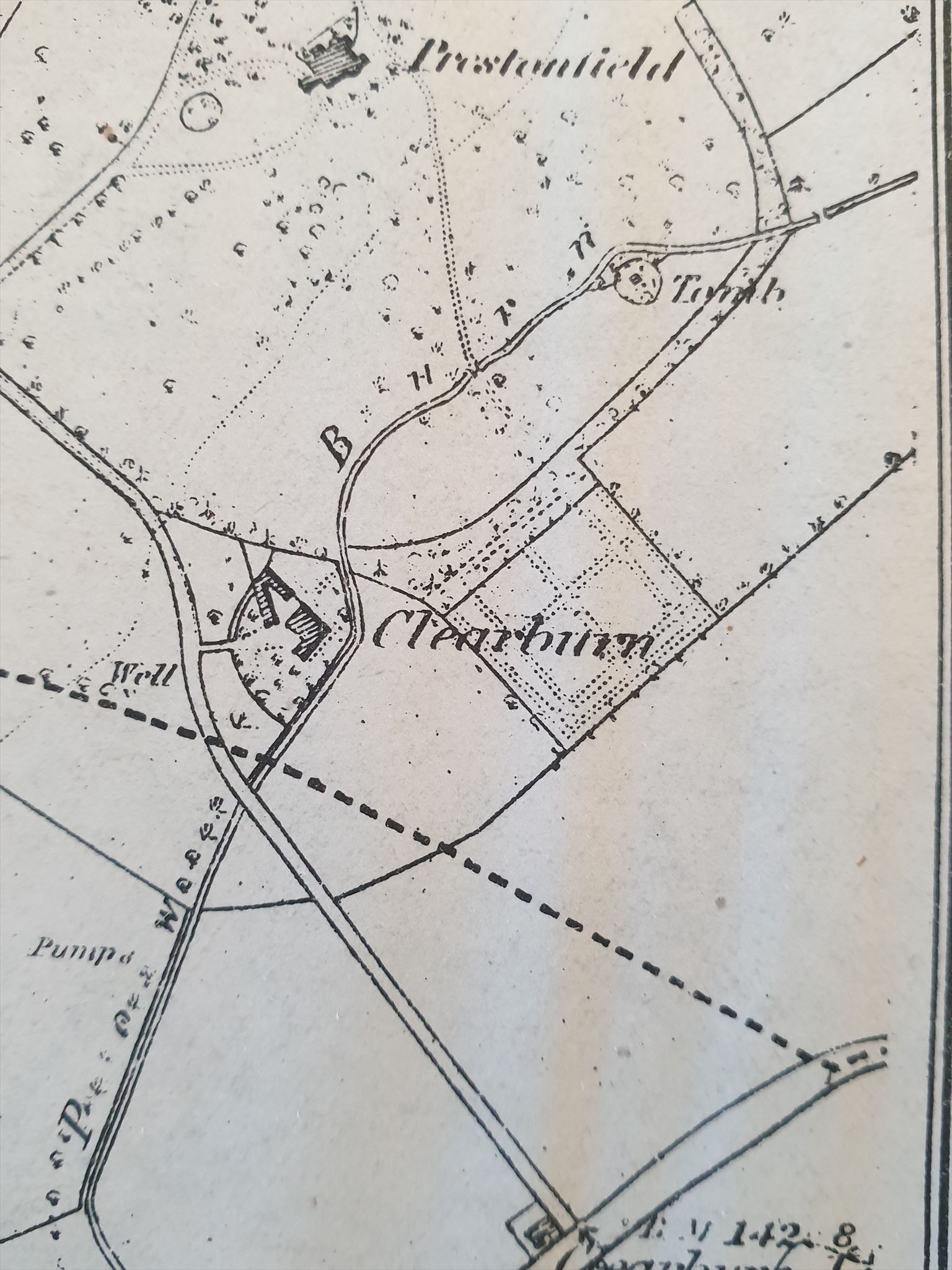
As the name suggests, this district took its name from the 'Clear Burn', the name given to the Pow Burn as it used to pass through here. Its old route is visible on the map. (The Pow Burn is formed from the joining of the Braid Burn and the Jordan Burn, and later becomes the Cameron Burn). The hamlet itself was roughly situated in the wedge bounded by Priestfield Road, Priestfield Avenue and Priestfield Gardens, at the southern border of the grounds of Prestonfield House. It was part of Duddingston and in mid-19th century there was a thriving brewing industry. (I like to imagine that beer was supplied to the hostelry at Cameron Toll, but have no evidence for this). Clearburn Farm was the birthplace in 1708 of Thomas Gillespie, a Church of Scotland minister who seems to have been mostly at odds with the church leaders. His father ran the farm and brewery as a 'bonnet laird': this means he wore a bonnet like humbler folk and was lower down the social pecking order than bigger landowners.
QUESTION TO ANSWER: Convert the last letter on the post box to a number to give A
WAYPOINT 2: CAMERON VILLAGE N 55° 55.900' W 3° 9.516
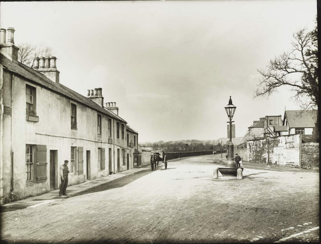
(acknowledgement: City of Edinburgh Council – Edinburgh Libraries)(www.capitalcollections.org.uk)
The village of Cameron was on the southmost edge of the area, and marked the southern city border, up to where Cameron Bridge crossed over the Pow Burn. It was owned by the Prestons of Craigmillar; Simon Preston was the Lord Provost of Edinburgh during the reign of Mary Queen of Scots. His country residence was Craigmillar Castle.
Cameron Village guarded a main route in and out of Edinburgh, with a toll of sixpence to be paid for goods and people entering the city. In the 1950s, the village was demolished to make way for the roundabout; most of the residents moved to the houses at the Inch estate.
The photograph above left was taken in 1900. You are looking up Dalkeith Road, with Peffermill Road going off to the right. The window jutting out at ground level at the far end of the row of houses is the tollmaster's house.
The area around here is still known as Sharpdale. It was a place where travellers could rest, with an inn and a watering trough for horses. (nothing changes does it: today's 'travellers' can rest here, get something to eat, and fill up their horseless carriages). The tolls were abolished in 1863.
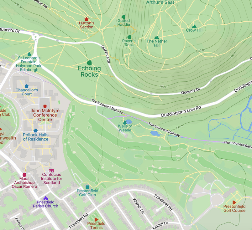
For this clue, we visit the nice wee park and look at the information board, the one with the illustration of Arthur's seat on it.
QUESTION TO ANSWER: In what year was Prestonfield Park acquired? The last number is B
WAYPOINT 3: CELLARBANK N55° 55.860' W003° 09.756'

Cellarbank lay just a bit south of Echobank, extending all the way to Peffermill. It was small but had its own school. (There is today a small housing development named after Cellarbank, but it is in Peffermill). Cellarbank had a tollbooth called the 'Greyfield Toll', on the other side of Dalkeith Road.
These villages were demolished by 1886 to make way for the tenements you see today along the east side of Dalkeith Road.
Historical snippet: Dalkeith Road was once known as Easter Height, with Morningside Road being Wester Height; together, they formed the 2 major north-south roads out of the city. Dalkeith Road was also part of Deere Street, the great Roman road that led from Eboracum (York) all the way past Hadrian's Wall, following roughly the modern A1 and A68, as far as the Antonine Wall at Camelon in Falkirk.
QUESTION TO ANSWER : Have a seat. Do you see the telegraph pole to your left? Find the letters and numbers CARVED into the wood on its side: the number with the largest value gives you C
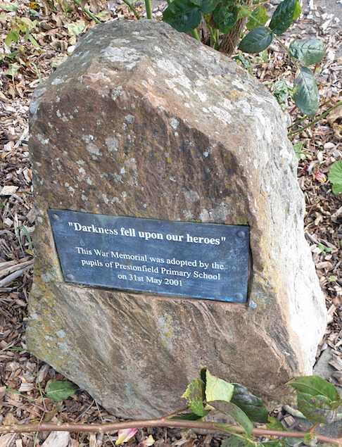
WAYPOINT 4: ECHOBANK: THE WAR MEMORIAL N 55° 56.025' W 003° 9.813'
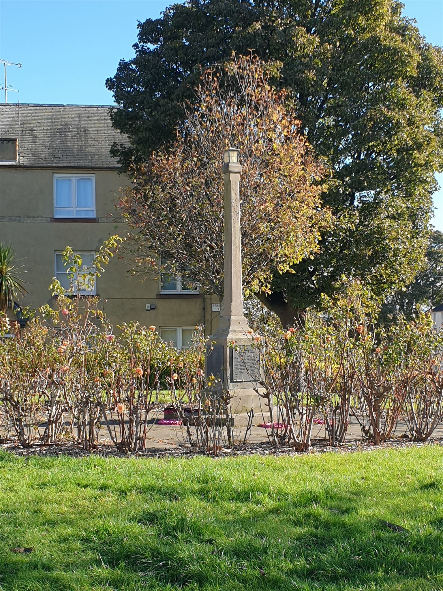
Echobank was the biggest of the 6 hamlets, and housed 68 families. It was situated on Dalkeith Road, opposite the cemetery. There is a story that the housewives used to do their washing at the Wells O' Wearie, and would call from Echoing Rock, a basalt ridge at the south-east corner of Arthur's Seat, to let the family know they were on the way home. (personally I have doubts about this story: if I'd been doing laundry at the well, the last thing I'd want to do would be to climb up to the rocks!) In bygone days, there was a park called Echo Park, where an agricultural show was held annually.
This war memorial was completed in 1950 after a collection of money from local people, to commemorate the 63 who gave their lives during WWII. It took 3 years for them to collect enough money, at sixpence a week per family; I hope you agree that the result is quite splendid. One side lists the dead from the housing scheme; another lists the dead from the Estate.
QUESTION TO ANSWER: One of the fallen has a connection to Prestonfield House, and takes up 4 lines on the memorial. Which Regiment did he belong to? Convert the 3rd letter into a number. This gives you D
WAYPOINT 5: ROSE HALL N 55° 56.188' W 3° 10.199
The village of Rosehall was situated at the eastern border of the ancient Burghmuir, and was the only part of that wild and desolate uncultivated land that lay to the east of Dalkeith Road. It was built on the garden land of a house, long gone, called Rose Hall. It was one of six small parcels of land that were feued between 1530 and 1580 and was originally called 'Prestonfield Gushet'. if you say 'Gusset' instead, you can work out why it got this name: it was a triangular-shaped piece of land extending from Salisbury Green to Priestfield Road. Even earlier maps name this place as 'Dawling's Acres'. In 1586, there were 8 properties or 'feus' here and by the beginning of the 19th century, there were 18 houses.
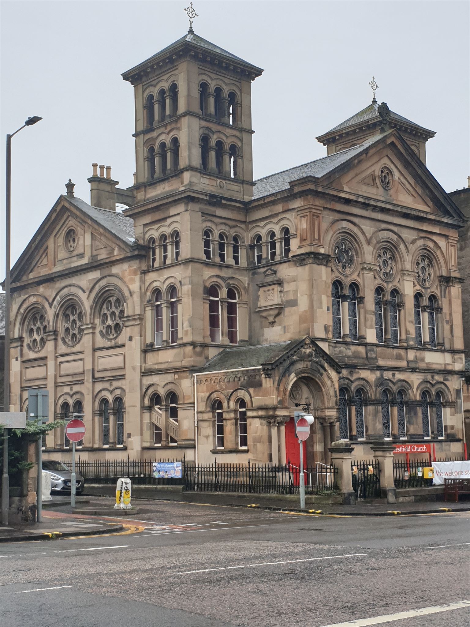
You are standing opposite Priestfield Church, previously known as Rose Hall Church; it is built on the land where Rose Hall used to be. The church is built in Italianate style and its notable features are the 2 square campanile towers and 3 ornate stained glass 'rose' windows.
Don't forget to collect the nearby Church micro 8175 Edinburgh Priestfield
Gushet: definition: a pocket in the armpit of a jacket or coat; an ornamental silk thread in a pattern; a triangular piece of land between two adjacent properties.
An interesting historical snippet: when Mary Queen of Scots was defeated by rebel lords at the Battle of Carberry Hill, following the murder of her 2nd husband, Lord Darnley, she was led on horseback, weeping and dishevelled, down the main highway between Peffermill and Cameron Bridge (the modern Dalkeith Road) to be imprisoned at the Provost's House in Edinburgh; on the way they would have passed Craigmillar Castle, where the murder plot had been hatched.
QUESTION TO ANSWER: Convert the third last letter on the post box to a number, this is E
WAYPOINT 6 MARCHHALL N55° 56.235' W003° 10.168
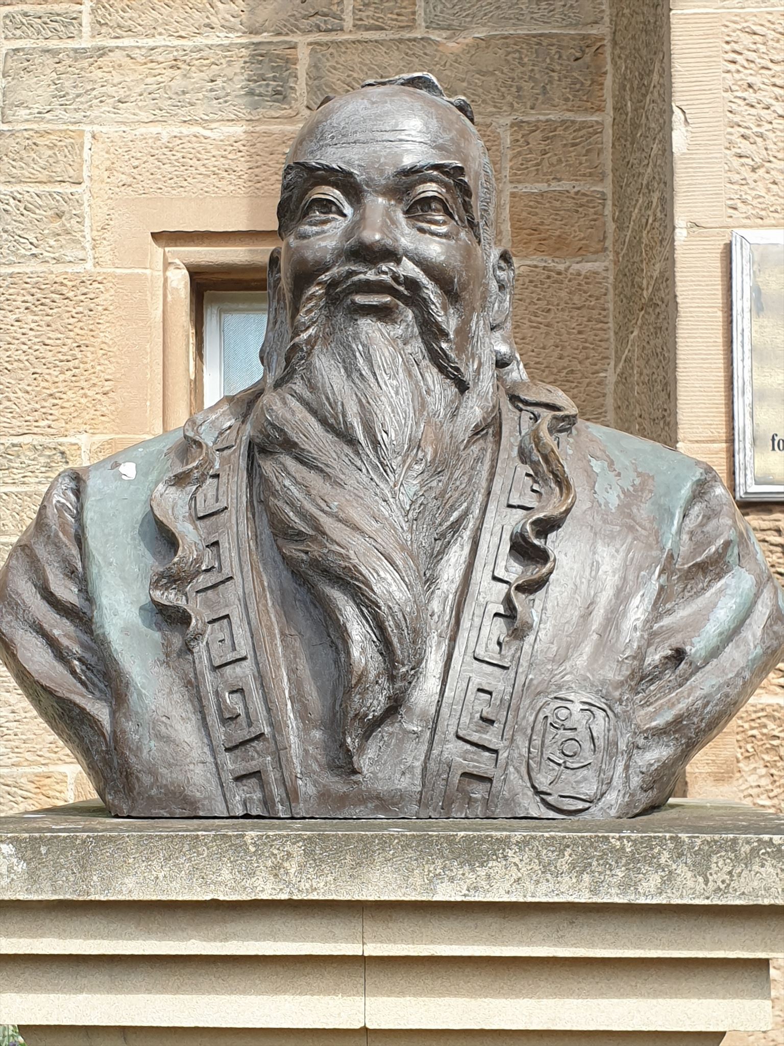
The village of Marchhall lies adjacent to Rose Hall. It originally had the stables of Priestfield House, but the building you see now, at the provided trailhead N55 56.225 W003 10.177, was built in 1854. It was used as a hospital during WWII then as an NHS nursing home. It was sold by the NHS in 2019 but so far lies empty. Let's stray a little into the grounds of Pollock Halls of Residence; use the small gate at the given trailhead. The land was donated to the university by Sir Donald Pollock. The building nearest to you is Abden House; Sir Donald had intended it to be home for the Principal of the university; it is now The Confucius Institute, a centre for Chinese studies.
QUESTION TO ANSWER: Have a rest, if you like, on the bench. Count the number of words on the plaque to Adam Dupré. Add these 2 digits together to get F
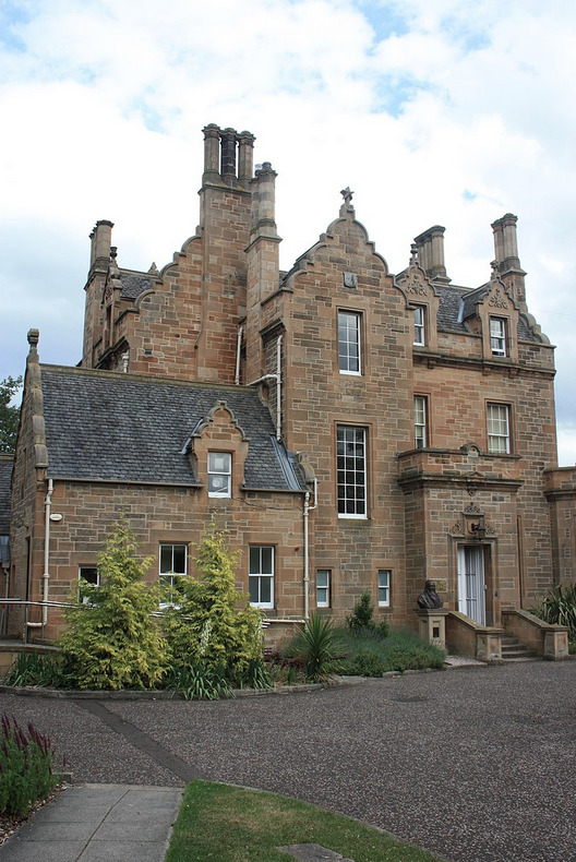
WAYPOINT 7: PRESTONFIELD HOUSE N 55° 56.179' W 003° 09.302
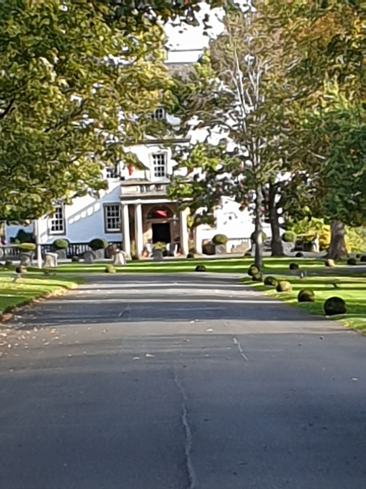

Here is the centre of the district: the sumptuous Prestonfield House Hotel. In 1150, Henry, Earl of Northumbria, son of King David I, established a monastery run by the Cistercian Monastery of Harehope. It was called Priestfield Abbey, giving its name to the surrounding area. The monastery is no longer there; the land reverted back to the Scottish Crown in 1355. In its place came Priestfield House in 1510. The estate was owned in turn by the Cant family (from1463); Thomas Hamilton (1510) and Sir James Dick (1677). In 1681 the house was set on fire by anti-Catholic students. Six years later, the present day house was built, incorporating some of what was left from the fire, to a design by Sir William Bruce, a descendant of King Robert the Bruce. He also designed Holyrood House, Hopetoun House and Thirlstane Castle. The design shows considerable Dutch influence, which is not surprising given that Bruce had lived for a time in Rotterdam; whilst there, he had worked as a sort of spy, carrying information back and forth that helped lead to the restoration of the monarch Charles II. Priestfield House was then renamed Prestonfield House, to distance it from its catholic origins.
Other parts of the building were added later: the porch in Georgian times and the stable block in 1816. This is now used as a venue for functions.
In 1746 Prestonfield was inherited by Sir Alexander Dick, part-time doctor, scientist and politician. Notable visitors around that time were David Hume, Allan Ramsay, Benjamin Franklin, Boswell and Dr Johnson. In the 19th century the house was owned by the Dyck-Cunnyngham family.
In 1960 the house was converted into a hotel and since 2003 is owned by James Thomson OBE, who has helped the CO enormously with the history of the house and the placement of this cache.
Sir Peedieduke and Peedieduchess remember attending many dinners here, hosted by pharmaceutical companies; usually greeted on arrival by the meowing and honking of the peacocks sitting on top of the entrance canopy!
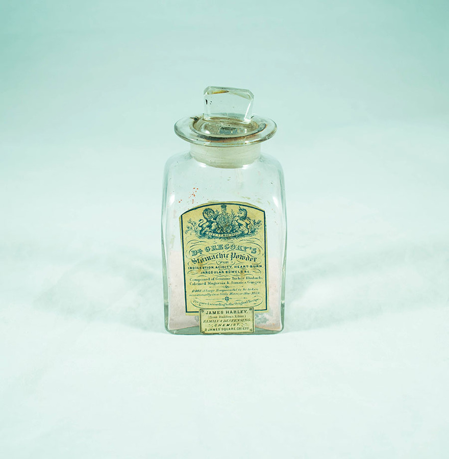
Historical snippet: As you look around the gardens, you may notice the rhubarb patch. It's on the left of the main entrance. This rhubarb is descended from the SAME stock as the original plants grown in the 18th century! Rhubarb was actually native to China and was imported to Russia where it became a valuable commodity, worth more by weight than gold, because of its medicinal properties. People were obsessed with their bowels in those days. Some seeds were brought to Scotland by Dr James Mounsey, physician to the Tsar Peter the Great. He gave some seeds to Drs Alexander Dick and John Hope, who grew them at Prestonfield and at the botanic gardens. Rhubarb was then used to make Gregory's Powder, a remedy for stomach problems. Dr James Gregory (b.1753) lived in Canaan Lodge and is mentioned in an adventure labcache by Peedieduchess, 'Edinburgh's Bible Belt'. Gregory's powder required 2 main ingredients: rhubarb, for its laxative compounds, dihydroxyanthraquinones; and magnesia, which was made in Steel's factory in Bruntsfield. Add in some peppermint oil and ginger root, and you obtain a very popular remedy which was still being sold up until 1953.
QUESTION TO ANSWER: There is a 2-digit number on the field artillery gun. It appears more than once. Add the 2 digits together, the 2nd digit of this new number is G
A little further on there is a place where you can have a seat while you do your sums. If you are lucky, Treacle the Highland Cow may come over to say hello: she's a bit lonely on her own these days; there used to be a bigger herd.
The cache is not far away.
THE FINAL CACHE LOCATION CAN BE FOUND AT:
N55 56. JKL W003 09.PQR
where
J = D
K = F
L = E
P = C/3
Q = B/2
R = G - A
Please rehide the cache well so it is not easily seen from the path.
There is a peedie prize for the First to Find.
GOOD LUCK!
