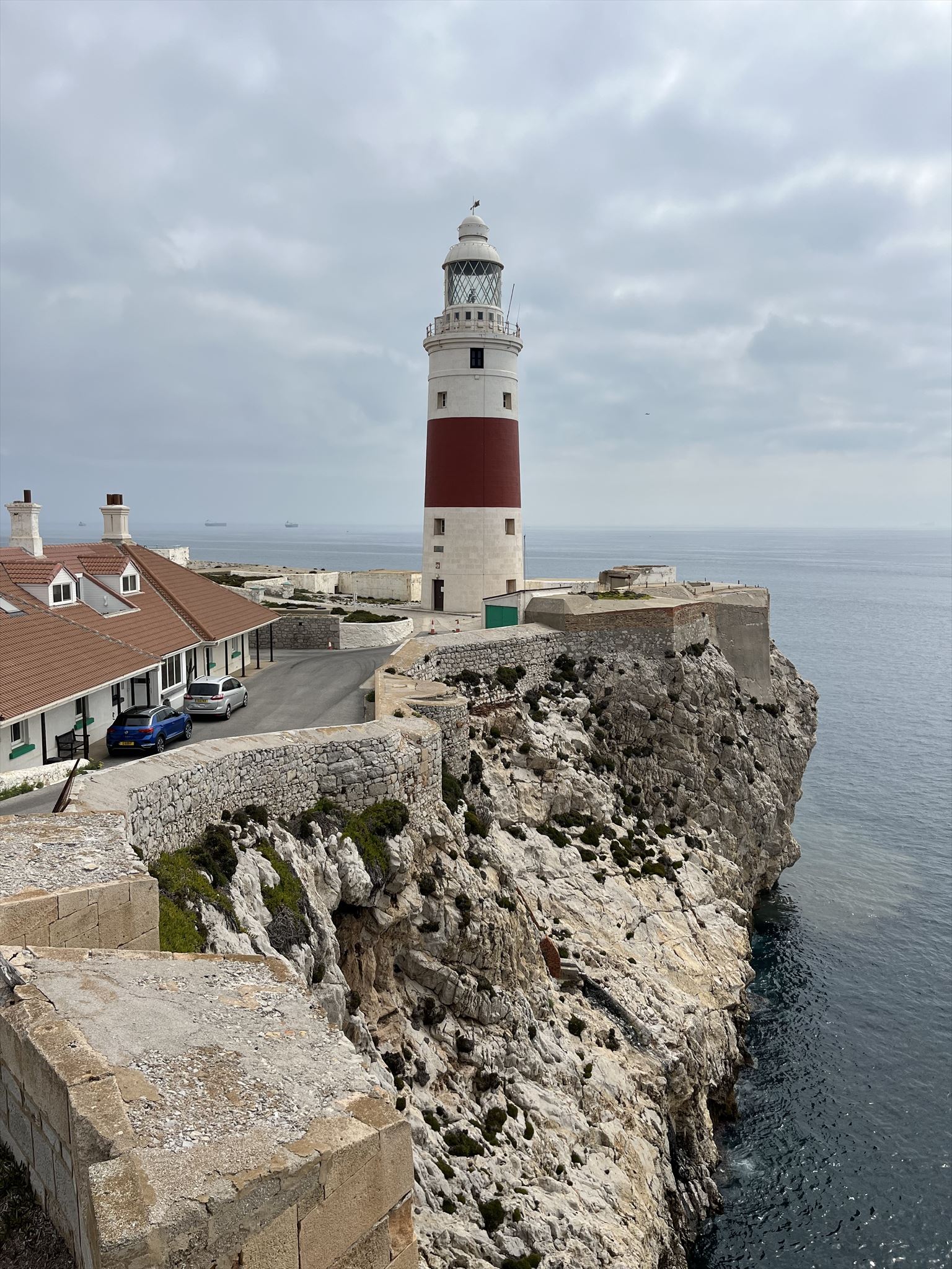
Europa Point is a prominent geographic feature located at the southern tip of Gibraltar, a British Overseas Territory at the entrance of the Mediterranean Sea. This iconic point offers breathtaking views of the Strait of Gibraltar, which separates Europe from Africa, and is known for its historical and cultural significance. One notable geological feature at Europa Point is the presence of wave-cut platforms, which provides evidence that mountain building is still in active process.
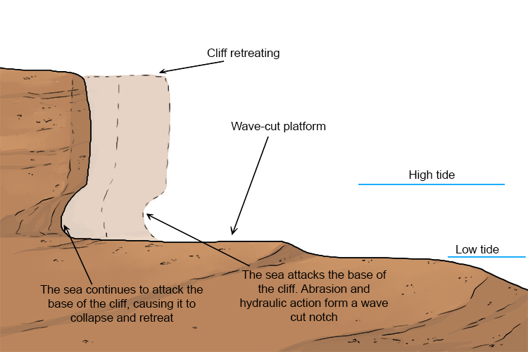
Wave-cut platforms are distinct geological features that form through a specific sequence of processes along coastlines. They originate from the combined effects of wave action and the underlying geology. Wave-cut platforms start with the relentless pounding of destructive ocean waves against a rocky coastline. These waves, often driven by strong winds, carry energy that is transferred to the shoreline upon impact. Over time, this repetitive wave action gradually weakens and dislodges pieces of rock from the cliff face. As the waves erode the rock, they focus their energy on the lower part of the cliff, where the impact is most intense. This selective erosion leads to the creation of a wave-cut notch, a small hollow or crevice in the rock. This notch gradually deepens as more material is removed. The process continues as the wave-cut notch extends further into the rock, eventually forming a larger cavity known as a wave-cut cave. As the cave expands horizontally, it weakens the cliff above it. This structural instability, combined with the ongoing wave action, causes sections of the cliff to collapse into the sea.
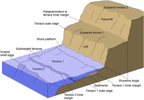
A marine terrace is a geological feature comprising a succession of wave-cut platforms that provide insight into past sea level variations relative to the adjacent land. It is important to emphasize that not all wave-cut platforms evolve into marine terraces. For a platform to transition into a terrace, it must be isolated from direct wave influence. This isolation occurs primarily due to changes in sea level driven by glacial-interglacial cycles or tectonic uplift processes. When a wave-cut platform is elevated above the contemporary sea level, it enters a phase of preservation. These preserved marine terraces are typically found arranged in parallel flights along the coastline, forming distinct topographic steps. The ascending elevation along the terraces corresponds to increasing geological age, reflecting successive stages in the Earth's history of sea level fluctuations and tectonic movements. Marine terraces serve as crucial geological archives, offering a tangible record of the intricate interplay between dynamic sea level changes and geological forces shaping coastal landscapes over extended geological timescales.
Logging Requirements:
- What is the tide at the time of your visit? Looking south, are you able to observe any submerged wave-cut platforms along the coastline?
- Next, turn around and observe the landscape around you. How many terraces do you see? Estimate the difference in elevation between each one.
- Current geologic evidence suggests that the maximum change in global sea levels during the Pleistocene Epoch (2.58 million to 11,700 years ago) was 8 meters. Based on your observations, were the marine terraces the result of sea level change or tectonic activity?
- Based on what you have learned, would you expect to find similar wave cut platforms and/or marine terraces in Morocco (across the Strait of Gibraltar) as well? Why or why not?
- Upload a photo with either yourself or a personal object taken at Europa Point. No group photos, each person must upload his/her own photo.