The cache is not at these coordinates. But, this is where you should start your journey. In fact, if you take a look west from the scenic cliff, you can see your future down there – Quarry Island. This hike will probably take a little more than an hour or so.
This is the next of the Hike/Bike with Me caches that I have started since moving to MN. Since most of my cache finds are done while exercising, I thought I would offer this delight to others. These caches will not necessarily be hard to find, but you will have to put some miles on the legs for them. So lace em up, grab some water, and come join the fun.
Totally, this hike will be about 2.5 miles. The hike will bring you down to Quarry Island and another portion of land along Gun Club Lake, all on established trails. The waypoints are all on trails, which can be accessed all year long. The final coordinates for the cache are placed in a winter friendly place near the starting point of the ride.
Please make sure you take a good look at the trail head waypoint (map image below). You will have some paved trail/sidewalk hiking to get there, but there is, in fact, an established trail that starts there, and as far as I know, that is the only legal way to enter the refuge area.

As for the stages ...
Canoe Drop Area – Take a look at the elevation at this point. Is it closer to 1 – 300 ft; 2 – 500 ft; 3 – 700 ft; 4 – 900 feet. Consider this A.
Electric Wires – In the area, you will see two tall poles. How many Xs are built between them? Consider this B.
Delta Falls – Within the falls area, what types of bricks are used here? 1 – circles; 2 – triangles; 3 – rectangles; 4 – squares. Consider this C.
Then: N44 52.0 (A*B) (A+C) W093 10.A (B*C) B
(Sorry about the math)
Hope you had a great hike.
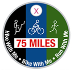
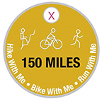
Earn the 75 and 150 mile Pathtag!
So far there have been 40 of these Hike/Bike/Run With Me Multi-caches - if you were to complete them all, you would have travelled more than 220 miles. Currently (January 2024), there are 35 active geocaches totaling 193+ miles (This includes three Hike With Me Adventure Labs). I wanted to give something to the geocachers who have "put a big dent" in trying to find these. So I created two pathtags for cachers who completed at least 75 and/or 150 miles while trying to get smileys on these caches. On each of the cache pages, I mention how long the travel should be for that cache. They vary from just a couple miles to a 20-mile mountain bike ride.
Here is a bookmark list of all of the caches.
So, take a look at your finds, add up the miles, and if you are more than 75 and/or 150 miles, let me know. You can either PM me, email me, or just grab me at an event. You do not have to show/prove anything to me about you qualifying. I will give you one if you say you have qualified.