Please note that during the spring and summer months, the grassy banks here can grow quite long with an abundance of Nettles. I recommend wearing waterproof trousers when the weather has been wet and appropriate footwear for your visit as some places may be uneven.

Tanvats is a small hamlet located approximately half a mile from Sots Hole on the Fen between Metheringham village and the River Witham. In the era before agricultural mechanisation, Tanvats had a vibrant community that included a school, a Methodist Church, a Church of England School, and a grocers shop. Locals were proud of The Oaksheaf, the local pub, claiming its bar to be the longest in the country.
Over time, changes have occurred in Tanvats. The Methodist church no longer stands, and the original school closed in 1948. The replacement school, situated between Tanvats and Sots Hole, ceased operation in 1985. Both the school and the old pub have been repurposed as private dwellings.
The name Tanvats has historical roots, originating from the tanning of animal skins in vats. This activity was reportedly carried out outside the village due to the potent smells produced during the tanning process.
Despite its isolation, Tanvats has a unique feature in its history. Access across the Delph to Blankney Fen was facilitated by a wooden footbridge, later replaced by a rope footbridge in 1937. After 1975, access to Blankney Fen transitioned to an infill bridge.
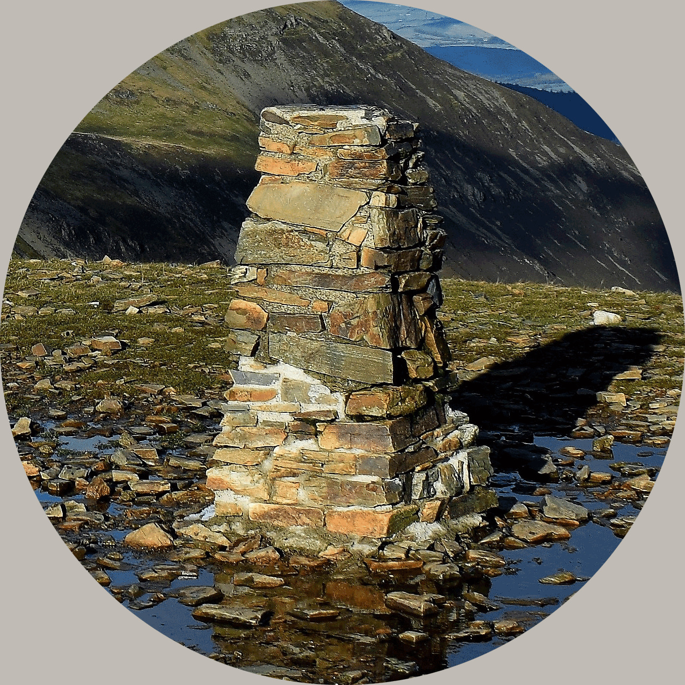
The trig point here was built on the 20th of September 1948, at a cost of £8 17s 6d. Last maintained by the OS in November of 1980.
About Ye Ole Survey Monuments
|
 |
Ye Ole Survey Monument (YOSM) is a captivating series of caches that pays homage to the remarkable legacy of OutForTheHunt's YSM series (GC45CC).
YOSM caches are strategically positioned at or near Trig Points. These triangulation stations have played a pivotal role as surveying landmarks, contributing to the mapping of expansive territories.
Some of these points, bearing historical significance, might now be situated on private land or have vanished with time. As a result, the caches are artfully placed in close proximity, reverently acknowledging the historical importance of these survey monuments.
|
More information, bookmarks and statistics can be found at the YOSM Website
If anybody would like to expand the Ye Ole Survey Monuments Series, please do.
I would ask that you request a number for your cache first at www.yosm.org.uk
so we can keep track of the numbers and names to avoid duplication.