Welcome to the Stony Lake Trails.
This is a Letterbox Geocache. There is a stamp inside. To find the container and sign the logbook, follow these directions.
1. Stop at the posted coordinates on the Yellow Trail. You should be near a yellow trail marker on a spindly tree.
2. Walk 31 metres at 80 degrees on the compass (east).
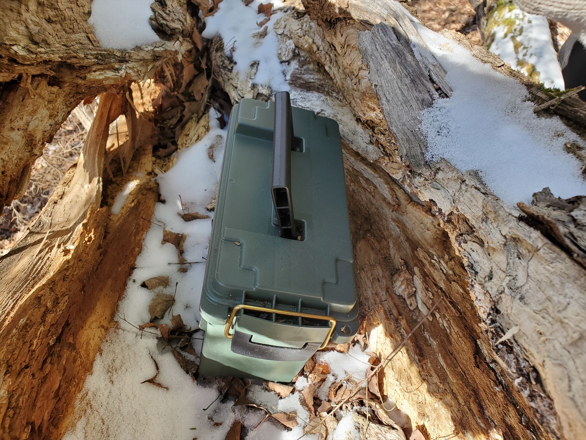
3. You should be walking towards a clump of evergreens with one large broken tree.
4. Step up and look inside the horizontal broken trunk and you should find an ammo can.
There are 3 possible official parking locations, though, when we hid the geocaches, we only parked in one location (the Red Trail Parking) and walked, so I have numbered the caches west of the Red Trail Parking in the order in which we walked. This hike takes you from the Red Trail, to the Yellow, around the Blue Trail and then loops back to the parking, about 7 kms. But you might want to move your vehicle or split the hike up into a couple of trips. To do ALL the geocaches on the Stony Lake Trails, including the entire Red Trail Loop, you will be walking just under 10 kms.
Red Trail Parking (P3) - N 44 34.053 W 78 07.332 (Fire Route 10) - space for about 4 cars
Blue Trail Parking (P1) - 105 Reid's Road - space for about 4-6 cars
South Parking (P2) - 595 Mount Julian, Viamede Road
Please note that Fire Route 10A is a private road. Also signs are posted for No Parking in spaces alongside roads, so you will only be able to park in the 3 designated parking locations.
This is the traditional territory of the Michi Saagiig and Chippewa First Nations and locals believe it is very likely that the First Nations used this area for camping and hunting. The land, once owned by the Ingleton and Wells families has been generously donated to the Kawartha Land Trust and made available to the public. This is a lovely hike through old growth forests, up a slight terrain to some limestone outcrops, around a bay of Stony Lake, and through an old homestead from the early 1800's. There is also a frisbee golf course set up along part of the Blue Trail. In spring you will want to wear boots. As always, check for ticks and avoid poison ivy. Geocaches have been placed along the trails.
If you see any litter from others, please go the extra mile and CITO it out. Thanks !
Most of the containers are as winter-friendly as was possible, though very heavy snow might make a few of them a little tricky.