Grogley Woods are located on a steep hillside on the western side of the Camel Valley. The woods are largely pine trees and are managed by the Forestry Commision to provde a balance of timber cropping, a mixed evironmental habitat for a range of flora and fauna and also as an area for recreational walking and mountain biking.
The name Grogley comes from an old Cornish word and means Rock Pasture.
To get to the cache you will need to walk or cyle (if you have a mountain bike) approximately 1.6 miles to reach the cache location. The first half of the walk is a steady uphill slope. The route I have given below keeps you on the good firm paths that zig zag up the hillside - Do NOT be tempted to walk on the numerous narrow tracks through the trees even though they may appear to be more direct - you are likely to encounter high speed mountain bikers who may well be unable to avoid colliding with you, your kids or your geohound. The skill and daredevil nature of these bikers is to be admired but avoided!!.
The Cache
Start your adventure at the car park and enjoy a steady walk on the main wide track in front of you for just over 1 mile - you will go around 3 hairpin bends as you make your way up the hillside. You will eventually arrive at Waypoint #1 (N 50 28.622 w 004 48.451). This is a "T" Junction where you need to turn left staying on the good, well-maintained track.
Walk on for about 100 metres to Waypoint #2 (N 50 28.555 W 004 48.475) - here, on your right, you will see an obvious dirt trail heading between a couple of pine trees in the direction of the cache GZ. Walk along this trail for about 250 metres.
When you arrive at Waypoint #3 (N 50 28.577 W 004 48.704) you will emerge onto a section of the main track where a number of trails also go off in various directions. Go straight over the main track and continue along the muddy trail for a further 400 metres to arrive at the cache location.
If all has gone well you should now be at a gate looking across some open fields on the top of Hustyn Downs.
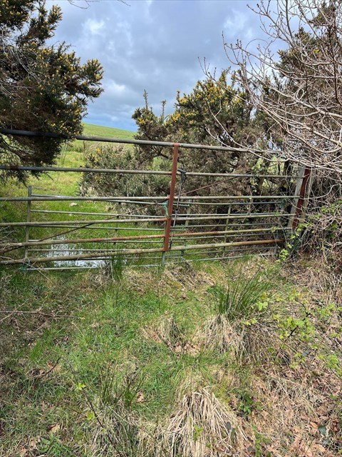
The cache is close by here. Please re-hide it as found. The is room for small TBs and Geocoins in the container.
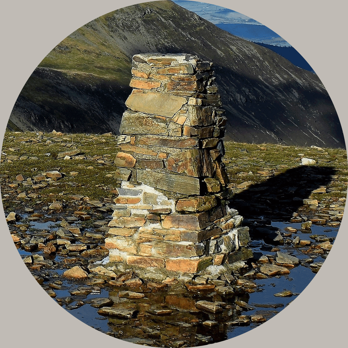
The Trig Pillar
Stand at the gate and look across the field in a WNW dirction and about 150 metres away you can see a raised clump of gorse on top of a small mound - this is one of the many barrows and tumuli which indicate that man has occupied and revered this high point for thousands of years.

In amongst the gorse, on the mound, stands the Hustyn Barrow Trig Pillar which has line of sight to Rough Tor, Belowda Beacon and St Breock Downs - an ideal survey location. On a clear day (it can be a misty location) and with good eyesight the pillar can be seen. To access the pillar requires a short walk across private farmland which is often populated by cows. If you are lucky enough to spot the farmer, he has been known to give permission to walk across to the pillar but please do not take trespass for granted.
Waypoint #4 gives the coordinates of the Trig Pillar
About Ye Ole Survey Monuments
|
 |
Ye Ole Survey Monument (YOSM) is a captivating series of caches that pays homage to the remarkable legacy of OutForTheHunt's YSM series (GC45CC).
YOSM caches are strategically positioned at or near Trig Points. These triangulation stations have played a pivotal role as surveying landmarks, contributing to the mapping of expansive territories.
Some of these points, bearing historical significance, might now be situated on private land or have vanished with time. As a result, the caches are artfully placed in close proximity, reverently acknowledging the historical importance of these survey monuments.
|
More information, bookmarks and statistics can be found at the YOSM Website
If anybody would like to expand the Ye Ole Survey Monuments Series, please do.
I would ask that you request a number for your cache first at www.yosm.org.uk
so we can keep track of the numbers and names to avoid duplication.