In order to claim this Earthcache, Read the information below and submit your answers to the questions under the How to Log this Earthcache section. There is no physical container. Observe the best you can. The objective is to learn and have fun.
Welcome to the Lake Wales Ridge!
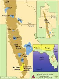
The Lake Wales Ridge, sometimes referred to as the Mid-Florida Ridge, is a sand ridge running for about 100 miles (160 km) south to north in Central Florida. Clearly viewable from satellite, the white sands of the ridge are located in Highlands County and Polk County, and also extend north into Osceola, Orange, and Lake Counties. It is named for the city of Lake Wales, roughly at the midpoint of the ridge. The highest point of the ridge is Sugarloaf Mountain, which at 312 feet (95 meters) is also the highest natural point in peninsular Florida. (The highest point of land, at 371 ft (113 m), is a manmade mining tank west of Bartow.) Iron Mountain, the location of Bok Tower, marks another well-known high point on the ridge, attaining an elevation of 295 ft (90 m). A northern unconnected extension of the Lake Wales Ridge exists in western Putnam County near the town of Grandin.
What is geologic uplift?
Uplift is the vertical movement of Earth's crust, resulting in an increase in the elevation of a region. Uplift can be caused by Tectonic Movement, which is the movement of tectonic plates, including collisions and subduction; by Epeirogeny (Warping), which is a broad, relatively slow and gentle uplift; or by Orogeny, which is the uplift associated with mountain building. Uplift can affect relative sea level, causing areas to emerge from or recede from the sea.
How did the Lake Wales Ridge form?
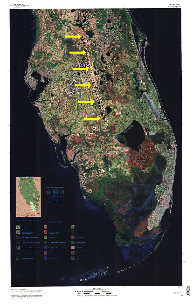
The material found beneath your feet actually came here from an area hundreds of miles northwest of here. Material from the Citronelle Formation, an area encompassing all or parts of Alabama, Mississippi and Louisiana, deposited here for eons as it eroded away from its original locations. Tidal action deposited the sediments here over time. Geologists originally believed this area formed due to orogeny, but this hypothesis was discarded in the 1960's by E. C. Pirkle, W. H. Yoho and A. T. Allen. Since this area is not tectonically active, tectonic plate movement has also been discarded as a hypothesis for its formation. Satellite images support the formation theory proposed by Pirkle el at. and the direction of movement of the sediment, as you can clearly see the terrain slopes down gently to the east.
How to claim this Earthcache:
Send me your answers to the following two questions and post the required pic with your log:
1. By what geological process do you think the Lake Wales Ridge formed?
2. Describe the sediments in the area. Are they mostly silica (whitish sand), phyllosilicates (clay) or ferrous deposits (dark sand)?
3. Grab a piece of paper and write your geo-nickname on it. Take a picture of it facing southwest (towards the water) and post it with your log. DO NOT send me your picture. Logs without pictures will be deleted without notice.
Sources:
Origin of the silica sand deposits of the Lake Wales Ridge area of Florida. by E. C. Pirkle, W. H. Yoho and A. T. Allen, September 1, 1964.
Various Wikipedia articles.
First-hand knowledge of geology by the CO.