“Trailblazer’s Landmark: The Gillette Rockpile”
Introduction
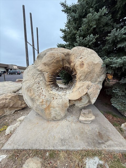
Discover the symbolic "Rockpile"—the very feature that signaled the birth of Gillette, WY Territory. Earlier settlers used this natural mound as their official demarcation, later guiding the town's growth when the railroad arrived. Today, it's preserved at the Campbell County Rockpile Museum site, offering a tangible link to local geology and civic history
Location
Geological Significance
-
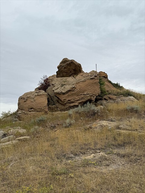
The Rockpile is situated within the Powder River Basin, a geological region famed for its coal-rich Paleocene strata like the Fort Union Formation—notably the Wyodak Coal Member, massive seams up to 110 ft thick near Gillette
-
While this exact outcrop may not expose coal, it represents the basin’s sedimentary history, likely composed of sandstones, siltstones, or other units from the same era—formed in fluvial, swamp, or lacustrine settings.
What You’ll See
As you approach the Rockpile, take note of:
-
Grain size: Is it fine or coarse? Makes you think of stream deposits (sandstone) or mud layers.
-
Color and layering: Reflecting oxidation or layering patterns.
-
Shape and structure: Rounded or angular—indicative of erosion or deposition history.
Rock Color
The color of sedimentary rocks often tells us something about the conditions in which they formed. For example:
-
Light tan or buff colors usually mean the rock is made mostly of sand-sized quartz grains.
-
Gray tones often indicate clay or silt was part of the deposit.
-
Reddish-brown staining happens when iron minerals in the rock are exposed to air and water, causing them to rust (oxidize), much like a bicycle left outside in the rain.
Rock Texture
Geologists describe texture by looking at grain size and surface feel:
-
Fine-grained rocks feel smooth, because the particles are tiny.
-
Medium-grained rocks (like sandstone) feel gritty, similar to sandpaper.
If you gently run your fingers across the Rockpile, you can feel whether it is smooth, gritty, or somewhere in between.
Rock Layers (Stratification)
Sedimentary rocks usually form in layers because rivers, lakes, or wind drop material one layer at a time. Over time, these layers stack up like pages in a book. Each layer (or “stratum”) may look slightly different in color or grain size. If you look closely at the Rockpile, you may see faint horizontal bands — these are the preserved layers of sediment from when the rock was first deposited.
EarthCache Challenges
To log this EarthCache, please answer and submit your findings (via the EarthCache site or owner’s email):
-
Describe the texture and color of the Rockpile rocks—are they fine-grained, well layered, reddish, gray, etc.
-
Interpret how the Rockpile formed: Based on your observations and what you know of Gillette’s geology, suggest whether it’s stream-deposited sandstone, floodplain mudstone, or another sedimentary type.
-
Historical trivia (Optional): What role did this formation play in Gillette’s early development? (Hint: settlers used it to stake claims, and the town was originally called “Rocky Pile.”)
-
Photo Oppotunity: Post a photo of yourself, GPS or GC name with the 'Pile'