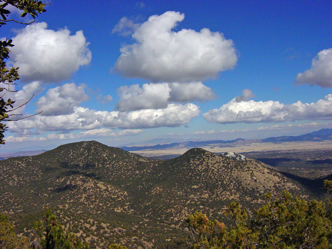
Cracked Rocks Peak cache is on the right and Mount Washington is on
the left.
A difficult hike
up steep slopes to a peak north of Mt Washington in the Patagonia
Mountains
You must sign the log or your find will be
deleted.
Mountain Range: Patagonia
Mountains
Map
Quadrangle : Harshaw
Mountain
Height: 7,211 feet
Hike
Length: about 2 miles, round trip
Hike Time:
2 hours, 30 minutes, round trip
Time is
calculated by The Appalachian Mountain Club's
White Mountain Guide, which uses an
approximate formula to estimate the time a given hike will take.
They calculate 30 minutes for every mile, plus 30 minutes for every
1,000 feet of ascent. Descent is assumed to take as long as walking
on a flat trail.
http://home.earthlink.net/~ellozy/calculator.html
Hike Type: Trail and some
bushwhack
Hike
Difficulty: Difficult
Elevation
Gain: about 2,500 feet, total to top
View:
Great
Directions to
Trailhead:
From
Tucson, take I-10 to I-19 South. Exit at #12. Turn left (East) onto
Rt. 289. After a few yards, the road name changes to Ruby Rd. After
1.7 miles, go right (Southeast) onto Via Frontera. After .1 miles
turn left (east) onto S. River Rd. After 5 miles is a one-lane
bridge and then a stop sign at Hwy 82 (no Hwy sign). Go straight
across the road on to Duquesne Rd. After about 7.5 miles go right
(about N 31 22.300 W 110 45.630) on to forest road #4763. If you
are driving a car, park right at the beginning of 4763. Drive up
the road/wash to about N31 22.600 W110 44.900 and
park.
Hike Directions:
Go
east/northeast up a wash until you find a border crossers’ trail
(BCTr). Go east up this very steep wash to a saddle (N31 22.207
W110 43.695), then south on the BCTr to the peak (N31 21.962 W110
43.807).
Vehicle: car, four-wheel drive with
high clearance, or jeep/ATV/mountain bike
Mile High
Hiking Club of Santa Cruz, AZ - Other hikes to peaks over one
mile high in Santa Cruz County, AZ (with and without caches) -
http://www.buddhistlinks.org/MileHigh/Guide.htm

