Middlesex Canal Cache Opens
A fun multi has been created that follows twenty three of the twenty seven miles of the Middlesex Canal. This cache begins in Medford and ends in Lowell. It has been broken down into ten stages (log boxes). In between each log box you will be looking for rings, magnets and micros. The above coordinates lead to the first micro. Inside that container will be the coordinates for your next location . I have also included as much information as I could find on each section of the canal. I am hoping this cache will be as educational as it is fun.
|
To complete all of the stages you will need to find:
10 rings ( white pvc pipe cut to one inch strips)
3 micros
2 magnets
11 log boxes
1 log box (optional)
|
You may wish to bring:
small notebook
pen or pencil
map book
GPS
|
Final Cache
The final cache is logged separately under Final Middlesex Canal Cache. To find this cache you will need to complete Middlesex Canal Cache Stage One through Ten. In log box Nine you will find the north coordinates needed to find this cache. In log box Ten you will find the west coordinates needed to find this cache.
Optional Log Box
The optional log box is logged separately under Middlesex Canal Cache Side Trip . To find this cache you will need to collect the numbers written on the rings and magnets, then plug them into the correct spot. Example, A = 1 could be written on a ring. Once you have all the numbers you will be near the cache location. For full details refer to the Middlesex Canal Cache Side Trip cache page.
Geocoins
Spread throughout this series are three geocoins. The object is to find one of them and carry it to the final with you. Once you complete all of the stages, return the coin to your favorite section of the canal and tell why you chose that spot. In order to enable everyone a chance to find a coin, please drop the coins soon after your completion and only in one of the stages of this series. Click on the links below to locate the Geocoins now.
Middlesex Canal Cache Geocoin 2
Middlesex Canal Cache Geocoin 3
Middlesex Canal Geocoin Reloaded
Prizes
The first five teams will find a yellow card in the Final Middlesex Canal Cache log box. Written on that card will be a prize, directions and a set of coordinates for a Billerica prize box. Prizes include a $25 99's gift card, $15 Blockbusters card, $10 Dunkin Donuts card and two Garmin baseball caps.
Thank you
Team Spoonhead for adjusting my coordinates in the further away towns. Dosido for getting my cache page up and running. Garmin for donating the two baseball caps. Team Spoonhead, Dosido and Fismo for inspiration and encouragement always.
The History
In 1803, after ten long years of planning and digging with pick axes, shovels and blasting with "the best foreign gun powder" , the Middlesex Canal was completed and open for business. From 1803 to 1853 draft horses pulled passenger packets and freight barges along its 27 mile route , through a series of twenty locks and eight aqueducts, from Charlestown to Middlesex Village ( now part of Lowell ).
At Middlesex Village , boats entered the Merrimack River and were poled or sailed up the river, skirting the falls via small branch canals as far north as Concord, New Hampshire. At the south end, freight traffic reached Boston by crossing the Charles River and entering the Mill Creek Canal along the present Canal Street to Haymarket Square and into the harbor near Quincy Market.
The canal was a vital force in opening Boston commerce to the interior of New Hampshire, from where came logs and timbers for Boston and Medford shipyards. Granite from the Westford and Tyngsboro quarries was carried down the canal for the construction of the Quincy Market and the State Prison at Charlestown. On the return trip from Boston much needed supplies and consumer goods were carried into the interior. Later, the raw cotton consumed in huge quantities by the Lowell mills and the cotton cloth they wove, traveled up and down the canal.
In addition to the commercial traffic were the tourists. The canal proprietors were among the first to cater to the tourist trade by developing a pleasure resort at Horn Pond in Woburn, complete with restaurant, swimming, picnic grove, band concerts, excursion boats, and a bowling alley. In winter when the ice was suitable people enjoyed skating on the canal, some going all the way from Charlestown to the Merrimack River and back in a single day.
The Golden Age of the canal was short lived because the Boston & Lowell Railroad. Built in 1835 it began to seriously cut into the canal's business. By 1853 the railroad , with its faster pace and year-round operation, had completely put the canal out of service.
Charlestownto Medford
People wishing to travel by packet from Boston to Middlesex Village (Chelmsford to 1826, Lowell thereafter) or any of the towns along the route, must first cross the Charles River to the passenger terminal in Charlestown, which was located at the corner of the present Rutherford Avenue and Essex Street. Stages ran regularly from Boston to Charlestown to connect with the canal boats.
Nearby at the intersection of Essex and Main Streets, once stood the Bunker Hill Tavern, where countless travelers and canallers refreshed themselves before or after making a canal trip.
After going aboard , the passenger could settle back and enjoy the view as the packet was towed away from Beachum's Landing and started the journey.
Let Your Journey Begin . . .
Heading north on Rutherford Avenue just before reaching Sullivan Square was the site of the Mill Pond Lock. This was where the canal left the mill pond and curved off to the northwest. A little further on was the site of the Malden Road Lock (at the traffic circle in Sullivan Square. )
From here , the canal generally continued northwest across Sommerville to the Medford town line. The land was level and so there was no need of locks in Sommerville. Today all remains of the canal are long gone.
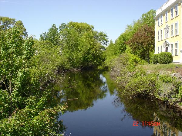
The canal then began a treacherous course to avoid the Medford Swamps and hills before connecting to the Mystic River by means of the Medford Branch Canal.
A mile beyond the branch canal was an aqueduct 135 feet long over the Mystic River. Your first micro is located here. It is a camouflaged container. Please replace exactly as found. If it is raining, please bring this micro in to your car to read in order to keep the contents dry.