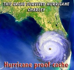
Cache is located in one of the local
parks that suffered a great amount of damage during Hurricane
Charley. You can still witness some of this damage, but most
has been clean up now. Kudoos to Charlotte County Parks and
Recreation for the magnificent job they have done in cleaning
up the local parks!!!
Hurricane Charley was the third
named storm, the second hurricane, and the second major hurricane
of the 2004 Atlantic hurricane season. It caused major damage to
parts of Cuba as it crossed the island as a Category 3 hurricane,
and strengthened further before reaching the U.S. It made landfall
at Charlotte Harbor in Charlotte County, Florida, as a Category 4
hurricane on the Saffir-Simpson Hurricane Scale. It was the
strongest hurricane to strike the area since Hurricane Donna in
1960 and the strongest hurricane to strike Florida since Hurricane
Andrew in 1992. After following the East Coast of the U.S., it
eventually dissipated near Cape Cod.
Charley was initially a well-developed
tropical wave approaching the Windward Islands. On August 9, while
around 50 miles (80 km) southeast of Grenada, this wave organized
enough to become the third tropical depression of the year. After
crossing the islands into the eastern Caribbean Sea, the depression
strengthened further, becoming Tropical Storm Charley on the
morning of August 10.
The storm moved rapidly across the
Caribbean, and reached hurricane strength on August 11, 90 miles
(150 km) south of Kingston, Jamaica. Hurricane Charley then passed
just south of Jamaica, and the next morning passed between Grand
Cayman and Little Cayman. On the night of August 12, Charley passed
just east of the Isle of Youth, then over mainland Cuba, just west
of downtown Havana as a category 3 hurricane with winds estimated
at 120 miles per hour (190 km/h).
After passing over Cuba, Charley weakened
slightly to 110 mph and crossed the Straits of Florida. Around 8
a.m. EDT, Charley passed over the Dry Tortugas. Tropical storm
force winds of 41 miles per hour (65 km/h) were recorded at Key
West International Airport, 70 miles (115 km) east.
The course Charley took at this time
caught many by surprise. Instead of following the predicted track
through the Tampa-St. Petersburg area, Charley made an abrupt turn
to the northeast, heading for Fort Myers and Sanibel Island. This
track was well within the official forecast's margin of error, and
NHC forecaster intern Robbie Berg publicly blamed the media for
misleading residents of areas further south.

Charley making landfall on
August 13, 2004.
At the same time as it turned, Charley rapidly strengthened,
going from a Category 2 storm at 110 miles per hour (170 km/h) with
a central pressure of 965 millibars to a Category 4 storm at 150
miles per hour (235 km/h) with a central pressure of 941 millibars
in only three hours. This rapid intensification was outside the
official forecast, which called for only a slight strengthening
before landfall. The change in strength was so drastic that the NHC
issued a special hurricane advisory outside of its normal schedule.
It is possible that the winds were even stronger at landfall,
possibly at or near Category 5 strength (155 miles per hour or 250
km/h), based on later images and assessments.
Hurricane Charley, just after its second US landfall in South
Carolina. This angled image of Hurricane Charley was taken by a
National Oceanic and Atmospheric Administration satellite at 12:45
p.m. EDT on August 14, 2004.

Charley became the second tropical storm to strike Florida in 24
hours when Tropical Storm Bonnie struck the Florida panhandle in
Apalachicola at 11 a.m. EDT on August 12, 22 hours before Charley
went over the Dry Tortugas. This made 2004 the first year two named
storms have struck the same state in the same 24-hour period since
1906. Mainland landfall occurred only 29 hours apart.
At 3:45 p.m. EDT, Charley made landfall at Cayo Costa, north of
Fort Myers. Charley moved inland near Charlotte Harbor shortly
afterwards. Its track would take it directly over Port Charlotte,
Wauchula, Kissimmee and Orlando. Sustained winds over 100 miles per
hour (160 km/h) were felt as far inland as Orlando.
Near midnight local time, Charley began moving back over water,
exiting Florida near Daytona Beach. It returned to land around 11
a.m. near North Myrtle Beach, South Carolina still retaining
hurricane strength. Charley continued to run off and on land up the
East Coast of the United States, and dissipated near Cape Cod
around mid-day on August 15.
Charley's strongest gusts were measured at
180 miles per hour (290 km/h) at Punta Gorda. This is an
amazing speed for a hurricane.
Impact
One death in Jamaica, four deaths in Cuba, and ten deaths in the
United States were directly attributed to Charley. Numerous
injuries were reported, as well as twenty indirect deaths in the
U.S.
Property damage from Charley was estimated by the NHC at $14
billion. This makes Charley the second most costly hurricane in
American history, behind Hurricane Andrew's $26 billion in 1992,
and above Hurricane Hugo's $7 billion ($9.4 billion in 2000
dollars) in 1989. (However, Hurricane Ivan later in the 2004 season
also surpassed Hugo, dropping Hugo to fourth. Later in the season,
Hurricane Frances also surpassed Hugo.)
Damage in Cuba has been estimated at over $1 billion USD.


As many as two million people were initially reported without
power in Florida, and a week after landfall it was estimated that
about 240,000 were still without power. The Tampa Electric Company
cut power in downtown Tampa to avoid potential damage to the
underground power grid from short circuits, caused by the storm
surge of conductive seawater. Havana's power was also knocked out
by Charley when it passed by. Over a million Florida residents were
evacuated.
Mandatory evacuation of non-residents, recreational vehicles,
mobile home residents, and special needs residents from the Florida
Keys was ordered. An evacuation order for the coastal areas of Lee
County was also issued. Pinellas, Hillsborough, Manatee, Pasco and
Sarasota Counties all had mandatory evacuations for areas prone to
the effects of storm surge.
President George W. Bush declared Florida a federal disaster
area, and Governor Mark Sanford of South Carolina declared a state
of emergency, ordering an evacuation of two coastal counties,
including Myrtle Beach.
Theme parks in Orlando, including Universal Orlando, Seaworld
and Disney's parks closed early; Disney Parks were open exclusively
for those staying in Disney Resorts. Disney's Animal Kingdom never
opened at all, making this only the second time Disney's parks have
closed due to a hurricane (The first was during Hurricane Floyd).
Ironically, Hurricane Charley closed the Typhoon Lagoon park longer
than the Magic Kingdom and EPCOT. The parks, except for Animal
Kingdom and other areas, reopened on Saturday, August 14 with
limited staff.
Public schools in some counties in the path of the hurricane
were scheduled to be closed for two weeks. In some areas this was
necessary because the school buildings were damaged or destroyed
(especially in Charlotte County). In other parts of Florida, no
power or water was yet available.
Agricultural losses were heavy. Florida is the second-largest
producer of oranges in the world and the storm damaged one-third of
the state's orange groves. The loss to the citrus crop was
estimated at $150 million. The loss could reach one-quarter of the
total crop. Other crops and agricultural buildings and equipment
also suffered.
The name Charley was retired in the spring of 2005 by the World
Meteorological Organization and will be replaced by Colin in the
2010 season.
Hurricane Charley

Track of Hurricane Charley
Duration: Aug. 9 - 14, 2004
Highest winds: 150 mph (240 km/h)
Total damages (in USD): $14 billion
Total fatalities: 15 direct, 20 indirect
Areas affected: Jamaica, Cuba, Florida, South Carolina

 <<a href="http://www.nefga.com">
This cache was placed by a member of the
Northeast Florida Geocachers
Association