This cache is nearing it's three year lifespan and will be
archived sometime in May. Chester County Parks and Recreation is
agreeable to having a replacement cache hidden. In fact, the area
is divided into three sections, and they are agreeable to having
one cache placed in each section. So, is anyone, two, or three of
you interested in placing a new cache here? (Two cachers have now
expressed an interest in these locations). I have a PDF map of the
three sections that I can email to anyone that makes a request.
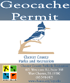
This is Chester County Parks and Recreation land. There is a permit
process for approval. Nothing scary. They just need some
information about you and the cache hide. After I had gotten the
coords, I filled out the permit right there at the office (located
very close to Warwick Park). Drop a note here or drop a note to my
profile if you are interested.
Open year-round, 8 AM to sunset. Dogs allowed on leash. Some
hunting DOES occur in this area. This property is also bordered by
some "Approved Trout Waters" of the French Creek. That means
parking will be at a premium the first Day/Week of Trout Season.
NOTE - New for 2007: Trout opening day here is Saturday March 31st
2007 in the 18-county Northease region (while the rest of the state
will see trout season open April 14).
There are two possible Trailheads to access this Cache. This is
a very nice wooded area, but it is not overly large. There is only
limited parking near each Trailhead, and they are within easy
walking distance of each other. The lower elevation trail follows
the South bank of the French Creek. All moisture drains toward this
low area and then into the Creek. There can be some wet spots on
this trail. Near this approach there is parking space for about 4
or 5 cars at N 40° 09.280' W 075° 38.420' (South end of Bridge,
West side of the road). There is also roadside space to park 2 cars
at the higher elevation trail. If there has been any recent wet
weather this would be the drier alternative. This is also the more
"kid friendly" approach. Parking coords here are N 40° 09.225'
W075° 38.380' at the Sawmill 1900 sign. I have revisited recently
during the warmer weather and have to qualify my "kid friendly"
observation about the upper trail. This is also a Horse trail.
There is Horse Exhaust on this trail. The lower trail along the
creek is longer, wetter, and has a few minor obstacles. But no
Horse Exhaust. Note: This Cache was originally a black painted .30
cal. Ammo Can. On 8/19/07 during a maintenance check I discovered
the Ammo Can is gone. I replaced it with a small container, updated
the hint and bumped up the difficulty. Lets see how long this one
lasts.
I can't find any remaining evidence of the actual sawmill at
this location. But, after you find the Cache you can explore what
does remain from the past. At N 40° 09.158' W 075° 38.230' there is
an old cement and stone Water Raceway. Look for a Name and Year
(1925) scratched into the Cement of the Raceway. Facing upstream
look on the Right side of the Creek. This could be covered with
leaves, silt, or higher than normal water. What do you make out the
Name to be? Notice the sections of Pipe and an old Valve still
lying there. The area between the Cache and the Raceway is somewhat
rocky.
If you approached by way of the lower trail (along the Creek) at
N 40° 09.227' W 075° 38.189' you should have noticed another 1925
Cement Pour with a Pipe stub sticking out of the top. Do you notice
the Full Date and Initials scratched into the West Side? What is
the relationship between these two 1925 man made objects. Was there
a water pipe running from the Raceway down to this point near the
creek? Why? And at N 40° 09.212' W 075° 38.155' there is an undated
small toppled structure. What was the purpose of this?
Also notice a Charcoal Pit at N 40° 09.212' W 075° 38.140' very
near the toppled structure. Are they related? Heat was an important
ingredient needed to produce Iron. Charcoal, when fired provided
heat to melt the Ore. Because Charcoal burned hotter and cleaner,
it was superior to using wood in a Furnace. To make the Charcoal,
felled timbers were brought to a flat space free of brush, roots,
and stumps to be burned. Much care was taken so that the surface
was hard and smooth to afford good shoveling and raking of the
coal. It had to be level to assure uniform burning. Anything
growing in this flat space now, has only taken root since the
production of Charcoal ceased.
 |
This cache was placed with the permission of
Chester
County Parks & Recreation Department. All caches must have
the permission of Chester County Parks and Recreation Department.
Please follow all Chester County Parks and Recreation
Rule and
Regulations. Parks are open year-round, 8 am to sunset. Dogs
are permitted on a 6' leash. Hunting may take place within the
parks during applicable hunting seasons. For more information on
Chester County Parks and contact information, please visit
http://www.chesco.org/ccparks. |