|
DEUTSCH:
"Samma Sama" führt uns in das Seidlwinkltal, das für den Saumvehr und die Verbindung Nord-Süd von historischer Bedeutung ist. So war die Ortschaft Wörth (früher Werde oder Luggau) nachweislich seit 1230 ein wichtiger Umschlagplatz für den Fuhrwerks- und Saumverkehr durch das Seidlwinkltal und über die Tauern nach Süden. Das Seidlwinkltal bildete den östlichen Zugang zum Heiligenbluter Tauern (Hochtor), der gegenüber allen anderen Tauernübergängen den Vorteil hatte, länger offen zu sein. Am Ende des Seidlwinkltals steht nun das original erhaltene Rauriser Tauernhaus, das als Versorgungsstätte der Säumer diente und bereits 1491 das Schankrecht erhielt. Heute erinnern Brauchtumsveranstaltungen wie die "Sama-Roas" (Säumer-Reise) in Rauris an die historischen Zeiten. (Informationsquelle: rauris.net)
Der Cache:
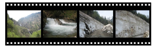
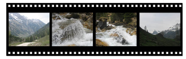
Parken kannst Du bei der "Fleckweide" (N 47° 10.217' / E 012° 55.107'), von dort aus beginnt dann eine gemütliche Almwanderung durch das Seidlwinkltal. Zu Beginn kannst du noch entlang der Seidlwinkler Ache den schmalen Pfad entlang gehen, später muss man dann aber doch hoch zum großen Schotterweg, der bis zurück zum Rauriser Tauernhaus führt.
Vorbei an einigen Almhütten, die auch Möglichkeit zur Einkehr bieten, geht es zum Schluss noch am Tauernhaus vorbei Richtung "Säumerweg". Dort findet man den Cache ohne Probleme bevor man in den Wald hineinkommt. Bis zum Tauernhaus kann man auche ohne Probleme mit einem Kinderwagen spazieren.
Der Cache ist doch ein einfacher Traditional geworden, damit er auch von der südlichen Seite (Hochtor, Lizlhofalm) aus erreichbar ist, und das Fiilm-Doserl liegt bei N 47° 07.190' / E 012° 52.532'.
Dauer:
zu Fuß ab Parkplatz "Fleckweide" zum Cache - 2 bis 2,5 h
mit dem Rad ab Wörth bis zum Tauernhaus - 1 bis 1,5 h
Happy Caching!
ENGLISH:
"Samma Sama" (means "let's be seaming people") leads us to the Seidlwinkl-Valley that is known for its historical seaming and the connection between north and south for trading people. The village Wörth (formerly Werde or Luggau) has been known demonstrably as an important reloading point for the seaming traffic through the Seidlwinkltal and over the Tauern to the south since 1230. The valley of Seidlwinkl built the eastern access to the Tauern of Heiligenblut (Hochtor) and had in comparision to all the other Tauern transits the advantage that it has been opened for a longer time. At the end of the valley there is still standing the Tauernhouse of Rauris that has been place of centralised supply for the seaming and trading people and it has reached its bar rights already in 1491. It is still preserved in its original condition. Today events like the "Sama-Roas" (seaming travel) remember to those historical times. (Information: rauris.net)
The Cache:
You can park at the "Fleckweide" (N 47° 10.217' / E 012° 55.107') from where a nice and comfortable alp hike through the Valley of Seidlwinkl starts. At the beginning you can also hike along the beck of Seidlwinkler Ache but later you have to go up to the bigger way of gravel. This way leads you back to the Rauriser Tauernhaus.
Passing a few alp hats where you can also have a short break you have to pass at the end the Tauernhaus in direction to the Säumerweg (seaming way). There you can find the cache before entering the wood. All the way is easy and comfortable to walk. Back to the Tauernhaus you can even walk with a buggy without any problems.
The cache is an easy traditional so that it can be also reached by people who come from the south (Hochtor, Lizlhofalm) and the micro is hidden at the coordinates N 47° 07.190' / E 012° 52.532'.
Duration:
walking from parking space "Fleckweide" to the cache - between 2 and 2,5 hours
with the bicycle from Wörth to Tauernhaus - between 1 and 1,5 hours
Happy Caching!
Bitte den Cache auch bewerten! / Please rate this cache!

|