This cache is where two transits cross in the entrance to the Lymington River. You need a boat to do it or to travel on the ferry between Yarmouth, Isle of Wight and Lymington (£). The return trip can make a great day out.
To claim the cache you need to post at least one photograph taken from the location.
For thousands of years, before modern electronics, there were few accurate ways for navigators to know precisely where they were. One of those few is transits. By visually lining up two fixed points, usually on the shore, you know you are on a particular line. Where two of them cross you know you are at a precise point. If lights are placed on these points the transit can be used in the dark.
The two transits involved in this cache are a special type, known as leading lines, they define a line to sail down to guide a ship past hidden dangers under the water.
The first are a pair of tall orange poles on the shore, one near the Sea Water Baths and the other in the park just North of the Royal Lymington Yacht Club guiding the way into the River Lymington from the Solent down the Long Reach. They are very difficult to see among all the yacht masts during the day. At night they each have a non flashing red light.
It can be seen as a black line on this chart, going out to sea from the two lights. "F.R.17m8M" means "Fixed (ie not flashing) Red light
17 metres high visible for a notional 8 nautical miles". The southern light is 12m hight. As you can see the line has a bearing of 319.5 degrees.
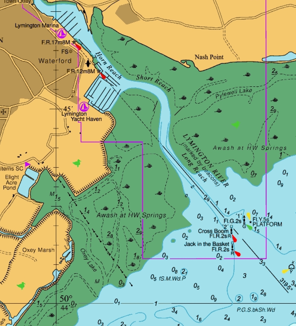 Note the green areas may well be covered by water, they are only totally uncovered at the rare theoretical lowest tide.
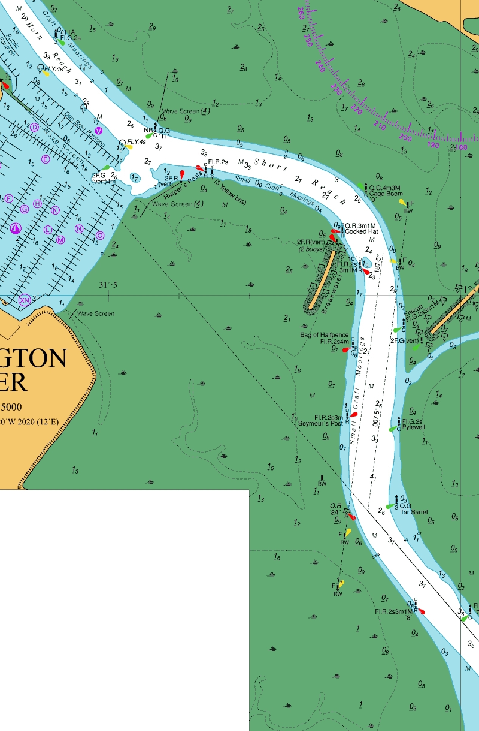
The second transit is a pair black and white piles with fixed white lights on top, they show where to turn right into the next reach in the river.
On the chart below you will also see another leading line in the Short Reach for outgoing vessels. Occasionally ferries pass each other in the Short Reach, each on the appropriate transit. Outgoing ferries pass through the cache location immediately after turning left, thus you get two opportunities to do the cache if you take a return trip!
 Note the green areas may well be covered by water, they are only totally uncovered at the rare theoretical lowest tide.
Virtual Reward - 2017/2018 This Virtual Cache is part of a limited release of Virtuals created between August 24, 2017 and August 24, 2018. Only 4,000 cache owners were given the opportunity to hide a Virtual Cache. Learn more about Virtual Rewards on the Geocaching Blog.