Gravenhurst Potholes EarthCache
-
Difficulty:
-

-
Terrain:
-
Size:  (not chosen)
Please note Use of geocaching.com services is subject to the terms and conditions
in our disclaimer.
Gravenhurst Potholes
| |
|
| |
The landscape at Gravenhurst, which is located off Hwy 11, is the result of glaciations that occurred during the last Ice Age. The most recent period of glacial advances is bitween 70,000 and 10,000 years ago. As the glaciers overlying Northern Ontario retreated, the resulting meltwaters and debris altered the landscape, forming a wide variety of glacial landforms and features that can be observed today. |
| |
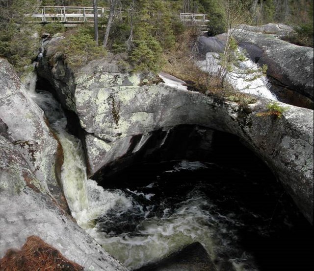
Flutes and pothole
|
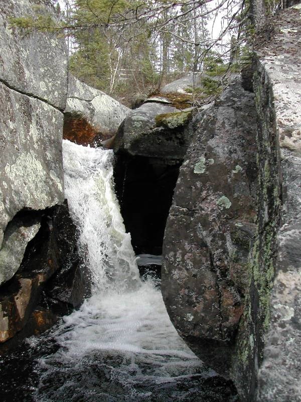
Pothole
|
| |
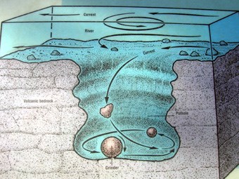
Gravel, and rocks became trapped in the spinning whirlpools and spiraling eddies, and over time, the grinding action of these abrasive materials drilled circular or cylindrical holes known as potholes into the underlying bedrock. And flutes that formed by the erosion of the bedrock by the unending grinding of suspended, saltating, and rolling particles against the bedrock.
|
| |
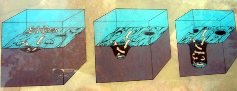
Diagram of the evolution of pothole formation.
|
| |
The specific abrading materials which carve the potholes during their formation are called grinders and are frequently found in the bottom of the pothole. With the continued downward spiraling action of the grinder, the pothole becomes deeper and the once angular surface of the grinder is smoothed (see diagram at right). |
 |
| |
|
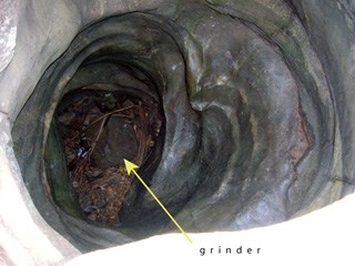
Above, a view inside a pothole is shown. The grinder which formed the pothole is visible at the base and the corkscrew pattern on the walls of the pothole was cut by the sprialing current of water.
At left, smoothed grinders are depicted in a display at the Interstate Park Information & Ice Age Interpretive Center. A field notebook is included for scale.
|
| |
|
| |
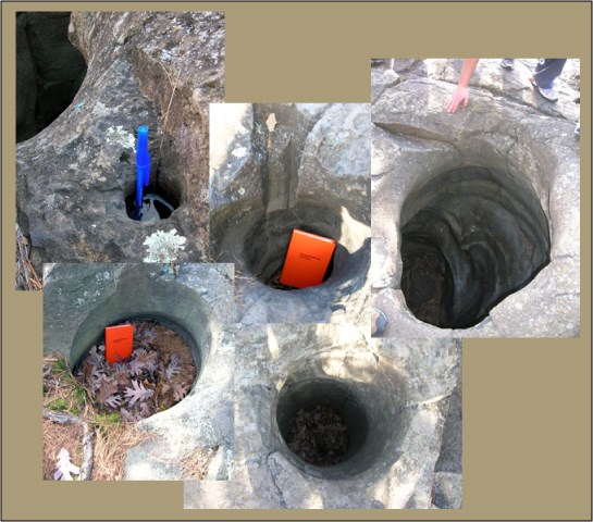 Compilation of potholes of varying sizes.
A pen and field notebook are placed in some potholes for scale. |
| |
|
| |
|
At left is a view of a "half-pothole" cross-section. This pothole was carved deep into the bedrock but because other potholes were located nearby, the glacial meltwaters wore away the wall between them leaving what we see today. The blue lines represent the original extent of the pothole before it merged with others. |
| |
|
| |
Logging Requirements:
1. Take a photo (optional) of you with GPS and the Pothole in the background.
2 Measure diameter and depth of Pothole.
3. Do you think these Potholes are gonna become bigger and deeper in the future? Why/why not?
4. Can you see any half potholes? How many?
|
| |
|
Additional Hints
(No hints available.)