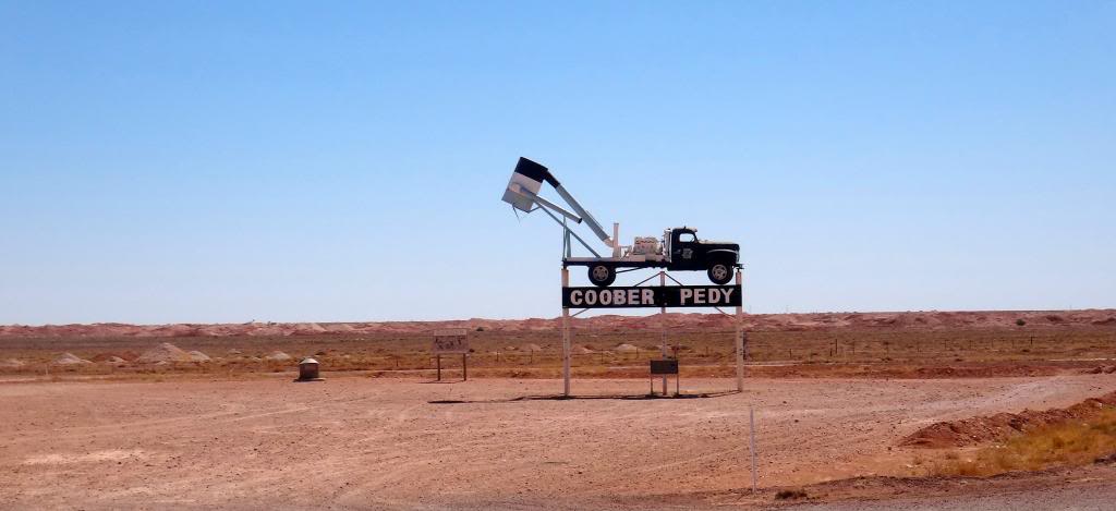
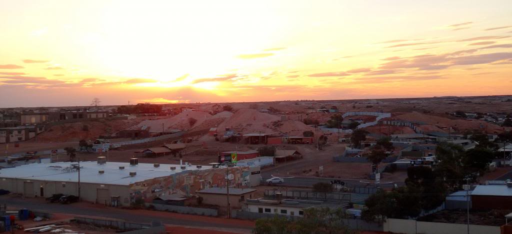
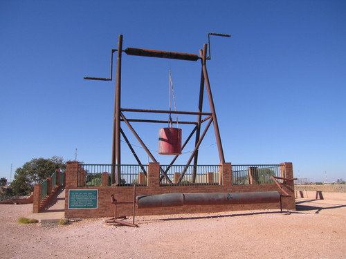
This EarthCache is located in the Outback at The Big Winch lookout in Coober Pedy, South Australia. It is highly recommended to visit the GZ and do this cache at dawn or dusk as the sunrises and sunsets are simply spectacular.

The aim of the cache is to learn about the geology surrounding Coober Pedy and the formation of opals. It is also to share with you the spectacular views of the surrounding Outback.
To complete this EarthCache you must visit the GZ in Coober Pedy. You will need to answer geological questions about the region, how opals were formed, and upload a photo of your visit at the GZ coordinates - The Big Winch lookout. The lookout is ideal for families with children and is wheelchair accessible. From here the whole of Coober Pedy is in view and you can look east to views the beautiful Breakaway Mountains.

Coober Pedy is a town in northern South Australia, 846 kilometres north of Adelaide on the Stuart Highway. The town is sometimes referred to as the "opal capital of the world" because of the quantity of precious opals that are mined there. Coober Pedy is renowned for its below-ground residences, called "dugouts", which are built due to the scorching daytime heat. Coober Pedy is probably best known for its unique style of underground living. There are authentic underground homes to explore as well as underground museums, opal shops, art galleries, underground churches and, of course, opal mines.
Opal was first found in Coober Pedy on the 1st of February 1915 and since then has been supplying the world with the majority of gem quality opal. Coober Pedy today relies as much on tourism as the opal mining industry to provide the community with employment and sustainability.
Coober Pedy has evolved in to one of the most unique places in Australia and perhaps the world. It is a cosmopolitan town with a population of 3,500 and over 45 different nationalities. The relaxed and friendly lifestyle of the town has made it a breeding ground for cultural tolerance, diversity and acceptance.

Landscape and Geology
What is Opal?
Opal is a form of silica, chemically similar to quartz, but containing water within the mineral structure. Precious opal generally contains 6-10% water and consists of small silica spheres arranged in a regular pattern.
Opal is formed from a solution of silicon dioxide and water. As water runs down through the earth, it picks up silica from sandstone, and carries this silica-rich solution into cracks and voids , caused by natural faults or decomposing fossils. As the water evaporates, it leaves behind a silica deposit. This cycle repeats over very long periods of time, and eventually opal is formed.
Opal occurs in many varieties, two of which are precious opal and potch.
Colour in precious opal is caused by the regular array of silica spheres and voids diffracting white light, and breaking it up into the colours of the spectrum. The diameter and spacing of the spheres controls the colour range of an opal.
Small spheres (approx. 150-200 nm) produce opal of blue colour only, whereas larger spheres (350 nm) produce red colour. Opal with red colour can display the entire spectrum. Opal colours also depend on the angle of light incidence and can change or disappear when the gem is rotated.
In potch opal, the silica spheres may be absent or too small or irregularly arranged to produce colour. These kinds of opals are not precious and are called "potch" by the miners, or common opals by mineralogists.
How is Opal formed?
Australia currently produces about 95 per cent of the world’s precious opal from widely scattered fields throughout central Australia and particularly Coober Pedy. No other country on Earth has such an abundance of this rare precious gemstone.
The opal deposits of Coober Pedy occur along flat-lying horizontal sedimentary layers about 30 metres below the earth’s surface. They are a product of a unique set of geological events which occurred over a 100 million year period.
Between about 122 million years ago and 91 million years ago, central Australia was covered by a vast shallow epicontinental sea. The sedimentary rocks which were deposited in this sea were derived from volcanic rocks and were organic-rich. These formed the principal host rocks for opal deposits in central Australia.
Following surface exposure through lowering of the sea level, these host rocks were subject to a prolonged sub-tropical weathering regime until about 40 million years ago. Central Australia probably looked not unlike today’s Amazon Basin. During this time, the water table was close to the surface and was acidic releasing silica and iron from weathering of the host rocks.
The climate became more arid from about 40 million years ago and, as a result, water table levels gradually lowered and the groundwater became alkaline. Mild tectonism at 24 million years ago gave rise to subtle extremely long wavelength surface folds which facilitated both lateral and vertical migration under arid conditions of the earlier-released silica. Opal was preserved in the weathered profiles beneath the crests of the developing surface folds as water tables here lowered more rapidly due to tectonic uplift. Siliceous cap rocks discouraged erosion. Over the last 10 million years, dissection and scarp erosion exposed the weathering profiles containing the opal.
Coober Pedy History

In January 1915, the New Colorado Prospecting Syndicate, consisting of Jim Hutchison and his 14 year old son William, PJ Winch and M McKenzie had unsuccessfully been searching for gold south of Coober Pedy. The men had set up camp and were searching for water when young Willie found pieces of opal on the surface of the ground. This was on the 1st February 1915 and 8 days later the first opal claim was pegged.
Coober Pedy was originally known as the Stuart Range Opal Field, named after John McDouall Stuart, who in 1858 was the first European explorer in the area. In 1920 it was re-named Coober Pedy, an anglicised version of Aboriginal words "kupa piti", commonly assumed to mean "white man in a hole".
In 1917 the Trans Continental Railway was completed. A number of construction workers followed by soldiers returning from World War 1 came to the opal fields, introducing the unique method of living underground in "dugouts". Conditions were harsh and the environment did not lend itself to easy living. Water and provisions had to be carted great distances and under very trying conditions. Even with the introduction of very large underground water tanks things improved only marginally, the entitlement of water being only 24 gallons (60 litres) per week.
Today the town water supply comes from an underground source 24 kilometres north of the town, then pumped through an underground pipeline to the water works where it is treated by reverse osmosis and pumped through a reticulated town water supply system. The treatment process is expensive consequently water costs $5 for 1,000 litres. The water quality is excellent and people should hold no fears about drinking it.
A map of Coober Pedy can be found here. Further useful information can be found at the Coober Pedy district web site.

Logging Requirements
In order to log this EarthCache you must visit the GZ in Coober Pedy. You will need to email us the answers to the questions and upload a photo of your visit at the GZ coordinates to claim your find. Please do not post any answers to the questions in your log, as it will be deleted.

There is no need to wait for a confirmation email to log your find. We will read each email to confirm your answers and will contact you if there is a problem. Please do not email us photos, just upload them with your log.
If we do not receive an email in a timely manner after logging your cache, we will delete the log.
Internet finds are not permitted and will be deleted. You must visit the GZ after the date of publication to claim this find.
Questions:
1) What is an opal and how are they formed?
2) Around Coober Pedy, what depth in metres are the opal deposits found?
3) What produces the range of colours in precious opals? Describe in detail.
4) What causes the difference in colour between blue opals and red opals?
5) What is potch? Why does potch have no value to opals miners?
The famous photo. In your log please include a photo of your visit at the listed coordinates facing across the town to the north by north west. In this direction The Breakaways should be in the distant background. As proof you have visited the GZ, the photo should include your GPS. Optionally you can include yourself or your caching group. A photo at the GZ is required to verify your log.
References
- The South Australian Tourism Commission
- Coober Pedy Retail, Business and Tourism Association
- The District Council of Coober Pedy
We hope you enjoy our second EarthCache

 My other caches can be found here