For Ten years I have been driving past this particular cut in the road and every time it catches my eye and I think “Oh look at that” isn’t it pretty! I have also wondered what had caused these amazing colours. Since starting Geocaching and learning about Earth Caches I have been hoping and waiting for an Earth Cache to be placed here, so my curiosity could be satisfied and perhaps I could get a smiley too, no such luck! On and off over the years I have thrown around the idea of placing the Earth Cache here myself but I never knew enough about the rocks. Recently while researching another Earth Cache I came across the relevant information!
I have identified the ‘Pretty Pink Rocks’ as Micaceous Siltstone, the Geological map of the area indicates that these rocks are of Silurian age. The original sediments for this particular area were deposited in a deep ocean.
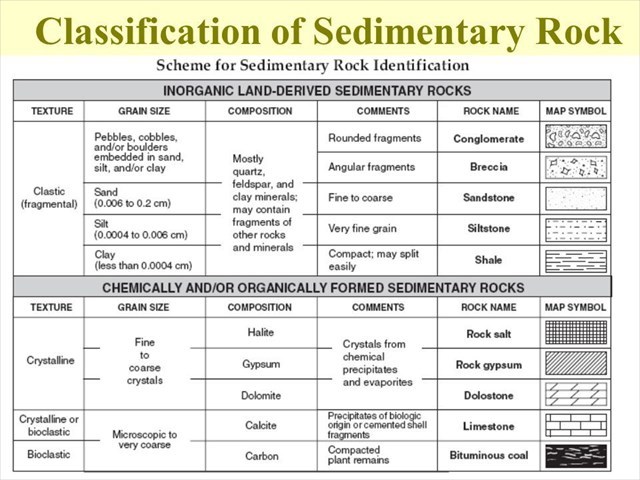
What is Siltstone? Siltstone is a sedimentary rock composed mainly of silt-sized particles. It forms where water, wind, or ice deposit silt, and the silt is then compacted and cemented into a rock.
Silt accumulates in sedimentary basins throughout the world. It represents a level of current, wave, or wind energy between where sand and mud accumulate. These include fluvial, aeolian, tidal, coastal, lacustrine, deltaic, glacial, paludal, and shelf environments. Sedimentary structures such as layering, cross-bedding, ripple marks, erosional contacts, and fossils provide evidence of these environments.
Siltstone is much less common than sandstone and shale. The rock units are usually thinner and less extensive.
The word "silt" does not refer to a specific substance. Instead, it is a word used for loose granular particles in a specific size range.
Silt-sized particles range between 0.00015 and 0.0025 inches in diameter, or between 0.0039 and 0.063 millimetres in diameter. They are intermediate in size between coarse clay on the small side and fine sand on the large side.
Grains of coarse silt are large enough that most people can see them without magnification on a background of contrasting colour. Most people are not able to sense them if they roll a few grains of silt between their thumb and index finger. Most people are able to detect a few grains of silt by biting them gently between their front teeth! Yes, experienced geologists and soil scientists really do use it for quick field identification of silt in sediment and soil!
Silt does not have a definite composition. It is usually a mixture of clay minerals, micas, feldspars, and quartz. The small-size fraction of silt is mostly clay. The coarse-size fraction is mostly grains of feldspar and quartz.
Siltstone occurs in a wide range of colours. It is usually grey, brown, or reddish brown. White, yellow, green, red, purple, orange, black, and other colours occur. Generally the colour is caused by the composition of the grains, the composition of the cement that binds them together, and stains produced by contact with subsurface waters.
The colours here at Beaconsfield are amazing, prettiest on a wet day, some of the prettiest Siltstone we have seen. The most likely explanation for these varied and bright colours are that they are all from iron minerals that oxidised when erosion removed most of the covering rock and soil, exposing the bedrock near the ground surface. This is a process called weathering.
When bedrock is near the ground surface, but still buried, it is saturated with ground water. Groundwater is constantly flowing though the buried bedrock. The ground water itself has minerals dissolved in it, so it is a chemical solution, and can be weakly acid or alkaline. Also, the top of the ground water table can fluctuate - rising and falling in response to rainfall.
This all means that the bedrock, the minerals in it, and the soil above are affected by changes in oxidation and chemical states over time as the groundwater itself changes. In addition, the rock is often porous only in patches, so these variations also control how the groundwater affects the different parts. This all means that minerals in the rock are affected differently in the different parts and can show a variety of colours of the iron minerals: reddish, yellow, brown and even green. In this particular area , you can see that the yellow colours are in the most smashed up parts of the bedrock, probably indicating that water flowed very freely through this patch.
What is Mica? Mica is what many people know as ‘fools gold’, it is a soft platy metamorphic mineral that often forms in siltstone or mudstone when they are heated up and some of the clay minerals change form and composition (the clay is metamorphosed by the heat).
What else can be seen at this location? There are quartz veins in the rocks, some of them are 'chopped up' which indicates that contact metamorphism, essentially heated up and smashed up as the molten granite from the Upper Devonian granodiorite has forced its way through these older sediments.
To log this Earth Cache we require you to visit the posted coordinates and WP2 and then make some observations, consider the information given, then message us with the following answers to the best of your ability;
1. Starting at the posted Coordinates and also again at WP2 we would like you to confirm we have identified this formation correctly: Siltstone can be difficult to identify in the field without close examination. As we mentioned earlier, most people are not able to sense the silty grains if they roll a few grains of silt between their thumb and index finger. Most people are able to detect a few grains of silt by biting them gently between their front teeth! Please confirm we have the identification correct!
2. At BOTH Waypoints compare the height of the embankment, do you think the Siltstone wall goes further down into the soil and do you believe both WP’s were connected before the road was cut through? (explain why or why not)
3. At WP2: Can you see any Mica, if so describe its size and appearance?
4. At WP2: Identify a Quartz vein, how long is the vein before it is 'chopped up'?
4. A photo of course, this task is optional.
You are welcome to log your find straight away to keep your TB's and Stats in order but please message us with your answers within 1 week. Cachers who do not fulfil the Earth Cache requirement will have their logs deleted without notice.
Source: Dr Anne Fleton, Geology.com