View From The Cache Site
For those who would rather 4x4 to a cache in this area, rather
than hike several miles up a steep trail, here's an alternative.
You'll still have to do a little hiking from the End of Vehicle
Travel (EVT), but it's not far. The road has a couple of steep,
rutted, and loose sections, so 4x4 will definitely be required.
These sections provide the fun factor we 4x4'ers crave.
For those without a 4x4, the cache can be reached by hiking the
.7 miles from Ruby Road. Beware of sliding on those steep sections
though!
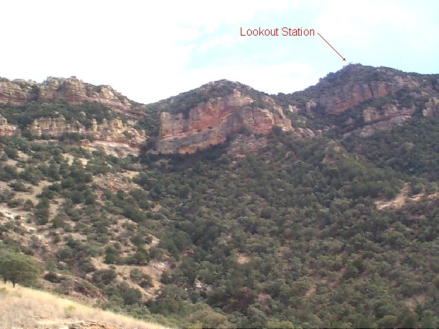
The views at EVT and at the cache are up at the western face of
the Atascosa range. The view is particularly awesome just before
sundown when the rocks glow with a beautiful golden color. Take
binoculars with you to examine the caves in the rock face. Is
that a mountain lion peeking out at you?
Atascosa Peak and
Atascosa Lookout caches are both above you and each just .6
miles from this cache, but you can't get to them from here! At
least, we don't recommend it. (We debated naming this cache
Atascosa Lookup!) It's not quite as high as the other two caches
above you, but the views from this cache ain't bad at all!