Take a short hike to stage one. You are looking for a laminated card. Make note of the code letters next to the stage two coordinates. Follow the blue blazed trail to stage two. You are looking for a plastic pipe (2 ½” Diam x 14” L). Use the code letters to dial in each of the last three digit latitude/longitude coordinates for stage three. Please do not screw the cap on too tight when reassembling the container.
After getting the final coordinates, hike up to the fields. From here you can go in many directions – the correct direction was revealed with the decoder. The final is a small locking container.
The difficulty of getting to stage three depends on the time of year. If the grass is short, you will have an easy hike. If the grass is long, you will have to forge a route. Good luck!
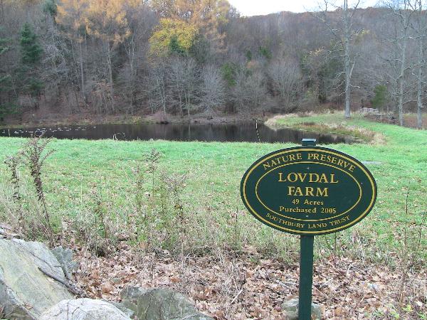
Lovdal Farm is a 49 acre nature preserve owned by the Southbury Land Trust. It connects with Phillips Farm, a 94 acre Land Trust preserve, via a trail in the Northwest corner of the field. Southbury is fortunate to have such a well organized and dedicated group as part of the town. Visit their web site at www.southburylandtrust.org.

Hope you enjoy my first hide. Many more to follow!