As required for Earthcache listings, incomplete logs will be deleted. In the case of this cache, with no notice. An incomplete log is one that does not include an e-mail to me with the answers to the questions below within 48 hours of the time the log is submitted.
At the end of the 48 hours, your log will be deleted with NO warning.
Crown Point and Vista House:
Crown Point and Vista House are located in the Columbia Gorge National Scenic Area, 11 miles east of Troutdale, Oregon.
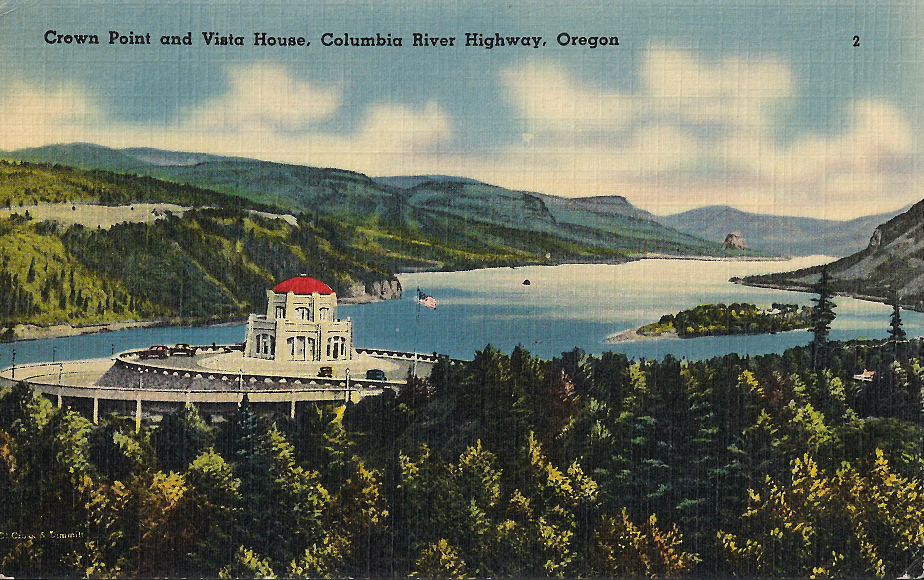
Crown Point is a remnant of a thick intracanyon flow of the Priest Rapids Flow that filled an early ancestral canyon of Columbia River to a total thickness of nearly 650 ft some 14 million years ago. The Priest Rapids is a member of the Wanapum Basalt of the Columbia River Basalt Group (CRBG), and erupted in the middle Miocene. The lower part of the cliff is made up of a thick section of volcanic sediments, which partly filled the canyon before it was covered by the lava flow. The single Priest Rapids flow consists of 508 feet of hackly-jointed basalt which in turn overlies more than 198 feet of bedded Priest Rapids hyaloclastite. The entire thickness of lava congealed as one cooling unit with an 80-ft basal colonnade and a very thick (475 ft) hackly entablature.
The Vista House was built in 1916 at the same time as Highway 30 (what is now the Historic Columbia River Gorge Highway, and the only way to reach Crown Point). The building was designed to be a place of refreshment and enjoyment of the Columbia Gorge. The octagonal building with its copper dome now houses a museum, gift shop and interpretive display of historic and geologic points of interest in the Gorge.
Rooster Rock and Rooster Rock State Park:
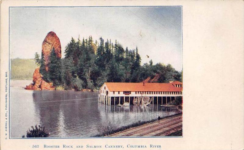
Rooster Rock is a landslide portion of the lava flow that is now known as Crown Point. The Rock has been estimated to be about 210 feet tall, including the underground portion. The scar from the slide is still visible on the cliff above Rooster Rock. The Rock is a spire from the entablature.
As an interesting side note, the land surrounding Rooster Rock is believed to be less than 500 years old. It is made up of river sediments that have collected around the Rock.
One other little item you may want to know. A portion of the beach at Rooster Rock State Park is a state-designated, and therefore very legal, clothing-optional beach. Yes, people run about that beach area nekkid!! This area of beach is at the far end of the Park from the Rock itself. Basically, you can not get to the Clothing Optional Beach by accident. If you go out there, it's your own fault, and neither the cache owner, Groundspeak, or the Geological Society of America can be held responsible for any "issues" you or your family member(s) may have as a result of seeing nekkid people.
Important Parking Information:
When you enter the Park, turn left. Go through the first parking lot, and park in the second lot.
Do NOT park in the third lot--the one at the boat ramp. It is reserved for vehicles with boat trailers, and you will get a ticket.
Logging This Cache:
First--Based on the information above, e-mail me your opinion of where on Crown Point the Rock came from. Please describe your proposed location relative to the Vista House (i.e. East face, West face, etc.). Do not put this info in your on-line log, whether encrypted or not.
No e-mailed answer to me, no smiley.
Second--OPTIONAL--In the Park near the coords given, you will see a boat ramp with a floating pier. Take and post a picture of yourself at the site.
Update--9/2/19:
