This EarthCache will take you to a USGS
Gaging Station on the Cedar Creek in Allen County,
Indiana.
During times of potential flooding, field
crews from the U.S. Geological Survey (USGS) race to gather vital
hydrologic data. They measure the river flow and water levels to
provide the information needed by river forecast- ers, engineers,
and emergency managers who rely on data from the USGS network of
about 170 Indiana streamflow-gaging stations . The network is
funded in a cooperative program of federal, State, and local
agencies, and is part of a national network maintained by the USGS.
Many of these stations are equipped to transmit real-time
streamflow data. In times of emergency, real-time streamflow
information is a key element in the protection of lives and
property.
USGS 04180000 CEDAR CREEK NEAR
CEDARVILLE, IN
LOCATION
Latitude 41°13'08", Longitude 85°04'35"
NAD27
Allen County, Indiana , Hydrologic Unit
04100003
DESCRIPTION
Drainage area: 270.00 square miles
Datum of gage: 780.09 feet above sea level
NGVD29. |
This gaging station is maintained in cooperation with:
• The Indiana Department of Transportation
• The U.S. Army Corps of Engineers - Louisville District
• The U.S. Geological Survey
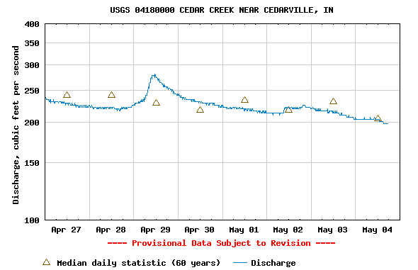
REALTIME FOR CEDAR CREEK: Real-time data typically are
recorded at 15-60 minute intervals, stored onsite, and then
transmitted to USGS offices every 1 to 4 hours, depending on the
data relay technique used. Recording and transmission times may be
more frequent during critical events. Data from real-time sites are
relayed to USGS offices via satellite, telephone, and/or radio and
are available for viewing within minutes of arrival.
LOCAL GEOLOGY: The
area surrounding the Cedar Creek is farm land and residential
areas. The immediate area around the gaging station is wooded
areas and a nature preserve is nearby as well. The topography
in areas is can be very steep especially to the North West.
The steep terrain caused the creek to rise rapidly.
Water runoff from flows into Cedar Creek causing the
creek to flood. Depending on the water level some of the
flood waters will fill the nearby Matea Nature Preserve.
However, this gaging station is vital in that the water flows
directly into the St. Joseph river which travels through the city
of Fort Wayne. The city of Fort Wayne has the confluence of
three rivers. The St. Joseph, Maumee and St. Mary's rivers.
Due to these three rivers flooding on the rivers and its
tributary's are a major concern. In times of heavy flooding
these gaging stations along the creeks and rivers surrounding the
city are vital in the early warning of potential flooding of low
lying areas along the Cedar Creek and the other rivers of Allen
County and further downstream.

You can go to this website to obtain data provided by this Gaging
Station.
Data
In order to get credit for
this EarthCache you must:
1. Post a photograph of
yourself and your GPSr with the gage in the background.
Please use caution when crossing the street.
2. Email the owner with the
following information:
a. What was the gage height
at the nearest time to your visit?
b. What was the volume of discharge at the nearest time to your
visit?
c. What was the approximate width of the river at the time of your
visit? Was it overflowing its banks? Please take your
measurement from the same side of the road as the parking
coordinates. There is a walkway on the bridge that allows you
to do this safely.