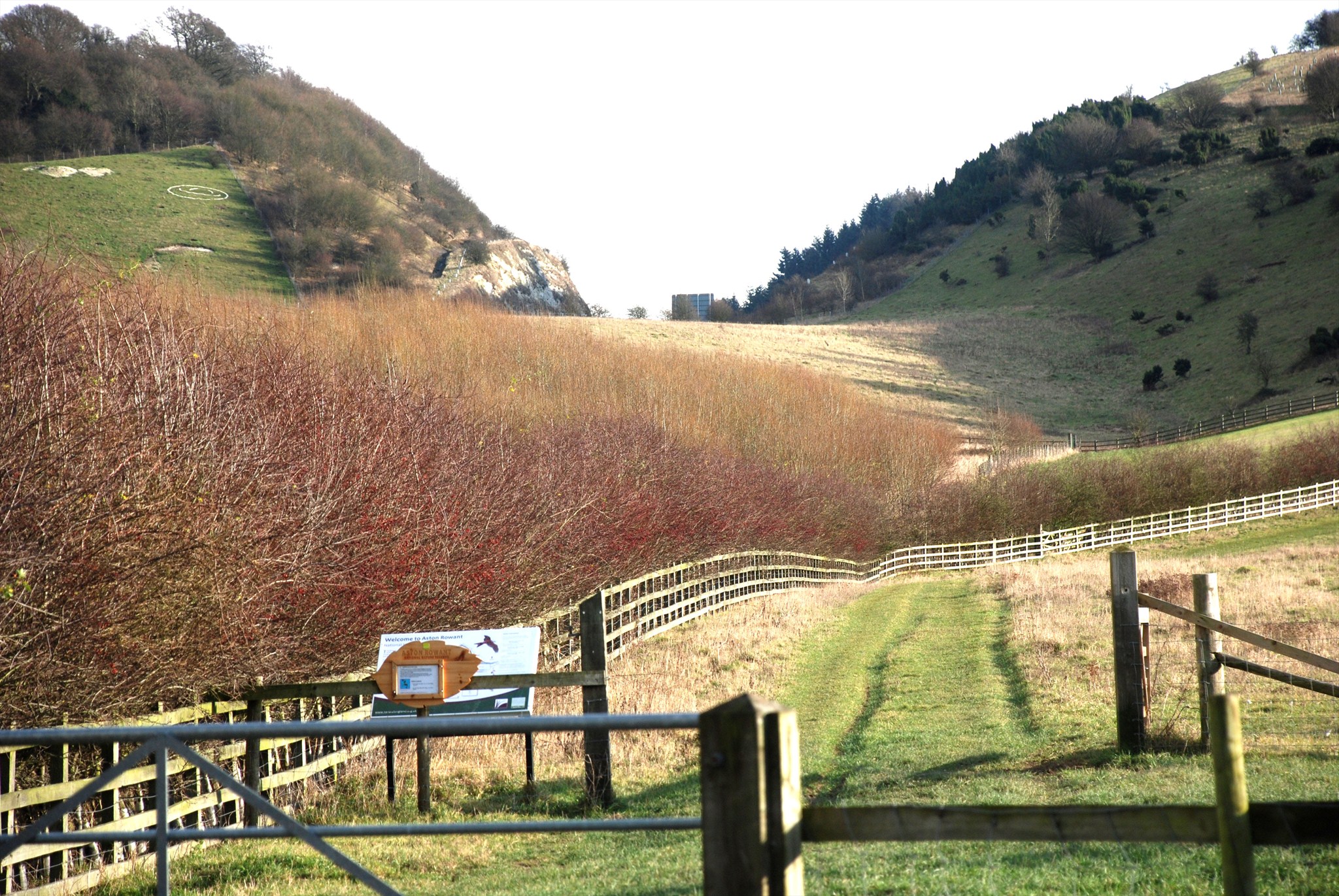
Standing at the above coordinates you will be on a minor road that crosses the M40. Looking north you will have the opportunity to see into the very landscape which we normally walk over following the engineering of a cut exposing layers of the earth.
Geological SSI - "A stratigraphically important site providing the best Coniacian section in central England, part of the Upper Chalk succession. Above the Chalk rock exposed at the base of the cutting there is a late Turonian to basal Coniacian section of coarse grained nodular chalk, extremely rich in fossils and important in defining the boundary between Turonian and Coniacian age rocks."
The chalk of the Chilterns is very soft, unlike the limestone of the Cotswolds, even though they have the same chemical composition. This is visible in the architecture of the two regions. Limestone is used to build houses in the Cotswolds, whereas in the Chilterns clay was used to make bricks because the chalk was not suitable for building. In many parts of the Chilterns the brick was used in conjunction with flints derived from the chalk, and brick and flint buildings are a feature of the vernacular architecture.
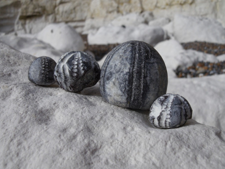
Flints are found in the chalk and are often concentrated in the clay overlying chalk in the Chilterns. It is a form of silica (as is sand), whose origins were the silica-rich organisms such as diatoms (microscopic algae), other plankton and sponges. When these creatures died, their silica skeletons dissolved in the water near the sea floor. The deep quiet waters of the chalk sea became locally saturated with silica which was re-precipitated giving rise to flints and replacing the calcium carbonate which went into solution. Initially this was a sticky jelly-like substance, but over a very short period the gel solidified into the very hard flint we find today. Often fossilized remains of sea-urchins and sponges are found in the core of the flint.
The Chalk has many variations in rock type. It includes clay-rich horizons, known as marl-bands, and hardgrounds, which are horizons of harder Chalk which developed during pauses of sedimentation on the sea floor; it also includes bands of flint nodules, which formed from a silica-rich ooze on the sea floor. The Lower Chalk is typically grey in colour due to a high proportion of clay, and has many marl-bands, whereas the Upper Chalk is typically white and has a higher proportion of flint. The most significant bands of harder rock are named, for example the Totternhoe Stone and Melbourn Rock. Alternating layers of softer and harder chalk have influenced the shape of the region's landscape. The Chalk has been divided up into a number of time horizons or ‘zones’ according to the characteristic fossils which occur in them. Using these zonal fossils it is possible to follow the continuity of Chalk strata as they outcrop across the country. Hardgrounds, marl bands and flint bands are also useful for correlating strata across wide areas.
To validate your find pleae e-mail me answers to the following questions,
1. Describe the zones you see within the cutting.
2. Are the lines horizontal, vertical or at an angle? What does this tell you about the ground at this location.
3. From the surrounding area (recommended parking) find some of the local flint. How was this flint formed? Can you find any fossils?
Feel free to upload a photo of yourself with the cutting in the background.
Please include with your e-mail, your caching name (e.g. metal-bijou) and your email address.
Don't worry about waiting for a reply before you log, in the very unlikely event that your answer is wrong I'll let you know so you can revise your answer or turn your smiley to a note.
 The most exciting way to learn about the Earth and its processes is to get into the outdoors and experience it first-hand. Visiting an Earthcache is a great outdoor activity the whole family can enjoy. An Earthcache is a special place that people can visit to learn about a unique geoscience feature or aspect of our Earth. Earthcaches include a set of educational notes and the details about where to find the location (latitude and longitude). Visitors to Earthcaches can see how our planet has been shaped by geological processes, how we manage the resources and how scientists gather evidence to learn about the Earth. To find out more click HERE.