Hidden in Westchester: Rock
Quarry
PARKING: N 41 04.703 W 073 45.405
Believe it or not, geology has played a central role
in the development of Westchester County. There are surprises
hidden in the rocks; sometimes they’re out in the open for
you to discover… if you know where to go! The first set of
coordinates provided will bring you to the parking area at
Cranberry Lake Preserve in North White Plains, NY. This 190-acre
park, nestled amid several towns, is full of nature and historical
trails. This location also hides a former rock quarry within its
boundaries. The quarry, now well off the beaten path, played a key
role in the development of its surroundings. In addition, there is
a Nature Center with programs available to the public so you can
learn more! Make sure to grab a trail map from the kiosk to guide
yourself to the quarry (the purple trail is one option to get you
there). Once at the quarry, you will be able to use the other
waypoints listed below. First, get to know what’s
below…
WESTCHESTER ROCKS!
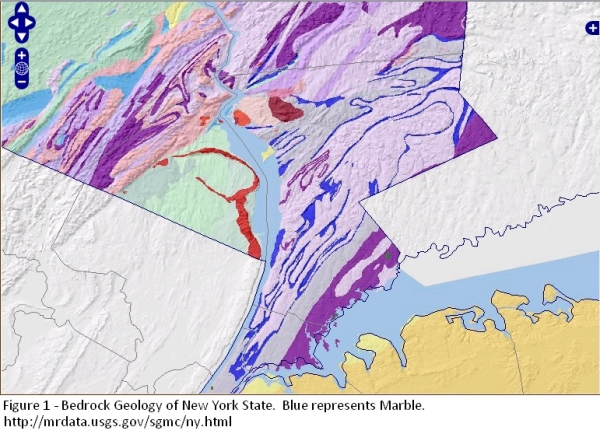
Much of Westchester County lies on three main types of
bedrock (the solid rock that lies underneath layers of soil
and sediment). These rocks hold lots of information about the area
and its formation, even though it is only sometimes exposed for us
to examine. These are Marble, Schist and Gneiss; all
of which are types of Metamorphic Rock. Rocks that have been
changed over time by heat and pressure are known as Metamorphic
Rocks.
MEET THE ROCKS
Marble is a gray-white rock that is commonly formed from the
metamorphism of limestone (a Sedimentary rock). This rock occurs in
thin veins throughout the county (in comparison to the amounts of
other types of bedrock). These veins form ribbons on a geologic
map.
The marble is mined for many uses, such as building materials and
sculpture work. Because marble is metamorphosed limestone, it is a
rock that is composed primarily of carbonate minerals, like calcite
(CaCO3). This mineral reacts with acids and can be slowly dissolved
by groundwater. Many of the rivers in Westchester County, like the
Bronx River, follow narrow bands of weak marble in the bedrock. It
is easier for the water to travel over and work its way through
this rock material than others.
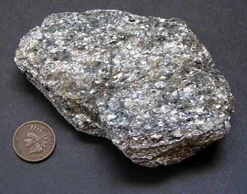
Schist is a dark, sparkly rock that is formed
by the metamorphism of sedimentary rocks like shale. In this area
of Westchester, mica schist is common. This rock, which is found in
Westchester and Manhattan is strong and was considered great
bedrock to build foundations of large buildings upon. Because of
Schist, tall skyscrapers and other large buildings were able to be
constructed, leading to the creation of nearby New York
City’s midtown and downtown areas.
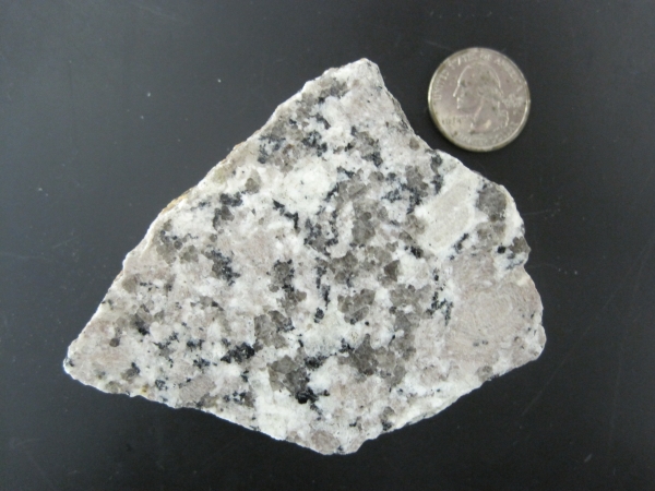
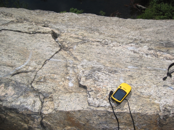
Gneiss is a rock that is usually formed by
the metamorphism of igneous or sedimentary rocks. This is the main
type of rock in the quarry. Although the rock in the quarry is
often referred to as granite, an igneous rock, the main source of
granite in Westchester is actually located in the northwestern
corner in Peekskill. In the Adirondacks and the
Westchester/Manhattan areas, some metamorphic rocks resemble
granite. These rocks are referred to as Granitic Gneiss. They have
a very coarse-grained texture and can show banding with light and
dark layers. This durable, eye-catching stone has been widely used
for construction.
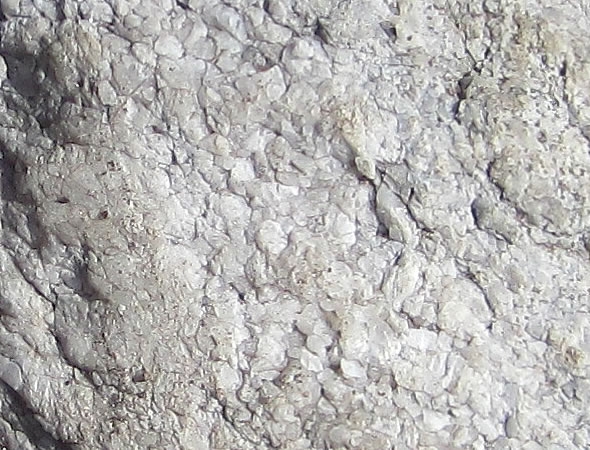
Gneiss, Granite and Granitic Gneiss (from the quarry) are shown
in the photos below (in order from top to bottom): 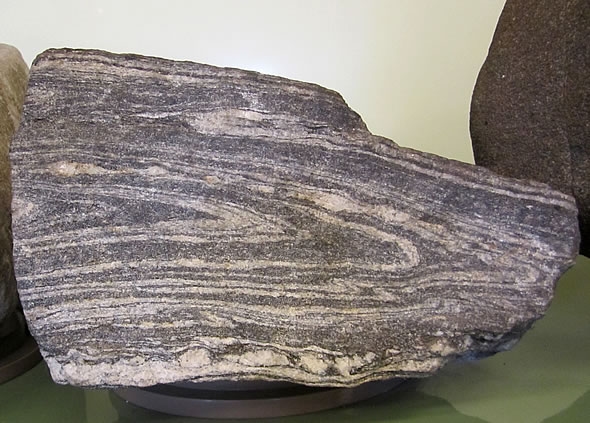
IN AND AROUND THE QUARRY – Visit these
waypoints!
Quarry History: N 41 04.345 W 073
45.225
At these coordinates you can learn a little bit about the history
of the area. I’ll leave this for you to
explore!
Top O’ the Quarry: N 41 04.366 W 073
45.229
From these coordinates you can enjoy a wonderful view of the entire
quarry and the pool, which was created as a result of the mining.
Please use caution while climbing the rocks! Take your time and be
on the lookout for broken glass.
LOGGING REQUIREMENTS:
Send me an email with the following information and answers
(Remember: DO NOT post any of this in your log):
1) GC code (GC2ZMPW) and title of EarthCache (Hidden in
Westchester: Rock Quarry)
2) What type of rock was quarried here and how was it
transported?
3) What was the rock used for?
4) BONUS: Why do you think it made sense to use this type of rock,
rather than other types commonly found in the Westchester County
bedrock?
5) OPTIONAL: Include a photo of the quarry, or yourself/group on
the quarry. Please do not post photos that give away information
about the history of this location.
JUST FOR FUN:
Check out Westchester County bedrock for yourself! (visit link)
Sources:
Roadside Geology of New York by Bradford B.
Van Diver
Cranberry Lake Preserve (a special thanks to Mr.
Taro Ietaka for granting permission for this cache)- (visit link)
NYS Regents Earth Science Reference Tables -
(visit link)
Geology Tour of Inwood Hill Park - (visit link)
Geology.com (Granite’s “commercial
definition”) - (visit link)