About SideTracked Caches
This cache belongs to the SideTracked series. It is not designed to take you to a magical place with a breath taking view. It's a distraction for the weary traveller, but anyone else can go and find it too. More Information can be found at the SideTracked Website
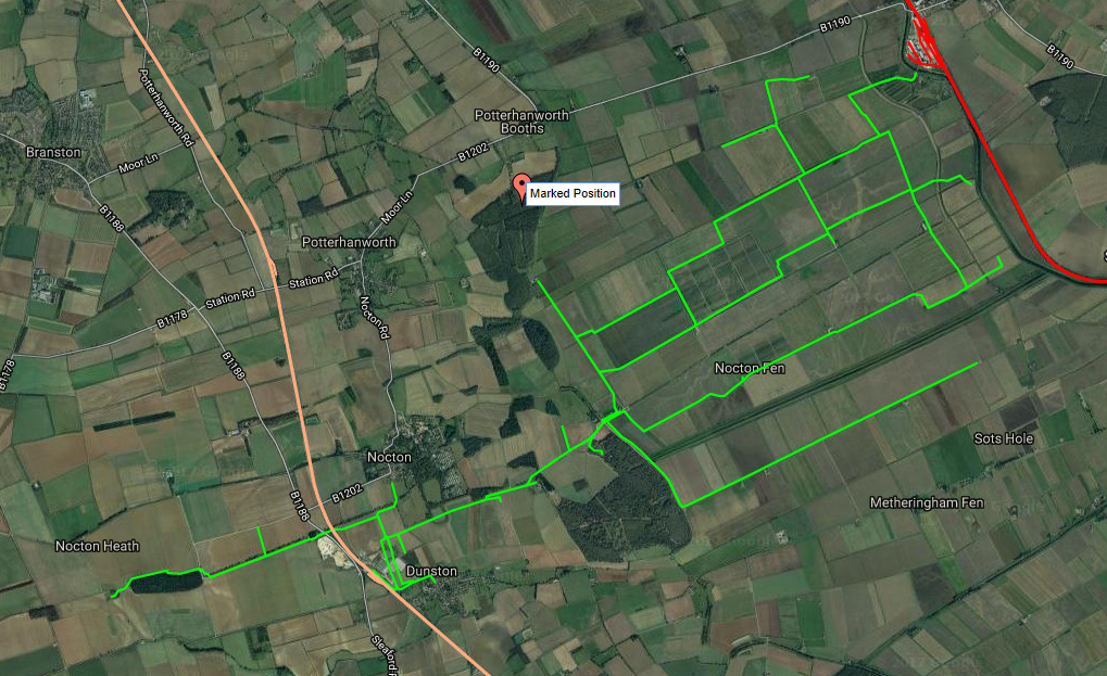
About Nocton Estates Light Railway
The Lincolnshire potato railways were a network of private, 1 ft 11+1⁄2 in (597 mm) narrow gauge farm railways which existed in the English county of Lincolnshire in the mid-20th century, for the purposes of transporting the annual potato crop between the fields and the nearest standard-gauge main line railhead.
There were two major systems of potato railways in Lincolnshire: This one located near the village of Nocton (the "Nocton Estate Light Railway" south of Lincoln), centred on Nocton and Dunston railway station; the other to the north of Holbeach in the south of the county, serving Fleet and Sutton Bridge stations. There were other, smaller systems elsewhere in Lincolnshire, for example at Deeping St Nicholas.
The most prominent potato producer and the greatest user of railway line were W. Dennis and Sons who owned large estates at Nocton (8,000 acres), Deeping St Nicholas (2,000 acres) and Kirton (2,000 acres). W Dennis and Sons established their Nocton Estate in 1919 – the annual production in the 1950’s being some 17,000 tons of food, consisting primarily of potatoes.
The Estate Manager (a Major Webber) inspired the purchase of the narrow gauge line from an Army Surplus Depot in Arras, France. The track had been used as a resupply line during the First World War.
Initially just 4 miles of the one foot eleven and a half inch gauge was established at Nocton... on the heavy fenland east of Wasp's Nest. After 1926, the narrow gauge line was greatly extended in order that it could be connected to the railhead on the Lincoln to Sleaford mainline. The weight of the line at Nocton, because of the intensive use of locomotives, was 20lb per yard.
In the end, the route amounted to almost 23 miles of single track (on the Nocton Estate alone). Eventually they were to operate over 30 miles of line in total. Almost every field on the large estates was reached so that produce could be harvested straight onto trucks.
The railhead (located near the old Dunston/Nocton Station) consisted of Estate workshops, a mill, greenhouse and engine shed. There was a 'dock' for offloading produce into lorries or the standard gauge railway waggons (located in a siding - a loop of the Lincoln/Sleaford main line).
At the mill was a large green baize covered board with an Estate field plan and the railway route marked on it. Each field was numbered and each wagon number was attached to a pin. Every wagon movement was noted by a traffic controller.
In 1927 the Bardney Beet Factory was built. Sugar beet from the Nocton Estate was transported to the factory by a mechanical grab running along a gantry over the River Witham, where it was picked up from a dump, from rail trucks dispersing their load.
The Estate's main customer was Smith's Potato Crisps and it was this company that finally bought the land from W. Dennis & Sons in 1936. At its peak, Nocton estate was using 220 working horses, had 1,000 cattle, up to 3,000 pigs and 2,000 sheep (their food was also transported by the narrow gauge railway from the mill).
Tractors were introduced in 1948 (24) and increased in number in 1951 (32). In 1955 the Estate was still producing some 17,000 tons annually - however since World War 2 and the growth of road transport, the rural roads had improved allowing articulated lorries to gain access to each farmstead. By 1960 almost all fields were accessible by road, thius sounding the death knell for the light railway. It was finally closed in July 1969.
The engines and rolling stock from Nocton have survived to this current day and can be seen at the Lincolnshire Coast Light Railway.
Now to solve this one for the final coordinates...
Let's have a look at this fabulous website that contains more images of the bygone Nocton Estates Railway - The information you need is all there!
http://www.davesrailpics.bravehost.com/nocton/nocton.htm
(please note you will need to click the more link at the bottom of this link to go to page 2.)
A = The number of colour photographs on this page.
B = Photo 1B - the 2nd digit of the year.
C = View of the sidings and the engine shed at Nocton seen from the mill. - 4th digit in photo reference number.
D = The number of images attributed to Museum of English Rural Life at Reading University.
E = The mill showing the standard gauge loading platform - 3rd digit in the photo reference number
F = Log books from the estate show that the locos were de-coked every
?4 months!
G = Riddling with hand riddles, weighing and bagging potatoes. - 4th digit of the photo reference number
H = 2D Tightly curved track - Number on the train plus one
J = View of the sidings and the engine shed at Nocton seen from the mill. - Number of semaphore signals in the photo
K = The number of vowels in Bill's full name
The cache can be found at:
North 53º AB.CDE
West 000º FG.HJK
Please do check your answer using the checker below - It's in an odd location, but all will be explained in the checker!
