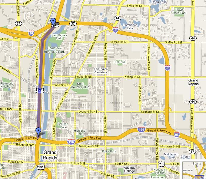
This cache is hidden next to I-296. A "secret" and unsigned Interstate Highway.

I-296 is 3.42 miles long connecting I-196 to the south with I-96 to the north.
It is one of the "Original Interstates" from the initial Interstate plans of the late-1950s. I-296 was built simply as a part of the already-proposed "Grand Rapids Expressway," which traces its roots back to plans in the late-1940s. In fact, by the time the I-296/US-131 freeway was opened to traffic, US-131 itself had been completed from M-43 in Kalamazoo northerly to downtown Grand Rapids.
The I-296/US-131 freeway completed the "Grand Rapids Expressway" north through the city to I-96 on the north side of town. From that point, the US-131 freeway would push on northerly over the next few decades past Cadillac.
I-296 was co-signed with US-131 until some point in the very late 1970s. The signs were then removed to minimize motorist confusion.
Adding to some of the interstate highway confusion in Grand Rapids:
- The first segments of present-day southerly I-196 from Grand Rapids to Holland were originally marked as I-96 and all of present-day northerly I-96 from Grand Rapids to Muskegon was opened as I-196 and for several years the freeway "inexplicably" changed numbers at today's Mile 37 on the east side of Grand Rapids. Sometime about 1963, the designations of I-96 and I-196 were swapped to their present-day alignments.
- Many people also mistake the I (for Interstate) as a 1 and vise-versa when referring to the interstates.


I-296 is still an "active" route designation and the 3.42 miles of US-131 from I-196 to I-96 is still an Interstate highway and qualifies for federal highway funds, even though there are no I-296 signs.
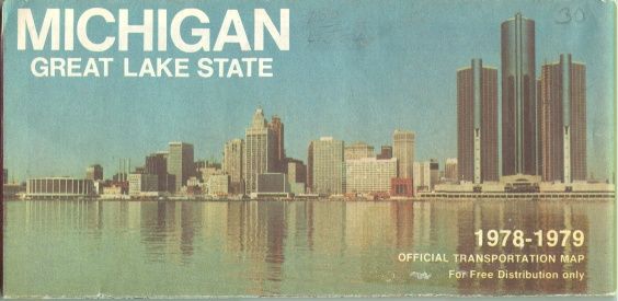
This section of freeway opened in 1962 and retained the I-296 designation until 1979. (The last Official Michigan Highway Map with I-296 indicated is the 1979 edition)
This cache is located near the Northern end of I-296. Please pay attention to the terrain rating...you DO NOT have to go down the hill. Cache is a small ammo box container.