Ngauranga is a suburb of New Zealand's capital city, Wellington, in the lower North Island. Situated on the western bank of Wellington Harbour, it lies to the north of the centre of the city. It is a Maori name meaning "the landing place", and the original spelling was "Nga-Uranga". The Ngauranga Railway Station was known as "Ngahauranga" when it opened in 1874.
Ngauranga's is known for its rugged terrain and it includes the Ngauranga Gorge, through which State Highway 1 passes on its route out of Wellington to Porirua and the west coast. To the east, State Highway 2 runs wedged between hills and Wellington Harbour on its route from Wellington to the Hutt Valley, Wairarapa, and beyond.
The Ngauranga Gorge is in the Wellington Region of New Zealand. State Highway 1 runs through the gorge, a vital link between Wellington City and the Kapiti Coast and the main route north out of Wellington. It is 2 kilometres long and has a grade of approximately 8%. 65,000 vehicles a day travel through it, and it connects the Wellington Urban Motorway with the Johnsonville–Porirua Motorway. The road up the gorge was upgraded in 1940 as the Centennial Highway.
The information is from http://en.wikipedia.org/wiki/Ngauranga and http://en.wikipedia.org/wiki/Ngauranga_Gorge
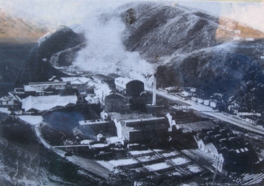
Francis Bee Flour Mill.
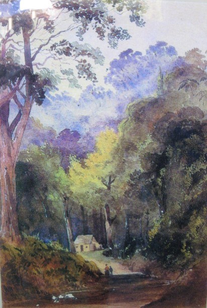
Ngauranga Road painting.
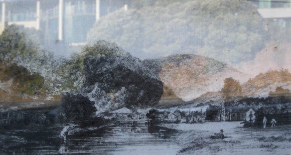
Ngauranga Stream.
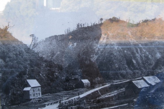
The Wellington Meat Company.
To find the cache you will need to answer the following questions, the cache can be found at S 41° 1A.BCD E 174° 4E.FGH
A = What year did the Chief died, the third number in that year is?
B = In the first paragraph how many words are in the (bracket) next to Ngauranga?
C = Henry Barber leased land and built the slaughter house and cannery in Ngauranga, how many letters in the second word of the name of the company that brought him out?
D = The products biggest years were (two dates). Add the dates of both third digits together.
E = The Ngauranga Gorge Road was described as what "??", number of words plus 2.
F = The third date in the paragraph The Ngauranga Gorge Road minus the second date, single number.
G = Who was The Ngauranga Stream and pa as depicted by?, number of letters in his last name?
H = What was the last digit in the year of the painting?
Please NOTE There is no parking at GZ but parking is available nearby on side roads, the final is a short walk from the published GZ.
When placed the cache a 400ml sistema contained the following items
Logbook
Pencils
A couple of swaps
Please NOTE that you must sign the log book for each individual cacher, Finds logged not corresponding with the logbook may be deleted.
Please take some time before leaving to ensure that the cache is re-hidden to ensure that it wont get muggled. Please no spoilers as we really don't want to spoil it for other finders.