I visited The Sinks on August 15, 2003. Since it was such a unique and interesting place, I expected this to be a virtual geocache. When I found that it wasn't, I wanted to make sure that other geocachers would be sure to see this interesting place.
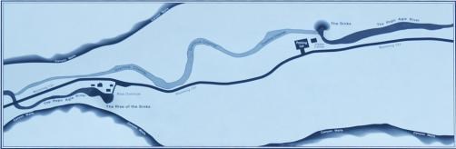
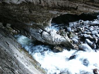
"The Sinks" is where the Middle Fork of the Popo Agie flows into a large, limestone cavern. The river comes above ground again at the "Rise of the Sinks". The Rise (N42-45.160' W108-48.333') is about 1/4 mile down canyon from The Sinks according to the signs; 0.41 miles according to my GPSr. By using dye tests, it has been found that it takes over two hours for the water to flow this distance.
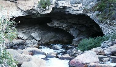
There is a trail down to the cavern, but its at least a two in terrain. There is a great increase in the flow rate during the spring runoff so be extra careful then.
The coordinates given are for the The Sinks overlook, and is wheelchair accessible. There are two signs at this location. To qualify to log this cache, do one of these:
- Post a photo of your visit, with both the cave and your GPS receiver visible.
- Email me the four two-digit numbers (in parenthesis) on the sign with the map. Remember, do not post the numbers, even if encrypted