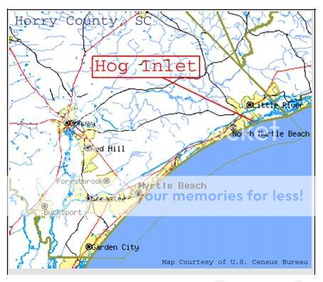
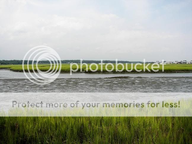
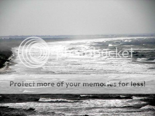
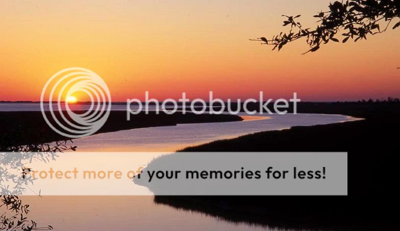
Hog Inlet is a salt marsh estuary. The inlet separates Waites
Island and the town of Cherry Grove South Carolina. The flow in the
estuary is dominated by the ocean tides. There are few sources of
fresh water from streams or springs that impact the marsh.The tidal
flow enters and exits the estuary through Hog Inlet which is
roughly 100 meters wide and 2 meters deep at low tide, but floods a
wide area of the mouth and the salt marsh at high tide.
Salt marsh life started long ago, about 15,000 years ago when
the last Ice Age glaciers melted. Various lakes were created by the
meltdown. Then thousands of years later they completely drained
into the sea through outlets in moraine dams. As the waters flooded
the coastal uplands they moved the shoreline inland through a
process termed "marine transgression." The drowned coastal streams
and river valleys are now our present day coves, embayments, and
salt marshes. In this salty sea soup, the magic of the salt marshes
were created.
Salt marshes are magical places of renewal. From their death and
decay they spring forth life. A primordial soup of the eternal
wonderful cycle of life. They are safe havens for biological
organisms, algae, marsh plants, young fish, crustaceans, birds and
woodland animals. Switchgrass shoots slow water movement, trapping
and accumulating sediments. This specially enhanced sedimentation,
coupled with the increasing volume of below-ground roots, allow the
elevation of developing marshes to keep up with a rising sea. As
salt marsh plants die and decompose, they create organic detritus.
This varying abundant food source is found in the muds of the salt
marsh bottoms and are essential for salt marsh dwellers survival.
The classic life cycle and food chain in action.
Tidal waters move up into the marsh and then retreat,
distributing detritus throughout the estuary. Algae are also an
important food source in salt marshes. Marsh plants adapted to salt
marshes cannot grow where waves are strong, but they thrive along
the calm gentle coast salt marshes. Broadly defined, estuaries are
places where freshwater rivers and streams flow into the ocean.
Estuaries are dynamic environments. Suspended sediments from land
erosion enter with the constant current of fresh water. Some of the
larger particles are deposited in quiet waters, forming deltas and
bars.
These are reworked twice a day as the high tide enters the
estuary from the seaward side, sometimes carrying marine sediments
with it. Thus the contours of an estuary are constantly reworked
and shifted. The transience of estuarine environments is indicated
by the scarcity of true estuarine sedimentary rocks.
The extent to which a marsh thrusts inland depends on the
surrounding terrain, and therefore changes as that terrain changes.
Nature, man, or both acting together, can cause these changes. Wind
and water erosion can bring down tens of thousands of tons of top
soil and raise the level of the marsh land above the reach of the
tide. The marsh grasses themselves can act as a dam against which
this buildup can progress. Extensive marshes may also occur along
sea coasts where the terrain is flat and there is some protection
from high winds and waves. These marshes are also very productive,
since the rising and falling tides periodically replenish mineral
nutrients and food items.
The tide is the dominating characteristic of a salt marsh. The
salinity of the tide defines the plants and animals that can
survive in the marsh area. The vertical range of the tide
determines flooding depths and thus the height of the vegetation,
and the tidal cycle controls how often and how long vegetation is
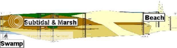
submerged. Two areas are delineated by the tide: the low marsh and
the high marsh. The low marsh generally floods and drains twice
daily with the rise and fall of the tide; the high marsh, which is
at a slightly higher elevation, floods less frequently.
Studies have shown that the volume of water in Hog Inlet Sea
Marsh is directly proportional to the tidal height at the mouth of
the inlet and that the flow of water through the inlet mouth is
spatially uniform in distribution in the marsh.
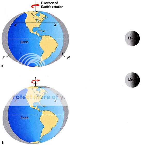
Tides are the rhythmic rise and fall of sea level . Tides are
caused by two forces: gravity and inertia. The gravitational
attraction between two bodies is directly proportional to their
masses and inversely proportional to the square of their distance
apart. The bodies of interest here are the Earth, Sun, and Moon.
Earth and the Moon are about a quarter of a million miles apart.
The Earth and the Sun are about 93 million miles distant. The mass
of the Sun is about 27 million times that of the Moon. The Moon,
however, is very roughly 400 times closer to the Earth than the
Sun, so its nearness gives it a greater effect. The bottom line is
that the gravitational effect between the Moon and the Earth is
about twice that of the Sun. Because the Moon is so much closer to
Earth than the Sun, its gravitational effect on the tides is about
twice that of the Sun. The gravity of the Sun also exerts a strong
tidal influence on the ocean. The tidal bulge produced by the Moon
is due to the Sun’s greater distance from the Earth.
The tides are basically large, low wave forms that cause
currents, called tidal currents. Tidal currents in the open ocean
are relatively weak; near land, however, they can attain speeds of
several kilometers per hour. Tidal currents in shallow water and
estuaries can be very important geologically. They can move large
amounts of sediment that can eventually shoal or block harbors and
must be removed by dredging. In some estuaries during high tide, a
large wave forms and travels upstream. Called a tidal bore, this
wave can be as high as 10 ft. or more and have speeds over 9 miles
per hour.
Storm surges and hurricanes carry sand from the ocean floor and
beach face over the dunes and into marshes behind the beach.
Between major storms, the beach builds up while marsh muds and peat
slowly cover up the sand layers. Researchers have found that when
they take sediment cores from the marsh, they can use the sand
overwash layers to find and date intense storms that are not
necessarily recorded in history books.
The processes that shape our coasts occur on a variety of time
and space scales. The coast is an incredibly complex system, of
which beaches are only one part. All aspects of the system—rivers,
estuaries, dunes, marshes, beaches, headlands, the surf zone, and
the seafloor—influence and respond to the others. Beach erosion
threatens property near the shoreline, but it also profoundly
influences a critical part of our coastal ecosystem: the marshes.
Tidal marshes in estuaries and behind barrier islands are the
dominant habitat along the Atlantic Coast of the U.S., and they are
particularly vulnerable to rising sea level.
Geological investigations of coastal environments can provide
long-term records of environmental change. Evidence of past storms
can be found in back-barrier sediments: When a storm washes sand
over the dunes and into marshes, it forms dateable layers in the
muddy sediments. Mapping regional occurrences of these “overwash”
deposits can allow researchers to estimate the storminess of years
past and help improve models of the probability of future storm
strikes.
An estuary, with all of its dynamic stirrings, has one attribute
that promotes its own destruction: It traps sediment. When
suspended mud and solids from a river enter the estuary, they
encounter the salt front. Unlike fresh water, which rides up and
over the saline layer, the sediment falls out of the surface layer
into the denser, saltier layer of water moving into the estuary. As
it drops, it gets trapped and accumulates on the bottom. Slowly,
the estuary grows muddier and muddier, shallower and shallower.
Occasionally a major flood will push the salt right out of the
estuary, carrying the muddy sediment along with it. Sediment cores
indicate that sediment may accumulate for 10, 20, or even 50 years,
laying down layers every year like tree rings. But then a hurricane
or big flood wipes out the layers of sediment, and sends the mud
out to sea.
Marshes are ecologically and economically important because they
regulate the exchange of water, nutrients, and waste between dry
land and the open ocean. They filter and absorb nutrients and
pollutants, and buffer coastlines from wave stress and erosion. And
tidal marshes provide nursery grounds for countless species of fish
and invertebrates. They are among the most biologically productive
ecosystems in the world, producing more biomass per area than most
other ecosystems.
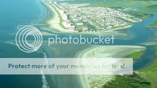
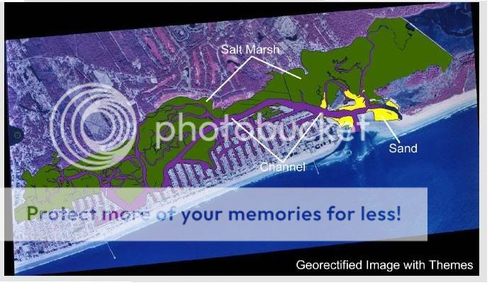
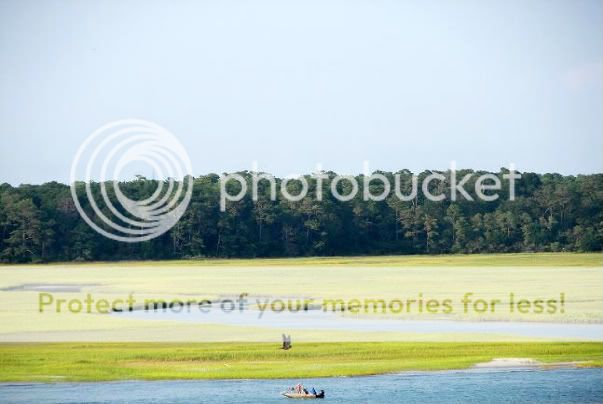
To view the Hog Inlet Sea Marsh up close, visit Russell Burgess
Preserve, a little known North Myrtle Beach City Park just above
the marsh edge. Email us the information to the calculations below
and post a picture of your GPS with a long range shot of the marsh
in the background. And don't forget to visit EZ Track's Traditional
Cache located here!
1. Estimate how wide the channel is below the coordinates
provided. Calculate the distance from the fence line to the sea
grass at the opposite edge of the channel.
a/ 100’ b/ 200’ c/ 300’
2. Estimate the height of the sea grass just below the provided
coordinates.
a/ 3’ b/ 4’ c/ 5’
3. What direction does the inlet flow into the marsh?
a/ East b/ West c/ North d/ South
Shorelines are the Earth’s quintessential interface: here, air,
land and sea converge to support diverse estuarine ecosystems.
Beaches and scarps come and go; deltas grow and fade. Marshes
flood; tides ebb.