BEACH TEMPLE

From the guidelines: "People do not need to wait for permission to log your EarthCache. Requiring someone to wait is not supported by the EarthCache guidelines. People should send their logging task answers to you, then log your EarthCache. When you review their logging task answers, if there is a problem, you should contact them to resolve it. If there is no problem, then their log simply stands."
Located on the western extreme of the Iberian Peninsula, in the south of Portugal, the Algarve is easily distinguished from the rest of the country. Not only because of its peripheral location, but also for its morphological and geological features.The Algarve region covers 6% of Portugal’s total area and its 5,000 km2 wide. On the north side it is limited by the Alentejo, on the east the Guadiana River separates it from Spain and on west and south it is bathed by the Atlantic.
Due to its diversity, conditioned by the geology, the Algarve can be divided in three main regions: the Mountains (Serra), the Barrocal (place full of ruts, crags or caves) and the Littoral.
Inland you will find Barrocal that is the orchard of the Algarve, with its many green shaded almond trees, fig trees, orange trees and a rainbow made of flowers.
This is the place to find whitewashed houses, with laced chimneys and views that spread to the ocean.
Further north you’ll find the range of mountains. Not a range of high peaks and ravines, but a chain of round shapes that spread to the horizon like a petrified smooth sea.
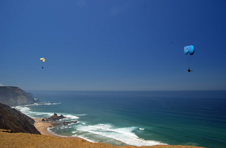
On the Littoral you will find beaches that work as a magnet for tourists from all over the world. On the Vicentina Coast (that begins a little before Sagres and spreads to the north) one can feel the presence of nature in the dark steep cliffs cut by small beaches. The south coast is attractive and invites to the pleasures of sun and sea. It offers small beaches wrapped by coloured cliffs and huge beaches framed by pine trees.
One of these beaches is Praia do Castelejo is a sandy beach, interrupted by many outcrops, situated on the rugged “Costa Vicentina” (Vicentina coast - Algarve’s west coast) near Vila do Bispo.
Praia do Castelejo is a popular beach particularly for surfers and body boarders, due to the strong waves providing excellent conditions and is often used for teaching these sports. Forming part of the Costa Vicentina Natural Park, the beach is particularly beautiful, with its black rocks contrasting with the golden sand. There is a large parking area and the beach has a restaurant and toilets, facilities for disabled and is supervised during the bathing season. The average summer seawater temperature is 18-21ºC.
Geologically the Algarve forms part of the South Portuguese Zone (SPZ). The SPZ constitutes the southernmost segment of the Variscan Iberian Massif. It is bounded to the north by the Beja-Acebuches Ophiolitic Complex and related accretionary wedge. To the south lie the Iberian Pyrite Belt (IPB) and flysch deposits forming the southern extent of the zone. Structural analysis within the Spanish side of the SPZ supports continuous south propagating deformation, evolving from early synmetamorphic thrusting in the internal zone to thin-skinned tectonics in the southern external domain (Onézime et al., 2003).
At Vila do Bispo outcrop turbidites of Lower Cambrian age which are cut locally by dolerite dykes.
THE CACHE
At the coordinates you will be presented with an outcrop of dark-coloured limestone. I need to know from you 1- what general shape is this outcrop, 2- what is the maximum thickness of the strata in this outcrop and 3- how high do you estimate it to be?
In addition you need also to upload your picture on the beach.
NOTE: no revealing pictures in the logs.
Send me the answers by e-mail though my profile and I will then give you permission to log the cache.
Sources:
Onézime, J., J. Charvet, M. Faure, J. Bourdier, and A. Chauvet (2003). A new geodynamic interpretation for the South Portuguese Zone (SW Iberia) and the Iberian Pyrite Belt genesis, Tectonics, 22(4), 1027, doi:10.1029/2002TC001387