Die Ettringer Lay
In den letzten 500 000 Jahren entstanden in der Osteifel neben drei größeren Ausbruchszentren – Riedener Kessel, Wehrer Kessel und Laacher-See – rund 40 Schlackenkegel. Die Historische Lay, wo vor 200.000 Jahren einer der drei Lavaströme des Vulkans Bellerberg entlang floss, einer der tiefsten Steinbrüche rund um den Beller Berg-Vulkan, ist auch in das Vulkanpark-Projekt des Landkreises Mayen-Koblenz aufgenommen worden.
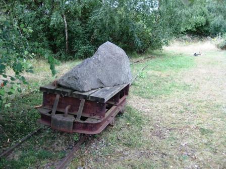
Die Ettringer Lay (Lay = Steinbruch) ist ein einzigartiges Denkmal der neuzeitlichen Steinindustrie. Grubenkräne, Kransockel, Gleise und Gebäudereste zeugen vom intensiven Abbau im 19.und 20.Jahrhundert. Nicht ohne Gefahr wurden hier die mächtigen Gesteinssäulen seines westlichen Lavastromes gebrochen, um daraus u.a. Baumaterial oder Pflastersteine zu gewinnen. Ein Rundweg mit Infotafeln führt den Besucher hinab in die Grube, an die mächtige 40m hohe alten „große Wand“ aus Basaltlava. Die Historische Lay, wo vor 200.000 Jahren einer der drei Lavaströme des Vulkans Bellerberg entlang floss, ist in das Vulkanpark-Projekt des Landkreises Mayen-Koblenz aufgenommen worden. Bei gutem Wetter ist die „große Wand“ ein beliebtes Kletterareal des Alpenvereins.
Mache bitte ein Bild von Dir oder deinem GPS (freiwillig)!:
Logbedingung!:
Folgende Fragen per Email bitte uns zusenden.
Mit Absendung der Antworten an uns hast Du Logerlaubnis.
Infotafeln::
- Wozu wurde der Basaltlavastein schon zur Römerzeit verarbeitet?
- Wieviel Pfennige bekam ein Pflastersteinhauer 1950 für einen gehauenen Stein?
- Aus wieviel Flanken besteht der Bellerberg-Vulkan?
- EC Freunde bestätigen durch ein (freiwilliges) Bild das Sie vor Ort waren :-)
Es ist ein schöner Rundweg!
Nehmt Euch Zeit mit, event. Klettergeschirr und es wird ein schöner Tag!

In the volcanic park the visitors experience more over the vulkanologischen origin of our region. Here volcanism is descriptive represented and described on the basis by looking and info. boards fascinatingly. Those leads walking ways past partially stations, as " also here in; Ettringer Lay" , on former industrial estates developed.
The Ettringer Lay
In the last 500 000 years approximately 40 cinder cones developed in the east Eifel beside three larger outbreak centers - Riedener boiler, Wehrer boiler and Laacher lake -. The historical Lay, where before 200 000 years one of the three lava stream of the volcano flowed along Bell hereditary suppl., one of the deepest quarries around the Beller mountain volcano, was taken up approximately also to the volcanic park project of the district Mayen Koblenz.
The Ettringer Lay (Lay = quarry) is a singular monument of the modern stone industry. Pit cranes, crane bases, tracks and building remainders witness from the intensive dismantling in the 19.und 20-century. Without danger the powerful rock columns of its western lava stream were not broken here, in order to win from it building material or paving-stones among other things. A round way with info. boards leads the visitor down there into the pit, to the powerful 40m high old „large wall “made of basalt lava. The historical Lay, where before 200 000 years one of the three lava stream of the volcano flowed along Bell hereditary suppl., was taken up into the volcanic park project of the district Mayen Koblenz. In good weather „the large wall is “a popular climbing area of the alpine association.
Please, make a picture of you or your GPS!:
Log condition!:
The following questions by email answert (Do not attach the picture):
Infotafeln::
- In which depth firm rock under high pressure and temperatures are partly melted around 1200°C?
- To which the basalt lava stone was already converted to the Roman time?
- How much Pfennigs a miner received 1950 for a stone which it finished had?
- Of how much flanks the Bell hereditary suppl. volcano consists?
Logs without previous release are removed! It is a beautiful round way! Carry you forward time and event. Climbing table-ware and a beautiful day becomes!