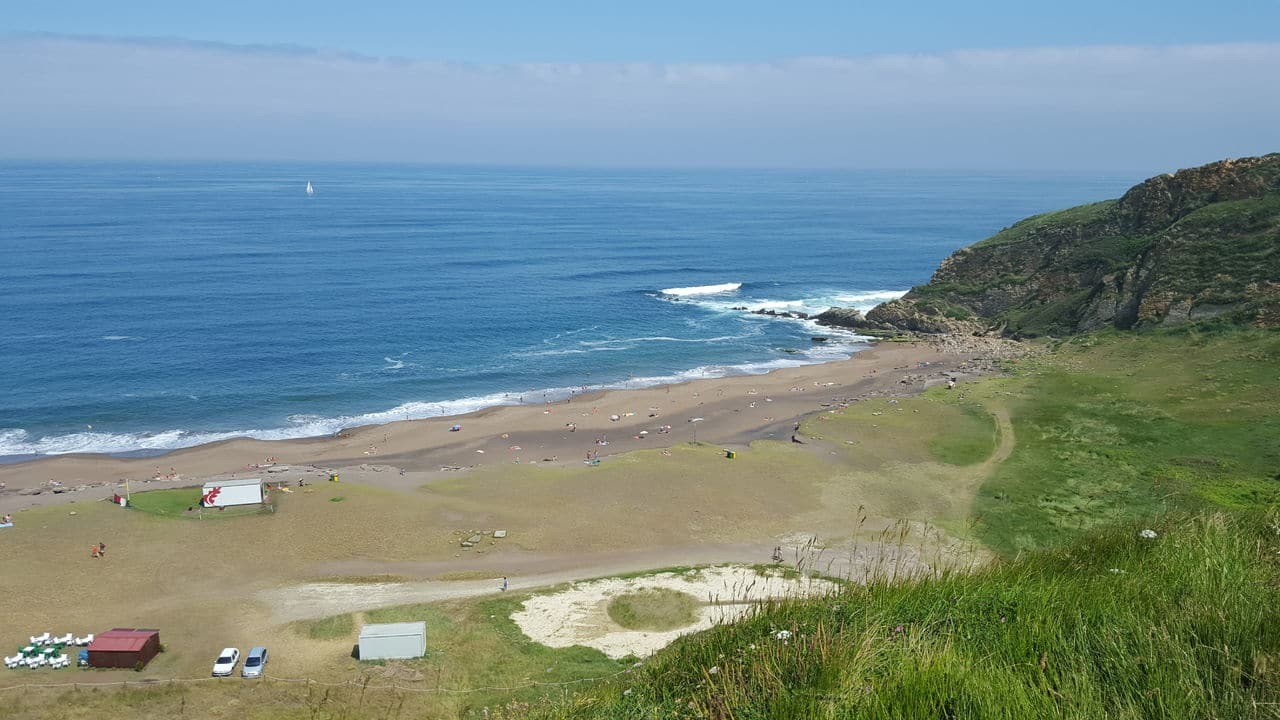
This Earth Cache intents to teach you about the meaning of the GSSPs and show you one of them in the very beautiful beach of Gorrondatxe / Azkorri in Getxo.
Este Earth Caché pretende enseñaros el significado y utilidad de los GSSPs y mostraros uno de ellos localizado en la hermosa playa de Gorrondatze / Azkorri, en Getxo.
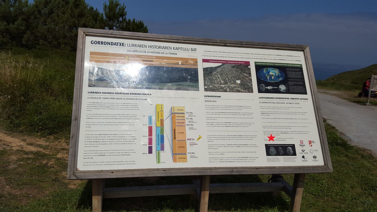
A Global Boundary Stratotype Section and Point, abbreviated GSSP, is an internationally agreed upon reference point on a stratigraphic section which defines the lower boundary of a stage on the geologic time scale. The effort to define GSSPs is conducted by the International Commission on Stratigraphy, a part of the International Union of Geological Sciences. Most, but not all, GSSPs are based on paleontological changes. Hence GSSPs are usually described in terms of transitions between different faunal stages, though far more faunal stages have been described than GSSPs. The GSSP definition effort commenced in 1977.
Una sección estratotipo y punto de límite global (Global Boundary Stratotype Section and Point, abreviado GSSP) es una sección estratigráfica acordada internacionalmente que sirve de referencia o localidad tipo para un determinado límite en la escala estratigráfica internacional. La definición de GSSP comenzó en 1977, un trabajo coordinado por la Comisión Internacional de Estratigrafía, una parte de la Unión Internacional de Ciencias Geológicas. Los GSSP suelen establecerse para definir los límites inferiores de los distintos pisos, unidades estratigráficas básicas de la escala cronoestratigráfica y basados principalmente en cambios paleontológicos
From the near hundreds GSSPs required to defined the epochs and stages, nine of them are located in the Iberian peninsula and one of the is in the Gorrondatxe beach. This GSSPs defines the Lutetian stage in the Eocene epoch, 47.8 millions of years ago, based on the first appearance of the Hantkennina
De los en torno a cien GSSPs requeridos para definir eras y periodos, nueve de ellos están localizados en la península ibérica y uno de ellos está localizado en la playa de Gorrondatxe. Este GSSP define la época Luteciense, segundo periodo del Eoceno, comenzado hace 47.8 millones de años, tomando como base el afloramiento de la Hantkennina
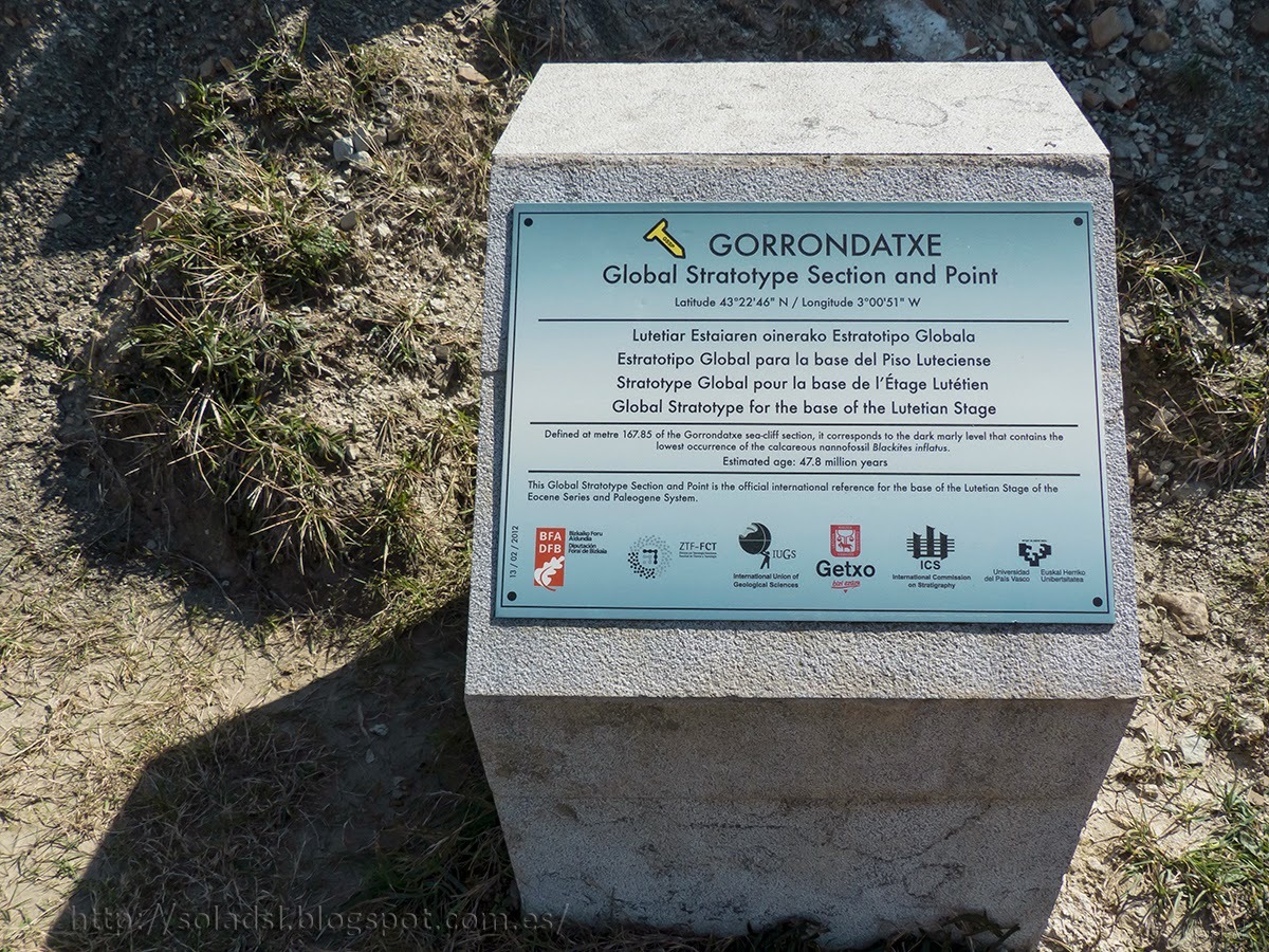
For this reason this area is declared Place of Geological Interest within the Basque Country.
Por esta razón esta zona es declarada Lugar de Interés Geológico del País Vasco.
To log this earth cache you need to send us the answer to the following questions.
Para logear este caché tendréis que enviar las respuestas a las siguientes preguntas.
- Can you describe what type of rocks can you see at this place (texture, color)? ¿Podrías describir el tipo de rocas que se ve en el área (textura, color)?
- In what date (day, month, year) was placed the nail mark indicating the GSSP at this area? ¿En qué fecha (dia, mes, año) se colocó el clavo con el GSSP en este lugar?
We recommend you to visit the waypoint, where you can take a picture of you at the place. Your comments in the log are very welcommed.
Recomendamos visitar el waypoint, donde se observa una estupenda vista de la playa. Una foto vuestra en el lugar y vuestros comentarios son bienvenidos.
We hope you enjoy this beautiful area of the basque shore.
Esperamos que disfrutéis de esta bonita zona de la costa vasca.
More info: Mas informacion:
https://engineering.purdue.edu/Stratigraphy/gssp/image.php?periodid=29&top_parentid=2&imageid=315
https://engineering.purdue.edu/Stratigraphy/gssp/index.php?parentid=0