Welcome to Sheridan
(elevation 4818')
Nevada State Historical Marker No. 122
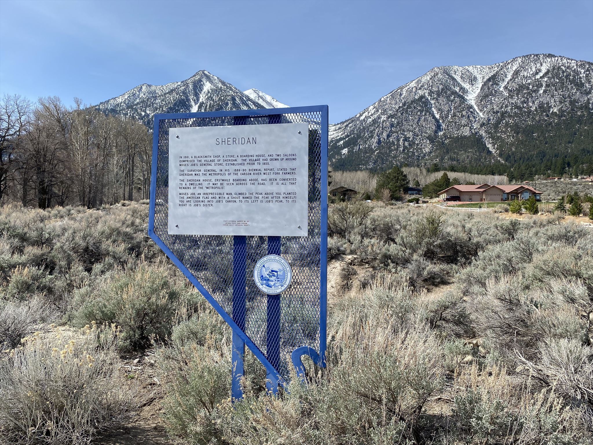
Welcome to Sheridan, Nevada... now a scenic stop along Nevada Route 206 in unincorporated Douglas County. This stop offers great views up the slopes of Job's Canyon, flanked by its two prominent peaks. Job's Peak (10,633') on the left and Job's Sister (10,823') on the right are part of the Carson Range, a lofy spur of the Sierra Nevada Range that dominates the skyline from Reno to Hope Valley.
Marker Text:
In 1861, a blacksmith shop, a store, a boarding house, and two saloons comprised the village of Sheridan. The village had grown up around Moses Job’s general store, established prior to 1855. The Surveyor General, in his 1889-90 biennial report, stated that Sheridan was the metropolis of the Carson River West Fork farmers. The Sheridan House, erstwhile boarding abode, has been converted to a dwelling. It may be seen across the road. It is all that remains of the “metropolis.”
Moses Job, an irrepressible man, climbed the peak above this location, planted the American flag and with a shout named the peak after himself. Job’s Canyon is above, and to its left is Job’s Peak. To its right is Job’s Sister.